Feb 27, 2017 | Postdoc, Risk and resilience
By Adam French – Peter E. de Jánosi Postdoctoral Scholar Risk and Resilience and Advanced Systems Analysis Programs
In mid-January, I found myself calling upon rusty rock climbing skills to scramble up a steep side canyon of Peru’s Rimac River valley. I was with a group of engineers and local municipal officials on the way to assess disaster reduction infrastructure that had been installed in early 2016 against the threat of a strong El Niño-enhanced rainy season. The Swiss-made barriers we were going to see, which resembled giant steel spider webs stretched across the streambeds, had been constructed in multiple locations in the Rimac watershed to reduce the destructive impacts of the region’s recurrent but unpredictable huaicos—powerful debris flows that form when precipitation runoff mixes with loose rock and other material on unstable slopes. The 2015-16 El Niño did not live up to its forecasted intensity in Peru, and the barriers went untested until heavy rains in early 2017 unleashed a series of huaicos on the Rimac valley, damaging homes and flooding roadways. Where the barriers were installed, however, no major impacts had been reported, and we were eager to see if the infrastructure had made a difference.
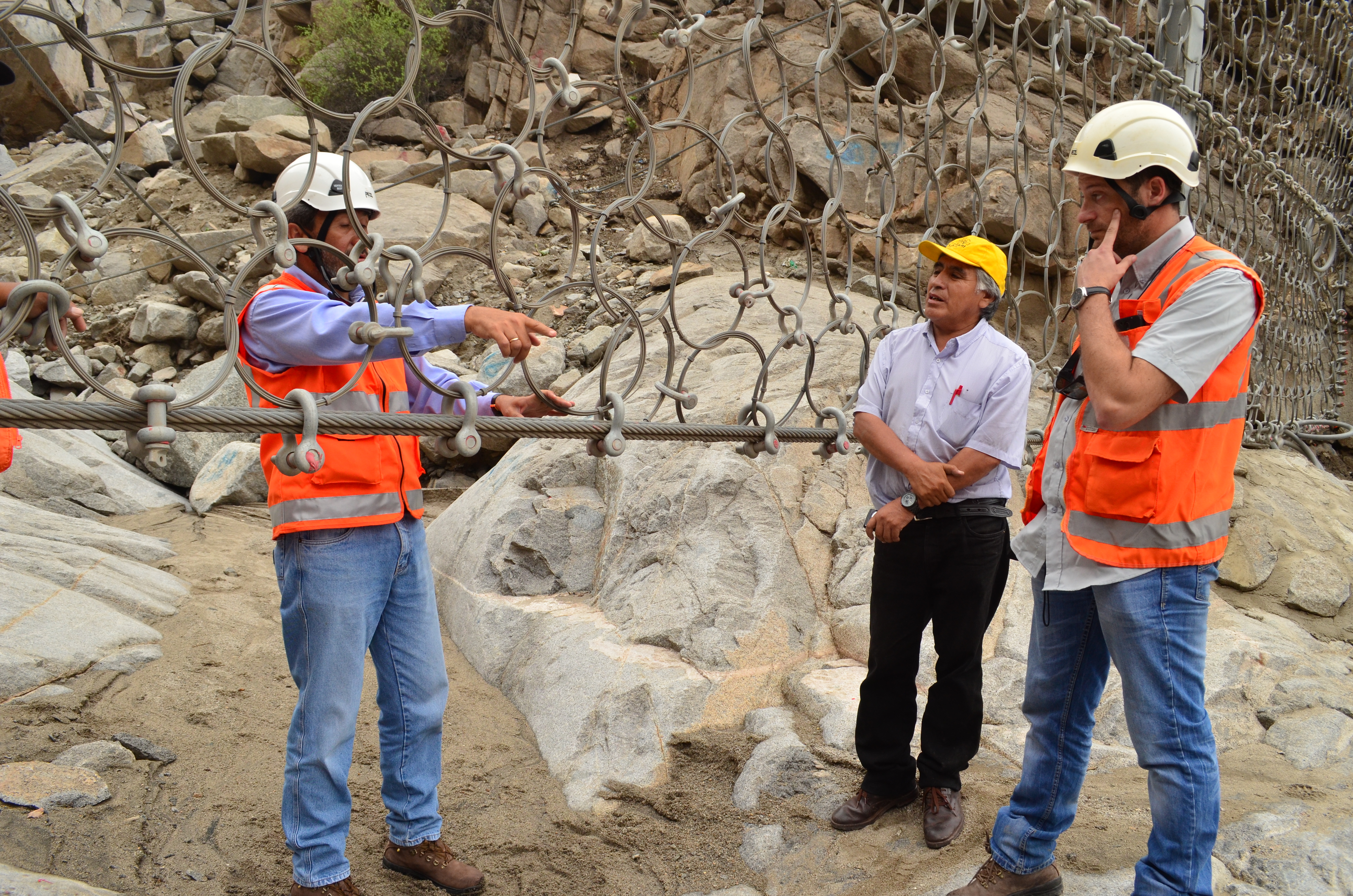
Engineers discuss hazard reduction infrastructure above Chosica, Peru. ©Soluciones Prácticas, Abel Cisneros (Click for more photos)
Most of the time, the Rimac valley looks more like a lunar landscape than a flood-risk hotspot. Yet with only a few millimeters of rain in the surrounding highlands, this arid region becomes extremely vulnerable to huaicos. Located between the sprawling cityscape of Lima—the planet’s second largest desert city—and the lush foothills of the central Andes, the middle reaches of the Rimac watershed have been settled rapidly over recent decades, often without effective zoning regulations to restrict occupation in even the most hazard-prone areas.
I had not planned to work in the Rimac basin when I moved to Austria to take up a postdoctoral position in late 2015. While my research includes the study of climate change-related risk in Peru’s Cordillera Blanca (the world’s most extensively glaciated tropical mountain range), I came to IIASA to focus on watershed-level governance and the implementation of the Integrated Water Resource Management (IWRM) paradigm. Yet as a Spanish speaker with extensive experience in Peru, I was well suited to get involved in IIASA’s activities in the Rimac valley as part of the Zurich Flood Resilience Alliance Project. This project, which includes close collaboration with the NGO Practical Action in Peru and Nepal, supports measures to understand and address the underlying drivers of flood risk and to move beyond short-term disaster preparedness and response towards transformative actions that build long-term capacity and resilience.
As part of IIASA’s Flood Resilience team, my work in the Rimac valley has included activities ranging from evaluating El Niño preparations to conducting interviews with public authorities and local residents living in the Rimac basin. This fieldwork is just part of our project’s efforts to identify the systemic components of flood risk and vulnerability in the region and to promote productive exchanges between residents, policymakers, and the scientific community through participatory research and innovative approaches such as serious gaming.
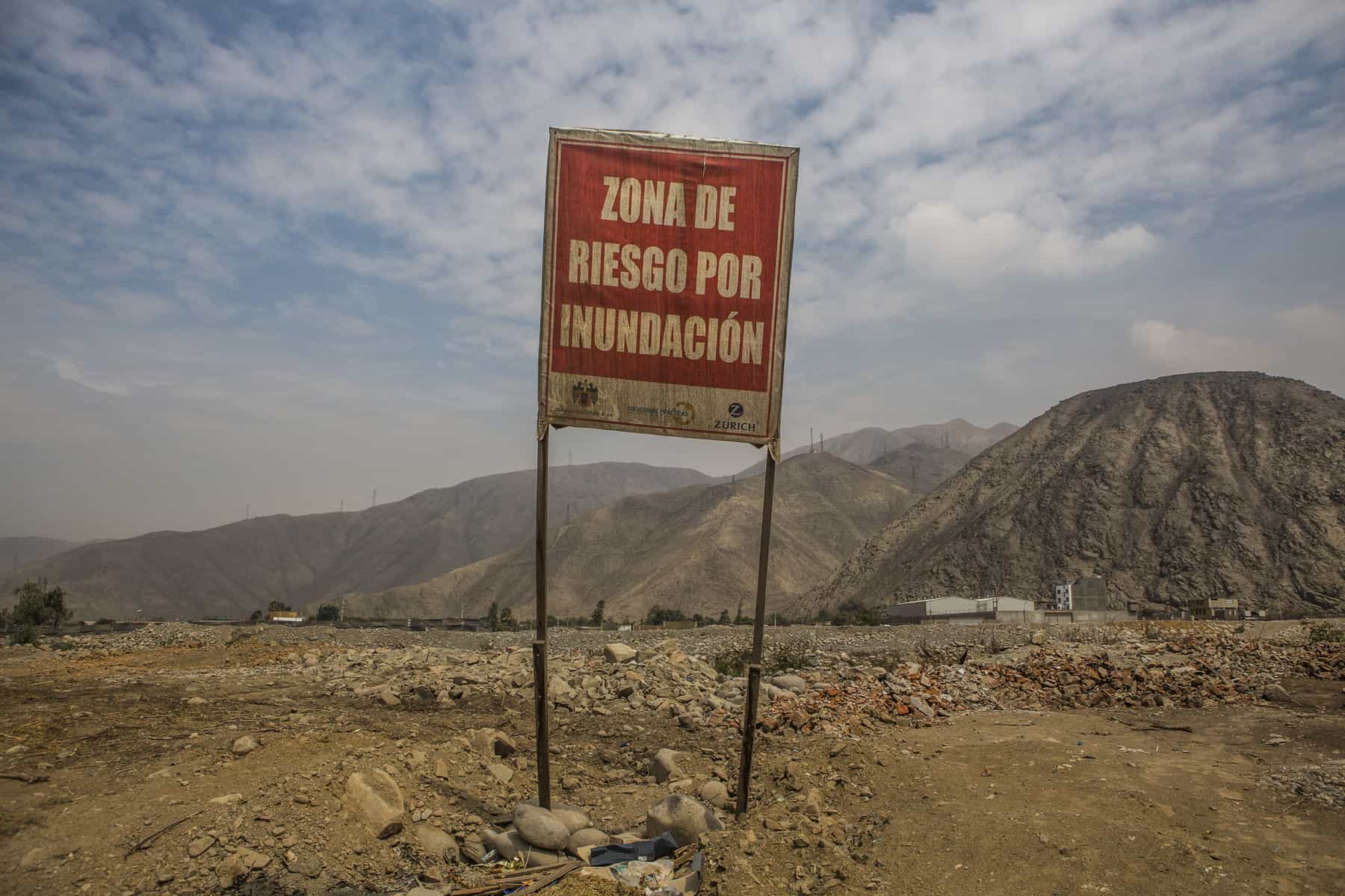
“Flood Risk Zone,” Ate, Peru. ©Soluciones Prácticas. Click for more photos.
In addition to building expertise in a new setting, my involvement in this work has helped me better incorporate risk-focused systems thinking into my broader research agenda—a perspective that is too often overlooked in integrated resource planning. An example of how my research interests are converging within this project is through the promotion of a risk-management working group to advise the multi-sectorial watershed council in charge of IWRM planning in the Rimac valley. The establishment of this working group and the participation of project partners at Practical Action in its activities should mark an important step in bringing lessons from the Flood Resilience project regarding links between disaster risk reduction, economic development, and community resilience to bear on watershed planning in the Rimac basin. More broadly, we hope these insights will influence policy making in other settings in Peru and beyond that face similar challenges in handling risk management and economic development as intricately linked and co-dependent governance processes.
Returning to our January field inspection, we found that one of the new barriers had been put to the test. The structure had captured several tons of debris, protecting a neighborhood that had been devastated by a huaico in 2015, and local authorities were already discussing the potential to build additional barriers to guard their community. While I celebrated this outcome with them, as I look to the future and the goals of the Flood Resilience Alliance, I am hopeful that such infrastructural interventions will be just one aspect of comprehensive plans for hazard reduction, with long-term risk management actions increasingly seen as a vital component of watershed-level planning and governance.
More information
IIASA, Zurich, Wharton, Practical Action: Flood Resilience Partnership
Flickr photo album: Rimac River valley, Peru – Fieldwork
Flood Resilience Portal
This article gives the views of the author, and not the position of the Nexus blog, nor of the International Institute for Applied Systems Analysis.
Feb 8, 2017 | Risk and resilience
By Junko Mochizuki Research Scholar, Risk and Resilience Program
After a 9.0 magnitude earthquake and subsequent tsunamis struck the northeast of Japan on March 11, 2011, large-scale destruction of the coastal communities, including nuclear accidents, turned into a political maelstrom. Debates over the country’s alternative energy futures became intense; worries over ailing energy infrastructure, public safety, and the lack of transparency and accountability led to the most extensive restructuring of its power sector in the country’s recent history.
Against this backdrop, renewable energy was heralded as one of the important solutions: A new nation-wide Feed-in-Tariff (FIT) was introduced in July 2012, replacing the Renewable Portfolio Standard (RPS), which many had perceived, until then, as largely inadequate.
Nearly six years have passed since. Japan’s reconstruction, originally envisioned to last for 10 years, is now in its latter phase. The coastal communities are slowing recovering, with many focused on the idea of ”building back better.” We now hear less about the country’s energy future in the national and international media. But less documented is how well these communities are performing in terms of the ambitious reconstruction plans that they had proposed.

The 2011 earthquake, tsunami, and nuclear disaster led to major destruction in Northeast Japan. But did it also bring an opportunity to “build back better?” ©mTaira | Shutterstock
This was the context in which my colleague Stephanie E. Chang and I began our research titled Disaster as Opportunity for Change, recently published in the International Journal of Disaster Risk Reduction. We evaluated renewable energy transition trends in the 30 coastal communities in Tohoku, Japan from 2012-2015. We focused on energy transition as one measurable dimension of ”building back better (BBB),“ because this is a popular concept that is often talked about, but rarely analyzed through empirical modelling.
In this study, we sought to answer three simple questions. First, are the disaster-affected regions really “building back better?” Have they introduced more renewable energy than the rest of Japan?. Second, why did some communities achieved greater renewable energy transition than others during recovery? Third, what was the role of government policy? We were interested in answering these questions through quantitative analysis, instead of an in-depth case study, since such in-depth analyses are rare in the field of disaster recovery.
In a reconstruction study, we typically need about 10 or more years to make major conclusions. Since we did our study in year six, this study doesn’t provide the final answer, but rather whether the disaster led to opportunity to build back better.
Our research indicated some clues in answering the above three questions, but many puzzles remain. First, it was clear that the disaster-affected regions achieved a greater transition to renewable energy, particularly in both small and mega-solar adoption. Other renewables including wind and geothermal are lagging due to many factors such as more complex approval processes. We focused our analysis on energy transition, measured in terms of per capita approved renewable capacity, as opposed to indicators such as installed capacity or power generated, since the latter depend on many factors such as the readiness of grid systems in accommodating intermittent renewables.
We also found that the relationship between a transition to renewable energy and the extent of disaster damage, and other post-disaster changes such as number of houses being relocated, appears to be non-linear. This means that the destruction caused by disasters, and subsequent decisions to relocate population, provided at least some momentum for wider societal change. Clearly, when communities experience very large destruction or extensive change such as land-use adjustment, this can overwhelm the local capacity to implement broader changes such as major investments in renewable energy. Balancing competing reconstruction demands is, therefore, an important policy question that must be dealt with, most ideally, prior to any large-scale disasters.
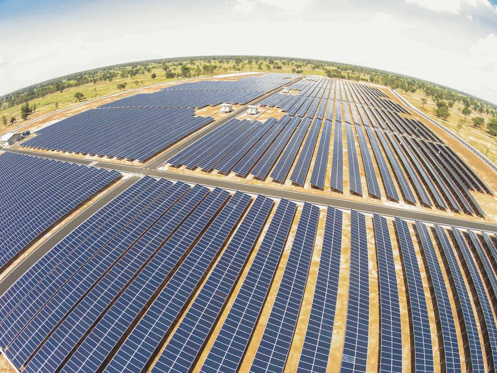
Japan is building mega solar installations like this one in the region affected by the tsunami and earthquake ©SE_WO | Shutterstock
Third, our results remain somewhat inconclusive as to the contribution of government policy. Counter-intuitively, communities having renewable energy plans prior to 2011 adopted significantly less solar energy after the Tohoku disaster. Statistical modeling such as ours tells little about how different aspects of national and prefectural policies have fostered or hindered local energy transitions and these are better answered through other means such as in-depth interviews.
Overall, we find potentially complex drivers of “building back better” and we hope that this study motivates further systematic studies of societal change in the context of post-disaster reconstruction. Of course, a better articulation of what policies work in promoting change and why will also help foster the sustainability transition even without the impetus of a disaster.
Reference
Mochizuki J & Chang S (2017). Disasters as Opportunity for Change: Tsunami Recovery and Energy Transition in Japan. International Journal of Disaster Risk Reduction DOI:10.1016/j.ijdrr.2017.01.009. (In Press)
This article gives the views of the author, and not the position of the Nexus blog, nor of the International Institute for Applied Systems Analysis.
Jan 12, 2017 | Citizen Science, Risk and resilience
By Ian McCallum, IIASA Ecosystems Services and Management Program
Communities need information to prepare for and respond to floods – to inform risk reduction strategies and strengthen resilience, improve land use planning, and generally prepare for when disaster strikes. But across much of the developing world, data are sparse at best for understanding the dynamics of flood risk. When and if disaster strikes, massive efforts are required in the response phase to develop or update information about basic infrastructure, for example, roads, bridges and buildings. In terms of strengthening community resilience it is important to know about the existence and location of such features as community shelters, medical clinics, drinking water, and more.
The risk Geo-Wiki platform
The Risk Geo-Wiki is online platform established in 2014, which acts not only as a repository of available flood related spatial information, but also provides for two-way information exchange. You can use the platform to view available information about flood risk at any location on the globe, along with geo-tagged photos uploaded by yourself or other users via a mobile application Geo-Wiki Pictures. The portal is intended to be of practical use to community leaders and NGOs, governments, academia, industry and citizens who are interested in better understanding the information available to strengthen flood resilience.
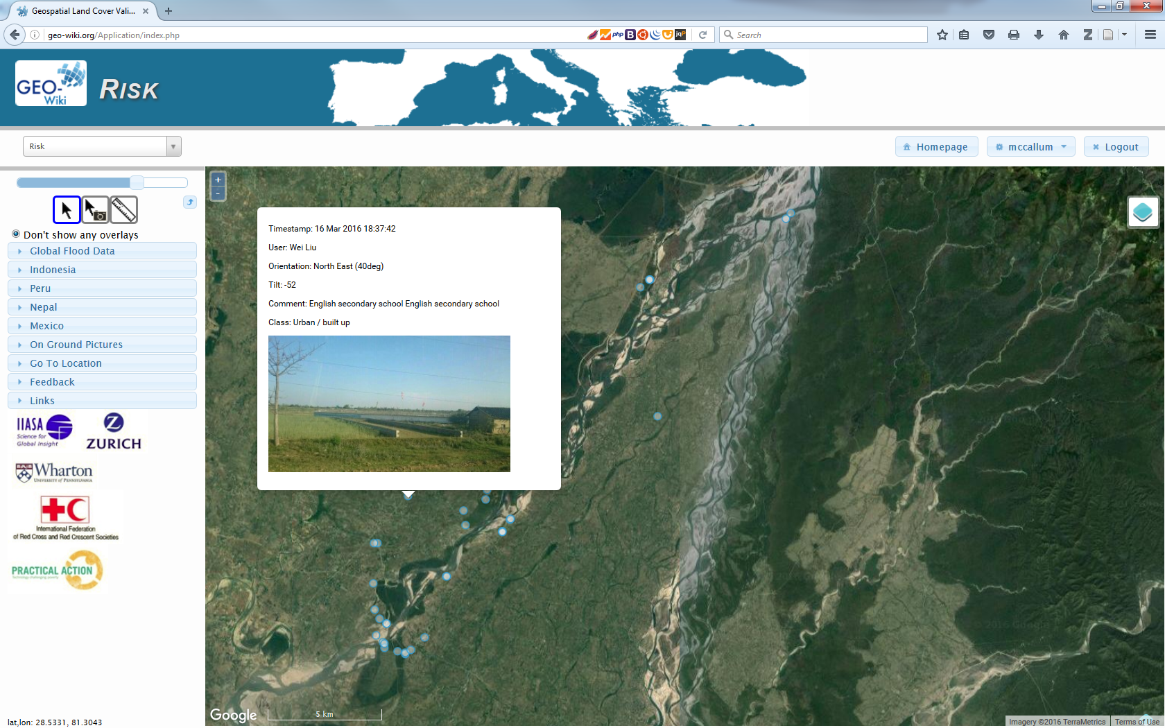
The Risk Geo-Wiki showing geo-tagged photographs overlaid upon satellite imagery across the Karnali basin, Nepal. © IIASA
With only a web browser, and a simple registration, anyone can access flood-related spatial information worldwide. Available data range from flood hazard, exposure and risk information, to biophysical and socioeconomic data. All of this information can be overlaid upon satellite imagery or OpenStreetMap, along with on-ground pictures taken with the related mobile application Geo-Wiki Pictures. You can use these data to understand the quality of available global products or to visualize the numerous local datasets provided for specific flood affected communities. People interested in flood resilience will benefit from visiting the platform and are welcome to provide additional information to fill many of the existing gaps in information.
Flood resilience and data gaps
One of the aims of the Risk Geo-Wiki is to identify and address data gaps on flood resilience and community-based disaster risk reduction. For example, there is a big disconnect between information suitable for global flood risk modelling and that necessary for community planning. Global modelers need local information with which to validate their forecasts while community planners want both detailed local information and an understanding of their communities in the wider region. The Flood Resilience Alliance is working with many interested groups to help fill this gap and at the same time help strengthen community resilience against floods and to develop and disseminate knowledge and expertise on flood resilience.
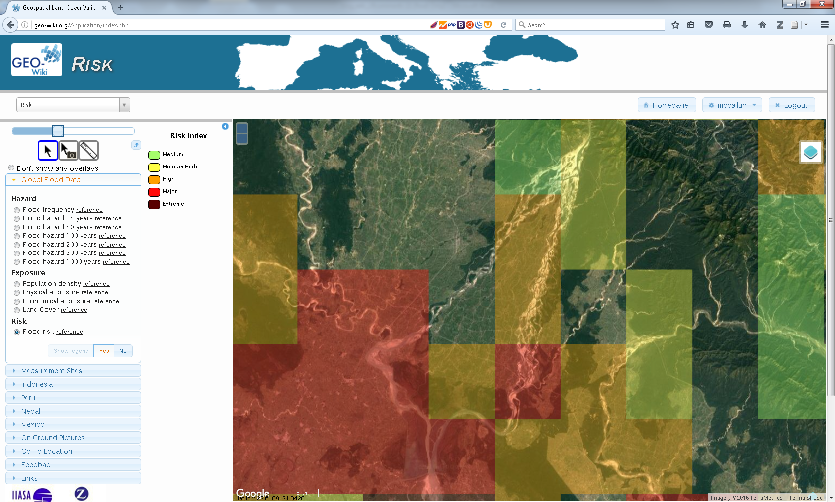
The Risk Geo-Wiki showing modelled global flood risk data overlaid at community level. While this data is suitable at the national and regional level, it is too coarse for informing community level decisions. © IIASA
Practical applications for local communities
Already, communities in Nepal, Peru, and Mexico have uploaded data to the site and are working with us on developing it further. For local communities who have uploaded spatial information to the site, it allows them to visualize their information overlaid upon satellite imagery or OpenStreetMap. Furthermore, if they have used Geo-Wiki Pictures to document efforts in their communities, these geo-tagged photos will also be available.
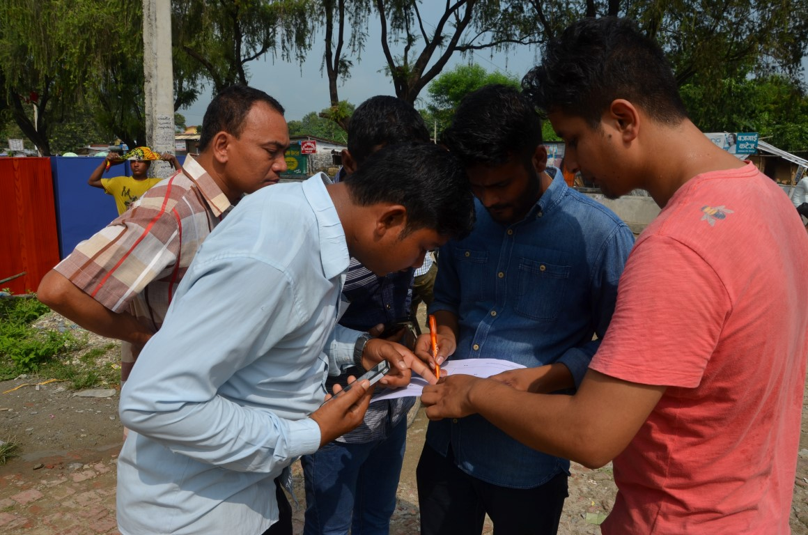
Community and NGO members mapping into OSM with mobile devices in the Karnali basin, Nepal. © Wei Liu, IIASA
In addition to local communities who have uploaded information, the Risk Geo-Wiki will provide important data to others interested in flood risk, including researchers, the insurance industry, NGOs, and donors. The portal provides a source of information that is both easily visualized and overlaid on satellite imagery with local images taken on the ground if available. Such a platform allows anyone interested to better understand flood events over their regions and communities of interest. It is, however, highly dependent upon the information that is made available to the platform, so we invite you to contribute. In particular if you have geographic information related to flood exposure, hazard, risk and vulnerability in the form of images or spatial data we would appreciate you getting in contact with us.
About the portal:
The Risk Geo-Wiki portal was established by the International Institute for Applied Systems Analysis (IIASA) in the context of the Flood Resilience Alliance. It was developed by the Earth Observation Systems Group within the Ecosystems Services and Management Program at IIASA.
Further information
- Risk Geo-Wiki
- Collection of geo-tagged photos with Geo-Wiki Pictures
- Mapping flood resilience in rural Nepal
- Flood Resilience Portal
- McCallum, I., Liu, W., See, L., Mechler, R., Keating, A., Hochrainer-Stigler, S., Mochizuki, J., Fritz, S., Dugar, S., Arestegui, M., Szoenyi, M., Laso Bayas, J.C., Burek, P., French, A. and Moorthy, I. (2016) Technologies to Support Community Flood Disaster Risk Reduction. International Journal of Disaster Risk Science, 7 (2). pp. 198-204.http://pure.iiasa.ac.at/13299/
This article gives the views of the author, and not the position of the Nexus blog, nor of the International Institute for Applied Systems Analysis.
Nov 10, 2016 | Risk and resilience
By Wei Liu, IIASA Risk and Resilience and Ecosystems Services and Management programs
Disasters caused by extreme weather events are on the rise. Floods in particular are increasing in frequency and severity, with reoccurring events trapping people in a vicious cycle of poverty. Information is key for communities to prepare for and respond to floods – to inform risk reduction strategies, improve land use planning, and prepare for when disaster strikes.
But, across much of the developing world, data is sparse at best for understanding the dynamics of flood risk. When and if disaster strikes, massive efforts are required in the response phase to develop or update information. After that, communities have an even greater need for data to help with recovery and reconstruction and further enhance communities’ resilience to future floods. This is particularly important for the Global South, such as the Karnali Basin in Nepal, where little information is available regarding community’s exposure and vulnerability to floods.
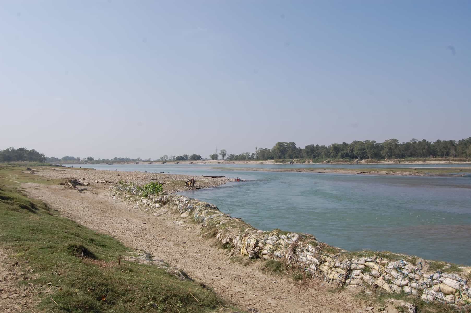
Karnali Basin in Nepal © Wei Liu | IIASA
That’s why we are working with Practical Action in the Zurich Flood Resilience Alliance to try to remedy this situation. Participatory Vulnerability and Capacity Assessment is a widely used tool to collect community level disaster risk and resilience information and to inform disaster risk reduction strategies. One of our first projects was to digitize a set of existing maps on disaster risk and community resources where the locations of, for example, rivers, houses, infrastructure and emergency shelters are usually hand-drawn by selected community members. Such maps provide critical information used by local stakeholders in designing and prioritizing among possible flood risk management options.
From hand-drawn to internet mapping
While hand-drawn maps are ideal for working in remote rural communities, they risk being damaged, lost, or simply unused. They are also more difficult to share with other stakeholders such as emergency services or merge with additional mapped information such as flood hazard. With the recent increase in internet mapping, platforms such as OpenStreetMap have made it possible for us to transfer existing maps or capture new information on a common platform in such a way that anyone with an internet connection can add, edit, and share maps. As this information is digital, it makes it easier to perform additional tasks, such as identifying households in areas of high risk or measuring the distance to the nearest emergency shelter, to support effective risk-reduction and resilience-building.
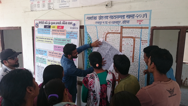
Practical Action Nepal, the Center for Social Development and Research, and community members discuss the transfer of community maps to online maps © Wei Liu | IIASA
From theory to practice
In March 2016, the Project team travelled to two Nepal communities in the Rajapur and Tikapur districts, to pilot the idea of working with a local NGO (the Center for Social Development and Research) and community members, to transfer their maps into a digital environment. The latter can easily be further edited, improved and shared within a broad range of stakeholders and potential users. Local residents in both communities were excited seeing their households and other features for the first time overlaid on a map with satellite imagery. The Center for Social Development and Research was also very enthusiastic about integrating their future community mapping activities with digital mapping, without losing the spirit of participation.
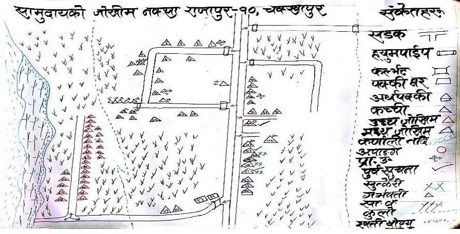
Hand drawn maps produced from community mapping exercises in Chakkhapur, Nepal © Practical Action
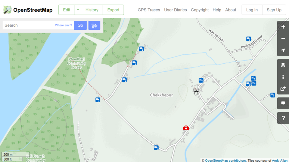
The resulting online maps in OpenStreetMap of Chakkhapur, Nepal, showing the location of drinking water, an emergency shelter and medical clinic. ©OpenStreetMap
Increasing resilience through improved information management
The first stage pilot study in the Karnali river basin confirmed the great potential of new digital technologies in providing accurate and locally relevant maps to improve flood risk assessment to support resilience building at the community level. The next step is to further engage local stakeholders. A wider partnership has been established between Practical Action, the Center for Social Development and Research, the International Institute for Applied Systems Analysis and Kathmandu Living Labs to further build local stakeholders’ capacity in mapping with digital technologies, including a training workshop for NGO staff members in September, 2016. The plan is to have more communities’ flood risk information mapped for designing more effective action plans and strategies for coping with future flood events across the Karnali river basin. A greater potential can be realized when this effort is further scaled up across the region and the results are placed into shared open online databases such as OpenStreetMap.
Further information
- Flood Resilience Portal
- Geo-Wiki Risk
- McCallum, I., Liu, W., See, L., Mechler, R., Keating, A., Hochrainer-Stigler, S., Mochizuki, J., Fritz, S., Dugar, S., Arestegui, M., Szoenyi, M., Laso Bayas, J.C., Burek, P., French, A. and Moorthy, I. (2016) Technologies to Support Community Flood Disaster Risk Reduction. International Journal of Disaster Risk Science, 7 (2). pp. 198-204. http://pure.iiasa.ac.at/13299/
Note: This article gives the views of the author, and not the position of the Nexus blog, nor of the International Institute for Applied Systems Analysis.
Oct 6, 2016 | Alumni, Systems Analysis
Chibulu Luo, PhD Student in the Department of Civil Engineering at the University of Toronto, and a 2016 participant in the IIASA Young Scientists Summer Program
We cannot think about sustainable development without having a clear agenda for cities. So, for the first time, the world has agreed – under the UN’s Sustainable Development Goals (SDGs) and the New Urban Agenda – to promote more sustainable, resilient, and inclusive cities. Achieving this ambitious target is highly relevant in the context of African cities, where most future urban growth will occur. But it is also a major challenge.
Of the projected 2.4 billion people expected to be added to the global urban population between now and 2050, over half (1.3 billion) will be in Africa. The continent’s urban communities will experience dramatic shifts in living and place significant pressure on built infrastructure and supporting ecosystem services. As many cities are yet to be fully developed, newly built infrastructure (estimated to cost an additional US$30 to $100 billion per year) will impact their urban form (i.e. the configuration of buildings and open spaces) and future land use.
In order to realize the SDGs, African cities, in particular, need an ecosystem-based spatial approach to urban planning that recognizes the role of nature and communities in enabling a more resilient urban form. In this regard, more comprehensive understanding of the dynamics between urban form and the social and ecological aspects of cities is critical.
Unfortunately, research to investigate these relationships in the context of African cities has been limited. That’s why, as a Young Scientist at IIASA, I sought to address these research priorities, by asking the following questions: What is the relationship between urban form and the social and ecological aspects of African cities? How has form been changing over time and what are the exhibiting emergent properties? And what factors are hindering a transition towards a more resilient urban form?
Fundamentally, my research approach applies a social-ecological system (SES) lens to investigate these dynamics, where resilience is defined as the capacity of urban form to cope under conditions of change and uncertainty, to be able to recover from shocks and stresses, and to retain basic function. At the same time, resilience is characterized by the interplay between the physical, social, and ecological performance of cities.
Resilient urban forms are spatially designed to support social and ecological diversity, such as preserving and managing urban greenery
Photo Credit: Image of Lusaka, Zambia, posted on #BeautifulLusaka Facebook Page
Currently, Africa’s urbanization is largely unplanned. Urban expansion has led to the destruction of natural resources and increased levels of pollution and related diseases. These challenges are further compounded by inadequate master plans – which often date back to the colonial era in many countries – and capacity to ensure equitable access to basic services, particularly for the poorest dwellers. Consequently, over 70% of people in urban areas live in informal settlements or slums.
My summer research focused on the specific case of Dar es Salaam, Tanzania, and Lusaka, Zambia – two cities with very different forms, and social and ecological settings. I used the SES approach to develop a more holistic understanding of the local dynamics in these cities and emerging patterns of growth. My findings show that urbanization has resulted in high rates of sprawl and slum growth, as well as reductions in green space and increasing built-up area. This has ultimately increased vulnerabilities to climate-related impacts such as flooding.
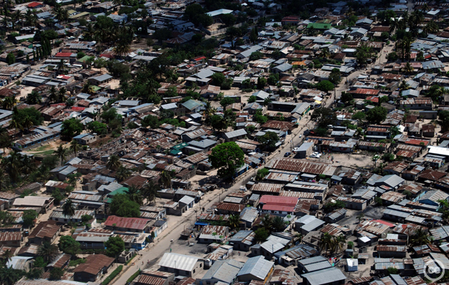
Densely built slum in Dar es Salaam due to unplanned urban development
Photo Credit: tcktcktck.org
Using satellite images in Google Earth Engine, I also mapped land cover and urban forms in both cities in 2005 and 2015 respectively, and quantitatively assessed changes during the 10-year period. Major changes such as the rapid densification of slum areas are considered to be emergent properties of the complex dynamics ascribed by the SES framework. Also, urban communities are playing a significant role in shaping the form of cities in an informal manner, and are not often engaged in the planning process.
Approaches to address these challenges have been varied. On the one hand, initiatives such as the Future Resilience for African Cities and Lands (FRACTAL) project in Lusaka are working to address urban climate vulnerabilities and risks in cities, and integrate this scientific knowledge into decision-making processes. One the other hand, international property developers and firms are offering “new visions for African cities” based on common ideas of “smart” or “eco“ cities. However, these visions are often incongruous with local contexts, and grounded on limited understanding of the underlying local dynamics shaping cities.
My research offers starting point to frame the understanding of these complex dynamics, and ultimately support more realistic approaches to urban planning and governance on the continent.
References
Cobbinah, P. B., & Darkwah, R. M. (2016). African Urbanism: the Geography of Urban Greenery. Urban Forum.
IPCC (b). (2014). Working Group II, Chapter 22: Africa. IPCC.
LSE Cities. (2013). Evolving Cities: Exploring the relations between urban form resilience and the governance of urban form. London School of Economics and Political Science.
OECD. (2016). African Economic Outlook 2016 Sustainable Cities and Structural Transformation. OECD.
The Global Urbanist. (2013, November 26). Who will plan Africa’s cities? Changing the way urban planning is taught in African universities.
UNDESA. (2015). Global Urbanization Prospects (Key Findings).
Watson, V. (2013). African urban fantasies: dreams or nightmares. Environment & Urbanization.
Note: This article gives the views of the author, and not the position of the Nexus blog, nor of the International Institute for Applied Systems Analysis.
You must be logged in to post a comment.