Nov 14, 2017 | Climate Change, Risk and resilience
By Thomas Schinko, research scholar in the IIASA Risk and Resilience Program.
The hurricanes that swept across the Atlantic in the last few months had terrifying, and in Irma’s case record-breaking, power. They flattened homes and destroyed electricity grids, flooded schools and even threatened the integrity of whole nations. Could some of that immense power provide the impetus we need to switch from talking about climate-related risks and damages to doing something about them proactively?
On top of the hurricanes, in just the last two months the world has seen major flooding in Asia, and scorching heatwaves in southern Europe. While climate-related risks are shaped by many factors, the science shows that climate change is loading the dice, making certain extreme events more likely, and providing more favorable conditions for their formation.
Many are pessimistic about our abilities or inclination to heed the wake-up call. They worry that current political divisions and governance structures will leave us dead in the water.
I have hope. I have been working with colleagues on a way forward on managing climate-related risks that defuses the political nature of the debate and helps forging a stakeholder compromise. At all governance levels and all across the globe, disaster risk management has a long and proven track record for dealing with climate-related and other geophysical extremes, such as earthquakes and volcanic eruptions. This established and politically uncontroversial setting is the point of departure for the concept of ‘climate risk management’. This new concept aims to deal with disaster risk reduction and climate change adaptation at the same time, providing a way to circumvent the political hurdles and strengthen global ambitions to tackle climate-related risks.
Aligning climate change adaptation and disaster risk management
In the medium to long term, climate change and adaptation must be incorporated into all kinds and levels of decision and policy making. We can achieve this by increasing understanding of the risks of climate change, and adjusting policy and practice over time according to the latest knowledge and expertise. The importance of climate change is already being recognized in diverse decisions and policies. Just recently, for example, Hong Kong Airport announced that the project to build a third runway incorporated sea level rise projections by the Intergovernmental Panel on Climate Change, and based on that will include the construction of a sea wall, standing at least 21 feet above the waterline.
Broad stakeholder participation
Putting climate risk management into practice requires balancing the perceptions of climate-related risks of all involved. This calls for a process that involves the participation of those in politics, public administration, civil society, private sector and research.

Putting climate risk management into practice requires balancing the perceptions of climate-related risks of all involved. © Aleksandr Simonov
This may sound excessively time consuming, or even impossible, but it’s not. I know that because I am involved in helping to apply climate risk management in the context of flood risk in Austria. We are only just embarking on the process, and it is lengthy, involving extensive collaboration with relevant ministries, departments, and the private sector—such as insurance companies—but ultimately it can help to co-create a strong policy for the future.
Despite considerable uncertainties in establishing a strong causal link to anthropogenic climate change as risk driver, by employing climate-relevant science to decision making on existing short-term risks we were able to kick-start a process to act on flood risk in the country. This includes critically reflecting on existing policy tools, such as the Austrian disaster fund, and injecting aspects of climate-related risk into long-term budget planning processes.
New solutions to tackle increasing levels of climate risk
As risks increase, however, moving beyond incremental adjustments of existing policy tools is imperative, and totally new solutions will have to be found. Tackling erosive and existential climate-related risks, which lead to the complete loss of people’s and communities’ livelihoods, would require truly transformational action. Such risks are currently discussed under the Warsaw International Mechanism for Loss and Damage associated with Climate Change Impacts, which was established in 2013 at the 19th Conference of the Parties to the UN Framework Convention on Climate Change.
For the case of increasingly intolerable flood risk this could mean that in the future raising dikes might not suffice and governments may need to start supporting alternative livelihoods (for example, switching from farming to services sectors); providing climate-resilient social protection schemes; or assisting with voluntary migration. This requires climate risk management to be a learning process itself; flexible towards adjusting to any ecological, societal or political transformations.
Towards transformational climate risk management
To tackle the substantial challenges imposed by increasing climate-related risks, truly transformational thinking is needed. By accounting for underlying socioeconomic and climate-related drivers of risk, as well as for different stakeholder perceptions, climate risk management allows compromises to be achieved that translate into concrete but adaptable action.
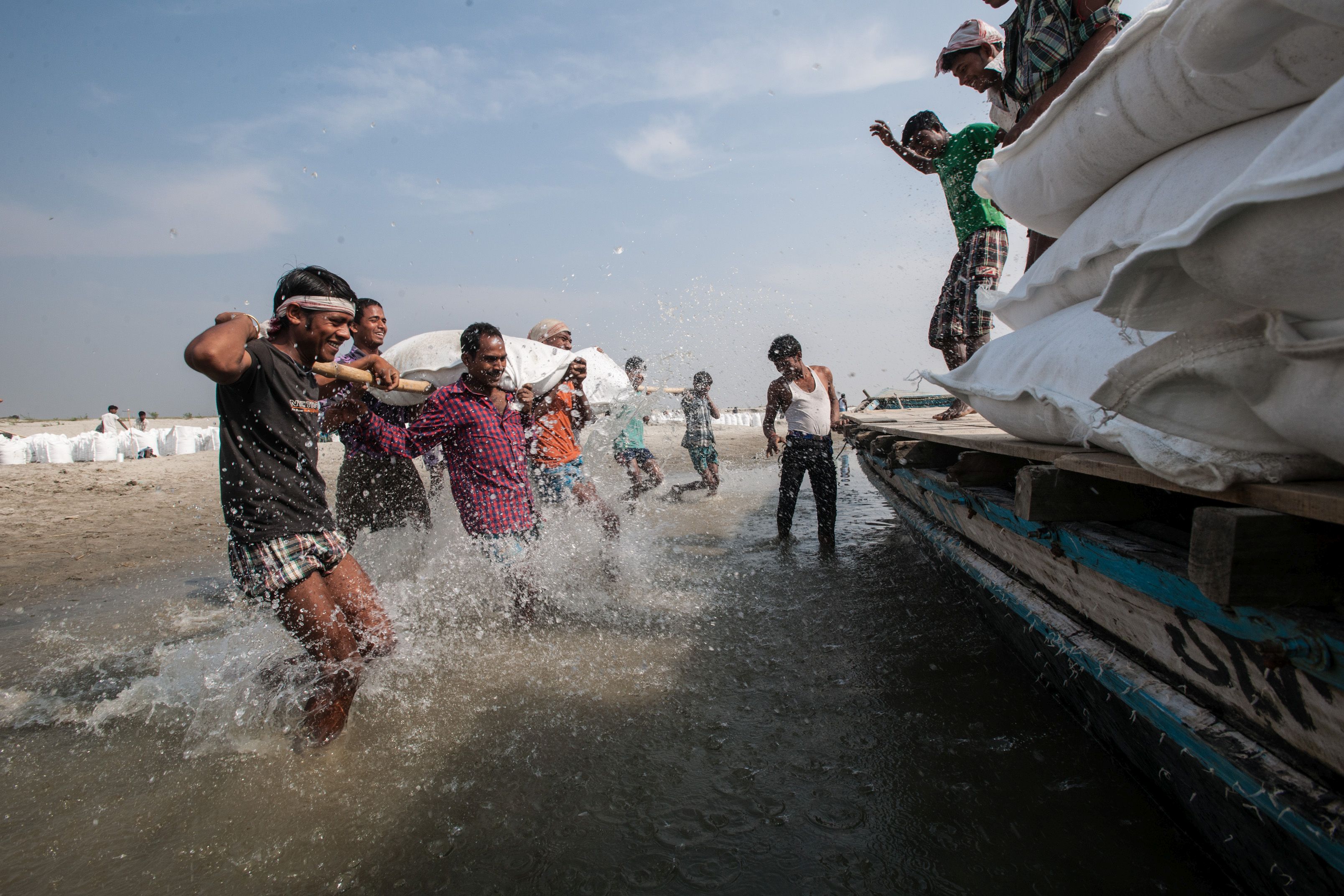
Assam Integrated Flood and Riverbank Erosion Risk Management Investment Program in India. © Asian Development Bank
Transformational thinking requires reframing of the overall problem over time. Reframing, in this context, refers to a change in the collective view on climate-related risks and how to tackle those. Taking again flood risk as a case in point, comprehensive flood risk management plans that are based on broad stakeholder participation processes and that allow for adaptive updates over time could be created. In the short term, re-evaluating existing measures may lead to an incremental adjustment of existing flood risk management efforts. The transformative notion comes in over time via proactively discussing trends in climate-related risks, which might eventually lead to the design of new policies and implementation measures, potentially also requiring alternative governance structures.
What is needed next is to provide space and resources for putting climate risk management processes, such as outlined here, into action. It would be a wise decision to seize the historic chance provided by the current alertness to the issue and start taking proactive action on today’s and future losses and damages due to climate-related risks.
Note: This article gives the views of the author, and not the position of the Nexus blog, nor of the International Institute for Applied Systems Analysis.
Aug 7, 2017 | Climate Change, Food & Water, Water, Young Scientists
By Parul Tewari, IIASA Science Communication Fellow 2017
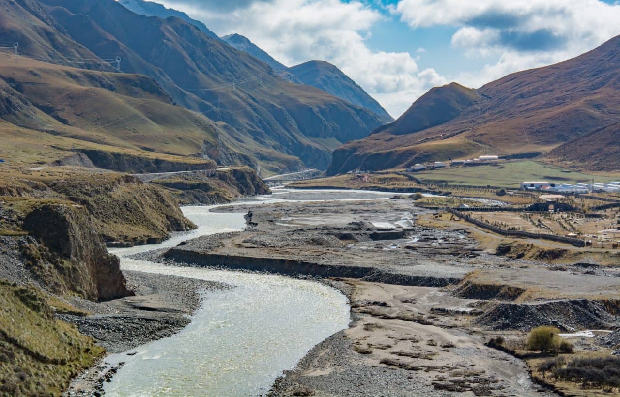
In 2016, Bolivia saw its worst drought in nearly 30 years. While the city of La Paz faced an acute water shortage with no piped water in some parts, the agricultural sector was hit the hardest. According to The Agricultural Chamber of the East, the region suffered a loss of almost 50% of total produce. Animal carcasses lay scattered in plain sight in the valleys, where they had died looking for watering holes.
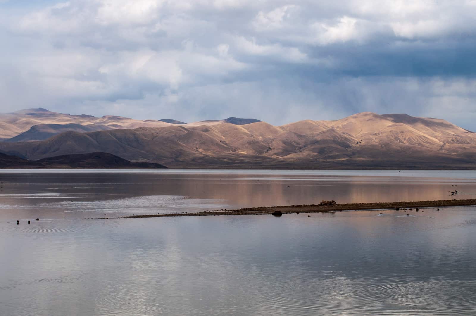
Lake Poopo (Bolivia) before it dried up © David Almeida I Flickr
One of the most dramatic results of this catastrophic drought was that Lake Poopo, (pronounced po-po) Bolivia’s second largest lake was drained of every drop of water. Located at a height of approximately 1127 meters, and covering an area of 1,000 square kilometers, what remains of it now resembles a desert more than a lake. This event forced the fishing community of Uru Uru, which depended on the lake, to either migrate to other lakes or look for alternate livelihood options.
Lake Poopo is located in the central South American Altiplano, one of the largest high plateaus in the world (Bolivia’s largest lake, Titicaca, is located in the north of the region). Due to its unique topography, the highland faces extreme climatic conditions, which are responsible for difficult lives as well as widespread poverty among the people who live there.
While Titicaca is over 100 meters deep, Poopo had a depth of less than three meters. Combined with a high rate of evapotranspiration, erratic rainfall, and limited flow of water from the Desaguadero River, Poopo was in a precarious position even during the best of times. Whatever little water flowed in from the river is further depleted by intensive irrigation activities at the south of Lake Titicaca before the water makes it way down to Poopo.
Sattelite images of Lake Poopo
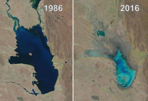
Changes in water levels of Lake Poopo over 30 years © U.S. Geological Survey, Associated Press
The lake’s existence had been threatened several times in the past. However, the 2016 drought was one of the most devastating ones. According to the Defense Ministry of Bolivia, early this year the lake started recovering after several days of heavy rain, restoring as much as 70% of the water. However, since the lake is a part of a very fragile ecosystem, there have been some irreversible changes to the flora and fauna in addition to the losses to the fishing communities living around the lake.
Charting a better future
Claudia Canedo, a participant of the 2017 Young Scientists Summer Program (YSSP) at IIASA, is exploring the impact of droughts and the risk on agricultural production in the light of this event, after which Bolivia declared a state of water emergency. Canedo was born and raised in the city of La Paz and experienced water shortages while growing up close to the Altiplano. This motivated her to investigate a sustainable solution for water availability in the region. With the results of her study she is hoping to ensure that such a situation doesn’t arise again in the Altiplano – that other communities directly dependent on ecosystem services, like that of Lake Poopo, do not have to lose everything because of an extreme weather event.
For a region where more than half the population is dependent on agriculture for their livelihoods, droughts serve as a major setback to the national economy. “It is not just one factor that led to the drought, though. There were different factors that contributed to the drying up of the lake and also contribute to the agricultural distress,” she says.
“The southern Altiplano lies in an arid zone and receives low precipitation due to its proximity to the Atacama Desert. Poor soil quality (high saline content and lack of nutrients) makes it unsuitable for most crops, except quinoa and potato in some areas,” adds Canedo. Residents also lack the knowledge and the monetary resources to invest in newer technology, which could possibly lead to better water management.
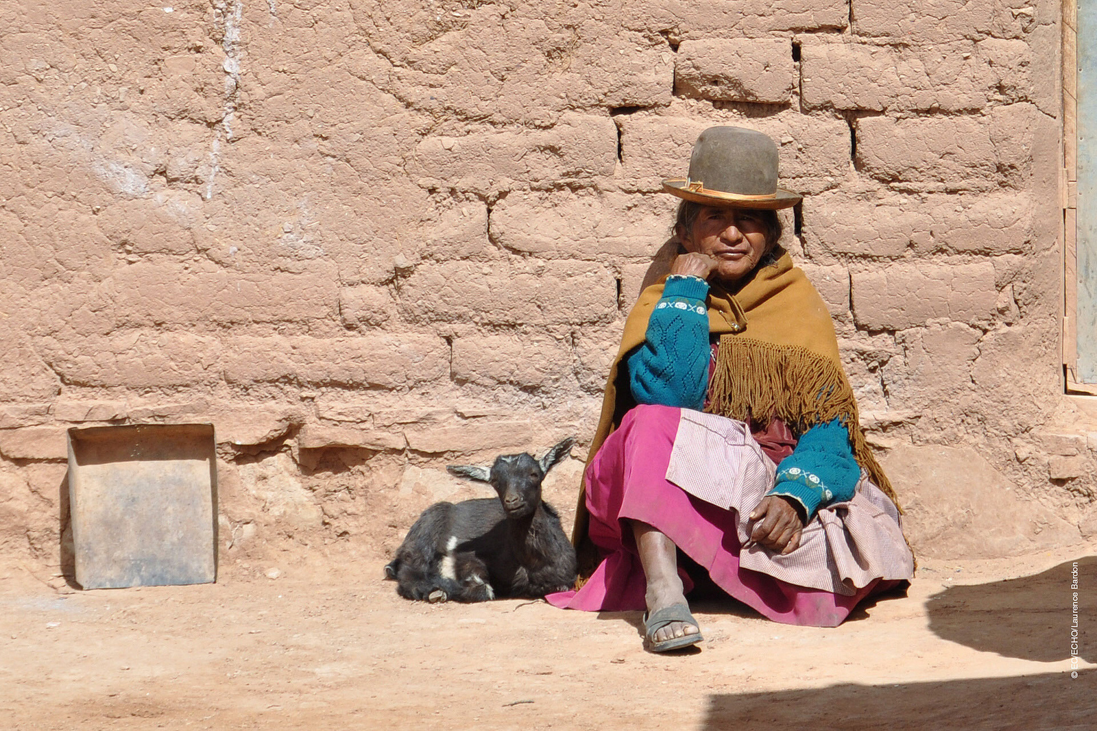
A woman from one of the drought affected communities in Bolivia © EU – Photo credits: EC/ECHO/Laurence Bardon I Flickr
One of the most critical factors in the recent drought was the El Nino- Southern Oscillation, the warming of the sea temperatures in the Pacific Ocean, which in turn carries the warmer oceanic winds and lowers the rate of precipitation in the highland leading to increased evapotranspiration. In 2015 and 2016, the losses due to this phenomenon were devastating for agriculture in the Altiplano, says Canedo.
In her quest to find solutions, the biggest challenge is the lack of recorded data from local weather stations for the past years. Although satellite data is available, it is too generic in nature to do a local analysis. Therefore combining ground and satellite data could enhance the present knowledge and provide consistent results of the climate and vegetation variability. If done successfully, Canedo hopes to identify a correlation between precipitation and vegetation. With this information, she can improve climate forecasting that could help the local people adapt to droughts powerful enough to turn their lives upside down.
With weather forecasts and early warning systems for extreme weather events like droughts, farmers would know what to expect and would be able to plant resilient varieties of crops. This might not earn them the same profits as in a normal year, but would not result in a failed crop. Claudia aims to come up with a drought index useful for drought monitoring and early warning, which will integrate short-term and long-term meteorological predictions.
Perhaps, in the future, with this newfound knowledge, the price for extreme weather events won’t be paid in terms of lost ecosystems like that of Lake Poopo, robbing people of their lives and livelihoods.
About the Researcher
Claudia Canedo is a participant in the 2017 IIASA YSSP. She is pursuing a doctoral program in water resources engineering at Lund University, Sweden. She is interested in studying the hydrological and climatological conditions over small basins in the South American highlands. The aim of her research is to define water resources availability and find strategies for sustainable water management in the semi-arid region.
This article gives the views of the author, and not the position of the Nexus blog, nor of the International Institute for Applied Systems Analysis.
Jul 26, 2017 | Alumni, Climate Change, Poverty & Equity, Sustainable Development, Water, Young Scientists
Adil Najam is the inaugural dean of the Pardee School of Global Studies at Boston University and former vice chancellor of Lahore University of Management Sciences, Pakistan. He talks to Science Communication Fellow Parul Tewari about his time as a participant of the IIASA Young Scientists Summer Program (YSSP) and the global challenge of adaptation to climate change.
How has your experience as a YSSP fellow at IIASA impacted your career?
The most important thing my YSSP experience gave me was a real and deep appreciation for interdisciplinarity. The realization that the great challenges of our time lie at the intersection of multiple disciplines. And without a real respect for multiple disciplines we will simply not be able to act effectively on them.
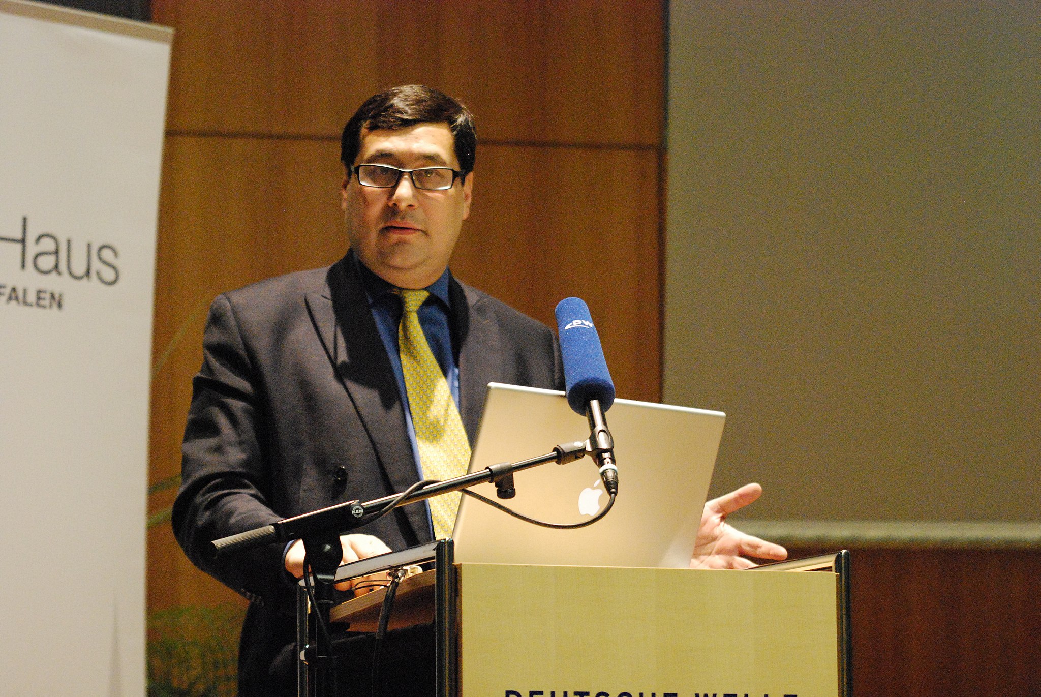
Prof. Adil Najam speaking at the Deutsche Welle Building in Bonn, Germany in 2010 © Erich Habich I en.wikipedia
Recently at the 40th anniversary of the YSSP program you spoke about ‘The age of adaptation’. Globally there is still a lot more focus on mitigation. Why is this?
Living in the “Age of Adaption” does not mean that mitigation is no longer important. It is as, and more, important than ever. But now, we also have to contend with adaptation. Adaptation, after all, is the failure of mitigation. We got to the age of adaptation because we failed to mitigate enough or in time. The less we mitigate now and in the future, the more we will have to adapt, possibly at levels where adaptation may no longer even be possible. Adaption is nearly always more difficult than mitigation; and will ultimately be far more expensive. And at some level it could become impossible.
How do you think can adaptation be brought into the mainstream in environmental/climate change discourse?
Climate discussions are primarily held in the language of carbon. However, adaptation requires us to think outside “carbon management.” The “currency” of adaptation is multivaried: its disease, its poverty, its food, its ecosystems, and maybe most importantly, its water. In fact, I have argued that water is to adaptation, what carbon is to mitigation.
To honestly think about adaptation we will have to confront the fact that adaptation is fundamentally about development. This is unfamiliar—and sometimes uncomfortable—territory for many climate analysts. I do not believe that there is any way that we can honestly deal with the issue of climate adaptation without putting development, especially including issues of climate justice, squarely at the center of the climate debate.
COP 22 (Conference of Parties) was termed as the “COP of Action” where “financing” was one of the critical aspects of both mitigation and adaptation. However, there has not been much progress. Why is this?
Unfortunately, the climate negotiation exercise has become routine. While there are occasional moments of excitement, such as at Paris, the general negotiation process has become entirely predictable, even boring. We come together every year to repeat the same arguments to the same people and then arrive at the same conclusions. We make the same promises each year, knowing that we have little or no intention of keeping them. Maybe I am being too cynical. But I am convinced that if there is to be any ‘action,’ it will come from outside the COPs. From citizen action. From business innovation. From municipalities. And most importantly from future generations who are now condemned to live with the consequences of our decision not to act in time.
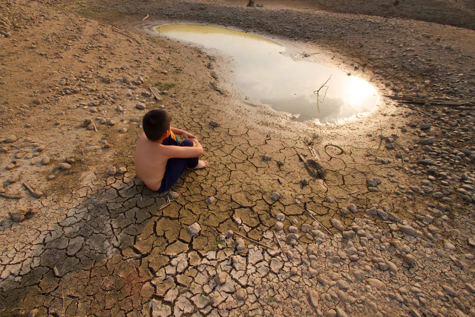
© Piyaset I Shutterstock
What is your greatest fear for our planet, in the near future, if we remain as indecisive in the climate negotiations as we are today?
My biggest fear is that we will—or maybe already have—become parochial in our approach to this global challenge. That by choosing not to act in time or at the scale needed, we have condemned some of the poorest communities in the world—the already marginalized and vulnerable—to pay for the sins of our climatic excess. The fear used to be that those who have contributed the least to the problem will end up facing the worst climatic impacts. That, unfortunately, is now the reality.
What message would you like to give to the current generation of YSSPers?
Be bold in the questions you ask and the answers you seek. Never allow yourself—or anyone else—to rein in your intellectual ambition. Now is the time to think big. Because the challenges we face are gigantic.
Note: This article gives the views of the interviewee, and not the position of the Nexus blog, nor of the International Institute for Applied Systems Analysis.
May 29, 2017 | Citizen Science, Risk and resilience
By Wei Liu, IIASA Risk and Resilience Program
What do Rajapur, Nepal; Chosica, Peru; and Tabasco, Mexico all have in common? Flooding: these areas are all threatened by floods, and they also face similar knowledge gaps, especially in terms of local level spatial information on risk, and the resources and the capacities of communities to manage risk.
To address these gaps, I and my colleagues at IIASA, in collaboration with Kathmandu Living Labs (KLL) and Practical Action (PA) Nepal are building on our experiences in Nepal’s Lower Karnali River basin to support flood risk mapping in flood-prone areas in Peru and Mexico.
Recent developments in data collection and communication via personal devices and social media have greatly enhanced citizens’ abilities to contribute spatial data, called Crowdsourced Geographic Information (CGI) in the mapping community. OpenStreetMap is the most widely used platform for sharing this free geographic data globally, and the fast growing Humanitarian OpenStreetMap Team has developed CGI in some of the world’s most disaster-prone and data-scarce regions. For example, after the 2015 Nepal Earthquake, thousands of global volunteers mapped infrastructure across Nepal, greatly supporting earthquake rescue, recovery, and reconstruction efforts.
Today there is excellent potential to engage citizen mappers in all stages of the disaster risk management cycle, including risk prevention and reduction, preparedness and reconstruction. In this project, we have successfully launched a series of such mapping activities for the Lower Karnali River basin in Nepal starting in early 2016. In an effort to share the experience and lessons of this work with other Zurich Global Flood Resilience Alliance field sites, in March 2017 we initiated two new mapathons in Kathmandu, with support from Soluciones Prácticas (PA Peru) and the Mexican Red Cross, to remotely map basic infrastructure such as buildings and roads, as well as visible water surface, around flood-prone communities in Chosica, Peru and Tobasco, Mexico.
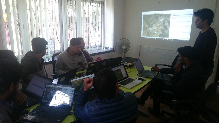
March 17th, 2017, staff and volunteers conducting remote mapping at Kathmandu Living Labs @ Wei Liu | IIASA
Prior to our efforts very few buildings in these areas were identified on online map portals, including Google Maps, Bing Maps, and OSM. Through our mapathons, dozens of Nepalese volunteers mapped over 15,000 buildings and 100 km of roads. The top scorer, Bishal Bhandari, mapped over 1,700 buildings and 6 km of roads for Chosica alone.
Having the basic infrastructure mapped before a flood event can be extremely valuable for increasing flood preparedness of communities and for local authorities and NGOs. During the period of the mapathons, the Lima region in Peru, including Chosica, was hit by a severe flood induced by coastal El Niño conditions. Having almost all buildings in Chosica mapped on the OSM platform now makes visible the high flood risk faced by people living in this densely populated area with both formal and informal settlements. These data may support conducting a quick damage assessment, as suggested by Miguel Arestegui, a collaborator from PA Peru during his visit to IIASA in April, 2017.
Recognizing the value of crowdsourced spatial risk information, we are working closely with partners, including OpenStreetMap Peru, to mobilize the creativity, technical know-how, and practical experience from the Nepal study to Latin America countries. Collecting such information using CGI comes with low cost but high potential for modeling and estimating the amount of people and economic assets potentially being affected under different future flood situations, for improving development and land-use plans to support disaster risk reduction, and for increasing preparedness and helping with allocating humanitarian support in a timely manner after disaster events.
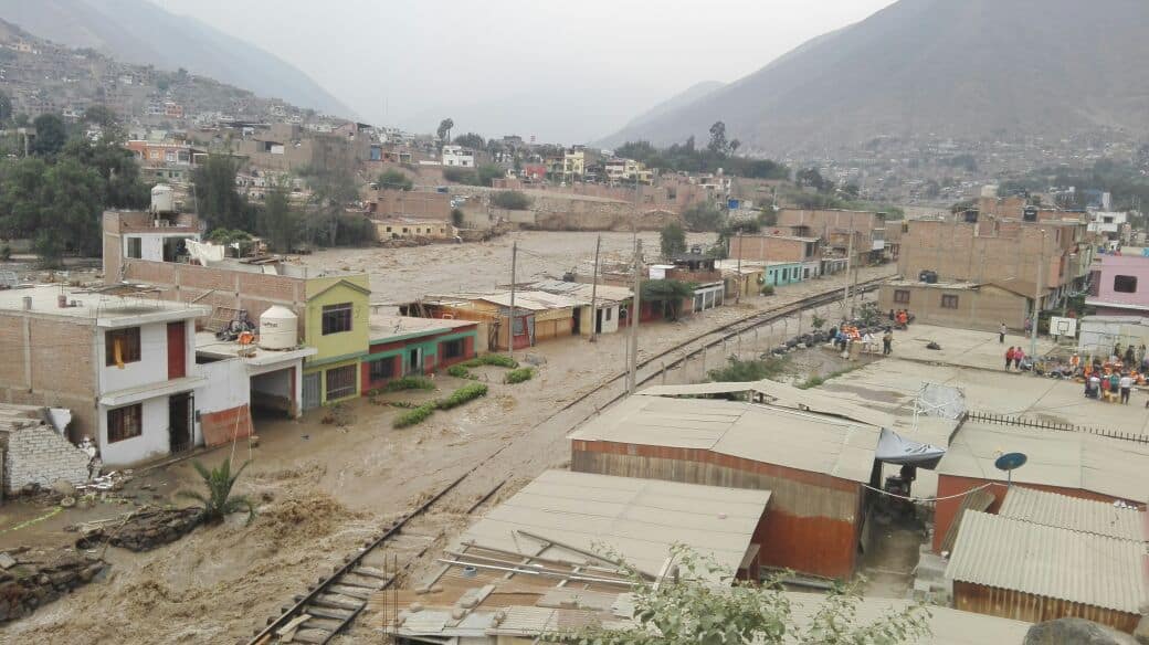
Flood-inundated houses and local railway in Chosica, Peru, 18/03/2017 @ Miluska Ordoñez | Soluciones Prácticas
The United Nation’s Sendai Framework for Disaster Risk Reduction states that knowledge in “all dimensions of vulnerability, capacity, exposure of persons and assets, hazard characteristics and the environment” needs to be leveraged to inform policies and practices across all stages of the disaster risk management cycle. CGI has a great potential to involve citizens from around the world to help fill this critical knowledge gap. These pilot mapathons conducted between Nepal and Latin America are promising examples of supporting community flood resilience through the mobilization of CGI via international partnerships within the Global South.
This article gives the views of the author, and not the position of the Nexus blog, nor of the International Institute for Applied Systems Analysis.
Apr 28, 2017 | Alumni, Systems Analysis, Young Scientists
University of Tokyo researcher Ali Kharrazi credits the 2012 IIASA Young Scientists Summer Program (YSSP) with strengthening his passion, and giving him the research skills, to make a positive impact on humanity and sustainable development. He continues to collaborate with the institute as a guest researcher.

Ali Kharrazi
What is your research focus?
I’m currently examining both theoretical and empirical dimensions related to resilience and the wider application of sustainability indices and metrics. Towards this end, I have lately completed a literature review of empirical approaches to the concept of resilience, examined the resilience of global trade growth, and examined the resilience of water services within a river basin network.
My future project includes the examination of the application of modularity for resilience and its impact on other system characteristics of resilience, such as redundancy, diversity, and efficiency. In addition, I am collecting more data on the water-energy-food nexus, to empirically examine the resilience of these critical coupled human-environmental systems to various shocks and disruptions. I am working with other researchers towards channeling the emergence of urban big data towards practical research in sustainability indices and metrics, especially those which are related to resilience. Finally, I am engaged in what may be called ‘action research’ towards better teaching and engaging the concept of resilience to students.
How do you define resilience for a layperson or a student?
At its simplest, resilience is the ability of a system to survive and adapt in the wake of a disturbance.
The concept of resilience has been dealt by various disciplines: psychology, engineering, ecology, and network sciences. The literature on resilience relevant to coupled social-environmental systems therefore is very scattered, not approached quantitatively, and difficult to rely upon towards evidence based policy making. There are few empirical approaches to the concept of resilience. This makes it difficult to measure, quantify, communicate, and apply the concept to sustainability challenges.
In a recent study, Kharrazi explored the resilience of the Heihe river basin in China ©smiling_z | Shutterstock
What is missing from current approaches of studying resilience?
There is a need for more empirical advancements on the concept of resilience. Furthermore, empirical approaches need to be tested with real data and improved for their ability to measure and apply in policymaking. If you look at the Sustainable Development Goals (SDGs) the concept of resilience is used numerous times, however the indicators used to reflect the concept need to be improved to better reflect the elements of the concept of resilience. This includes the ability to consider adaptation, the ability to integrate social and environmental dimensions, and the ability to evaluate systems-level trade-offs.
We need to apply the different empirical approaches to the concept of resilience towards real-world sustainability challenges. With the emergence of big data, especially urban big data, we can better apply and improve these models.
How did you personally become interested in this field of research?
I always wanted to make a positive impact for humanity and our common interest in sustainable development. When I first started my PhD, my PhD supervisor at Tokyo University, Dr. Masaru Yarime, told me to always set your sight on the ‘vast blue ocean’ and how as researchers we should dedicate our time to critically important yet less researched areas. Given the global discussions of SDGs and the Agenda 2020 at that time I became interested in the concept of resilience, its relationship to common sustainability challenges, and our inability to measure and quantify this importance concept. My research stay at IIASA and YSSP and especially my experience with the ASA group strengthened my passion to contribute to this area and therefore since my PhD I have continued to research in this area and apply it to various domains, such as energy, water, and trade.
How would you say IIASA has influenced your career?
Without IIASA and especially the YSSP in the Advanced Systems Analysis program, my academic career would have never taken off. I am truly indebted to the YSSP, where I learned how to engage in scientific research with others from diverse academic and cultural backgrounds and most importantly had the chance to publish high quality research papers. IIASA also gave me the chance to get experience in applying for international competitive funding schemes and truly believe in the importance of science diplomacy and influence of science on global governance of common human-environmental problems in our modern world.
Follow Ali Kharrazi on Twitter
Ali Kharrazi, second from left, received his certificate with other participants of the 2012 YSSP
References
Kharrazi A, Akiyama T, Yu Y, & Li J (2016). Evaluating the evolution of the Heihe River basin using the ecological network analysis: Efficiency, resilience, and implications for water resource management policy. Science of the Total Environment 572: 688-696. http://pure.iiasa.ac.at/13594/
Kharrazi A, Fath B, & Katzmair H (2016). Advancing Empirical Approaches to the Concept of Resilience: A Critical Examination of Panarchy, Ecological Information, and Statistical Evidence. Sustainability 8 (9): e935. http://pure.iiasa.ac.at/13791/
Kharrazi A, Rovenskaya E, & Fath BD (2017). Network structure impacts global commodity trade growth and resilience. PLoS ONE 12 (2): e0171184. http://pure.iiasa.ac.at/14385/
This article gives the views of the author, and not the position of the Nexus blog, nor of the International Institute for Applied Systems Analysis.

You must be logged in to post a comment.