By Wei Liu, IIASA Risk and Resilience and Ecosystems Services and Management programs
Disasters caused by extreme weather events are on the rise. Floods in particular are increasing in frequency and severity, with reoccurring events trapping people in a vicious cycle of poverty. Information is key for communities to prepare for and respond to floods – to inform risk reduction strategies, improve land use planning, and prepare for when disaster strikes.
But, across much of the developing world, data is sparse at best for understanding the dynamics of flood risk. When and if disaster strikes, massive efforts are required in the response phase to develop or update information. After that, communities have an even greater need for data to help with recovery and reconstruction and further enhance communities’ resilience to future floods. This is particularly important for the Global South, such as the Karnali Basin in Nepal, where little information is available regarding community’s exposure and vulnerability to floods.
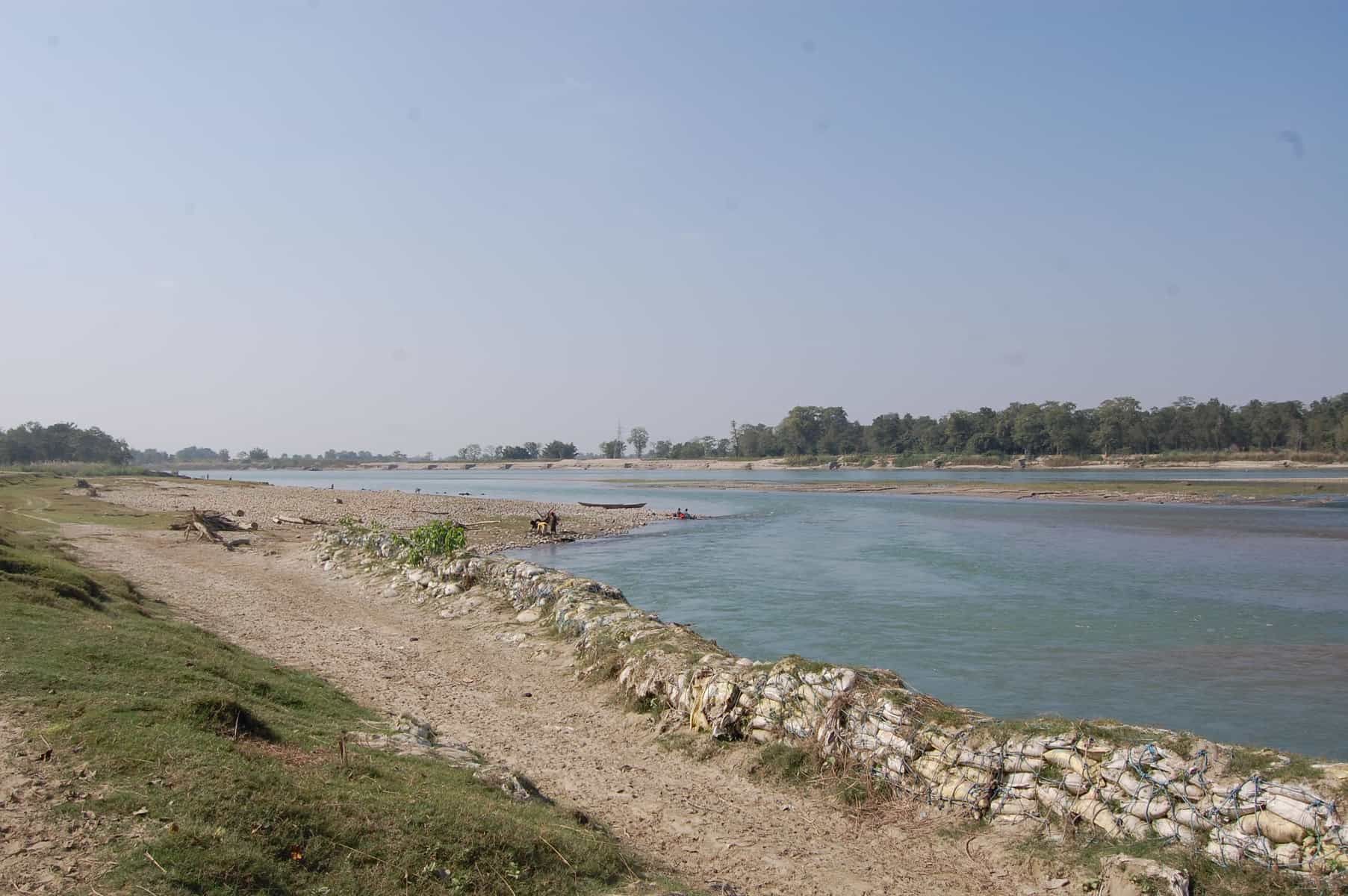
Karnali Basin in Nepal © Wei Liu | IIASA
That’s why we are working with Practical Action in the Zurich Flood Resilience Alliance to try to remedy this situation. Participatory Vulnerability and Capacity Assessment is a widely used tool to collect community level disaster risk and resilience information and to inform disaster risk reduction strategies. One of our first projects was to digitize a set of existing maps on disaster risk and community resources where the locations of, for example, rivers, houses, infrastructure and emergency shelters are usually hand-drawn by selected community members. Such maps provide critical information used by local stakeholders in designing and prioritizing among possible flood risk management options.
From hand-drawn to internet mapping
While hand-drawn maps are ideal for working in remote rural communities, they risk being damaged, lost, or simply unused. They are also more difficult to share with other stakeholders such as emergency services or merge with additional mapped information such as flood hazard. With the recent increase in internet mapping, platforms such as OpenStreetMap have made it possible for us to transfer existing maps or capture new information on a common platform in such a way that anyone with an internet connection can add, edit, and share maps. As this information is digital, it makes it easier to perform additional tasks, such as identifying households in areas of high risk or measuring the distance to the nearest emergency shelter, to support effective risk-reduction and resilience-building.
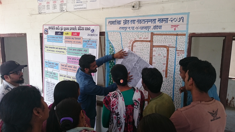
Practical Action Nepal, the Center for Social Development and Research, and community members discuss the transfer of community maps to online maps © Wei Liu | IIASA
From theory to practice
In March 2016, the Project team travelled to two Nepal communities in the Rajapur and Tikapur districts, to pilot the idea of working with a local NGO (the Center for Social Development and Research) and community members, to transfer their maps into a digital environment. The latter can easily be further edited, improved and shared within a broad range of stakeholders and potential users. Local residents in both communities were excited seeing their households and other features for the first time overlaid on a map with satellite imagery. The Center for Social Development and Research was also very enthusiastic about integrating their future community mapping activities with digital mapping, without losing the spirit of participation.
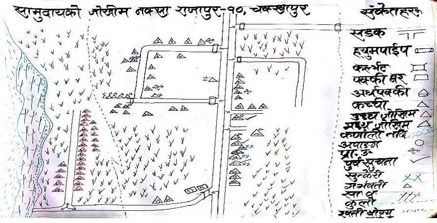
Hand drawn maps produced from community mapping exercises in Chakkhapur, Nepal © Practical Action
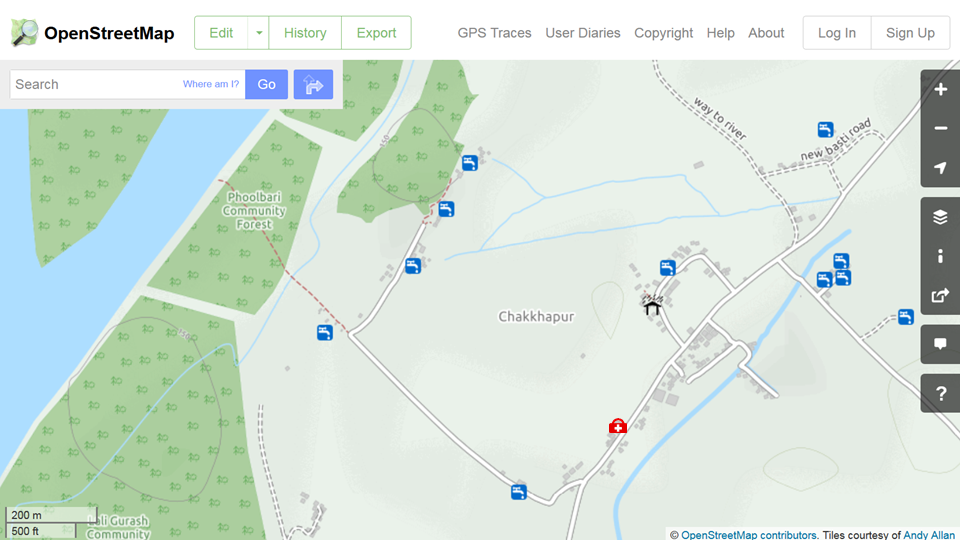
The resulting online maps in OpenStreetMap of Chakkhapur, Nepal, showing the location of drinking water, an emergency shelter and medical clinic. ©OpenStreetMap
Increasing resilience through improved information management
The first stage pilot study in the Karnali river basin confirmed the great potential of new digital technologies in providing accurate and locally relevant maps to improve flood risk assessment to support resilience building at the community level. The next step is to further engage local stakeholders. A wider partnership has been established between Practical Action, the Center for Social Development and Research, the International Institute for Applied Systems Analysis and Kathmandu Living Labs to further build local stakeholders’ capacity in mapping with digital technologies, including a training workshop for NGO staff members in September, 2016. The plan is to have more communities’ flood risk information mapped for designing more effective action plans and strategies for coping with future flood events across the Karnali river basin. A greater potential can be realized when this effort is further scaled up across the region and the results are placed into shared open online databases such as OpenStreetMap.
Further information
- Flood Resilience Portal
- Geo-Wiki Risk
- McCallum, I., Liu, W., See, L., Mechler, R., Keating, A., Hochrainer-Stigler, S., Mochizuki, J., Fritz, S., Dugar, S., Arestegui, M., Szoenyi, M., Laso Bayas, J.C., Burek, P., French, A. and Moorthy, I. (2016) Technologies to Support Community Flood Disaster Risk Reduction. International Journal of Disaster Risk Science, 7 (2). pp. 198-204. http://pure.iiasa.ac.at/13299/
Note: This article gives the views of the author, and not the position of the Nexus blog, nor of the International Institute for Applied Systems Analysis.
You must be logged in to post a comment.