Jun 12, 2017 | Citizen Science
By Linda See, IIASA Ecosystems Services and Management Program
Satellites have changed the way that we see the world. For more than 40 years, we have had regular images of the Earth’s surface, which have allowed us to monitor deforestation, visualize dramatic changes in urbanization, and comprehensively map the Earth’s surface. Without satellites, our understanding of the impacts that humans are having on the terrestrial ecosystem would be much diminished.
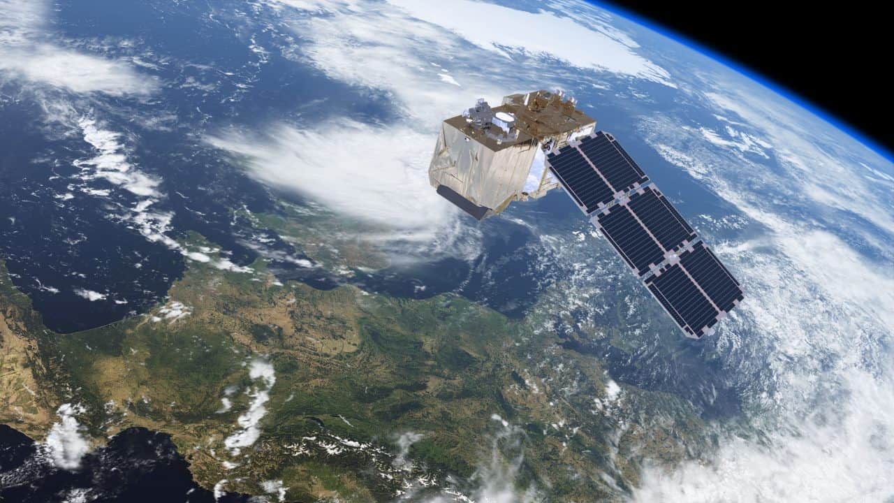
The Sentinel-2 satellite provides high-resolution land-cover data. © ESA/ATG medialab
Over the past decade, many more satellites have been launched, with improvements in how much detail we can see and the frequency at which locations are revisited. This means that we can monitor changes in the landscape more effectively, particularly in areas where optical imagery is used and cloud cover is frequent. Yet perhaps even more important than these technological innovations, one of the most pivotal changes in satellite remote sensing was when NASA opened up free access to Landsat imagery in 2008. As a result, there has been a rapid uptake in the use of the data, and researchers and organizations have produced many new global products based on these data, such as Matt Hansen’s forest cover maps, JRC’s water and global human settlement layers, and global land cover maps (FROM-GLC and GlobeLand30) produced by different groups in China.
Complementing Landsat, the European Space Agency’s (ESA) Sentinel-2 satellites provide even higher spatial and temporal resolution, and once fully operational, coverage of the Earth will be provided every five days. Like NASA, ESA has also made the data freely available. However, the volume of data is much higher, on the order of 1.6 terabytes per day. These data volumes, as well as the need to pre-process the imagery, can pose real problems to new users. Pre-processing can also lead to incredible duplication of effort if done independently by many different organizations around the world. For example, I attended a recent World Cover conference hosted by ESA, and there were many impressive presentations of new applications and products that use these openly available data streams. But most had one thing in common: they all downloaded and processed the imagery before it was used. For large map producers, control over the pre-processing of the imagery might be desirable, but this is a daunting task for novice users wanting to really exploit the data.
In order to remove these barriers, we need new ways of providing access to the data that don’t involve downloading and pre-processing every new data point. In some respects this could be similar to the way in which Google and Bing provide access to very high-resolution satellite imagery in a seamless way. But it’s not just about visualization, or Google and Bing would be sufficient for most user needs. Instead it’s about being able to use the underlying spectral information to create derived products on the fly. The Google Earth Engine might provide some of these capabilities, but the learning curve is pretty steep and some programming knowledge is required.
Instead, what we need is an even simpler system like that produced by Sinergise in Slovenia. In collaboration with Amazon Web Services, the Sentinel Hub provides access to all Sentinel-2 data in one place, with many different ways to view the imagery, including derived products such as vegetation status or on-the-fly creation of user-defined indices. Such a system opens up new possibilities for environmental monitoring without the need to have either remote sensing expertise, programming ability, or in-house processing power. An exemplary web application using Sentinel Hub services, the Sentinel Playground, allows users to browse the full global multi-spectral Sentinel-2 archive in matter of seconds.
This is why we have chosen Sentinel Hub to provide data for our LandSense Citizen Observatory, an initiative to harness remote sensing data for land cover monitoring by citizens. We will access a range of services from vegetation monitoring through to land cover change detection and place the power of remote sensing within the grasp of the crowd.
Without these types of innovations, exploitation of the huge volumes of satellite data from Sentinel-2, and other newly emerging sources of satellite data, will remain within the domain of a small group of experts, creating a barrier that restricts many potential applications of the data. Instead we must encourage developments like Sentinel Hub to ensure that satellite remote sensing becomes truly usable by the masses in ways that benefits everyone.
This article gives the views of the author, and not the position of the Nexus blog, nor of the International Institute for Applied Systems Analysis.
May 29, 2017 | Citizen Science, Risk and resilience
By Wei Liu, IIASA Risk and Resilience Program
What do Rajapur, Nepal; Chosica, Peru; and Tabasco, Mexico all have in common? Flooding: these areas are all threatened by floods, and they also face similar knowledge gaps, especially in terms of local level spatial information on risk, and the resources and the capacities of communities to manage risk.
To address these gaps, I and my colleagues at IIASA, in collaboration with Kathmandu Living Labs (KLL) and Practical Action (PA) Nepal are building on our experiences in Nepal’s Lower Karnali River basin to support flood risk mapping in flood-prone areas in Peru and Mexico.
Recent developments in data collection and communication via personal devices and social media have greatly enhanced citizens’ abilities to contribute spatial data, called Crowdsourced Geographic Information (CGI) in the mapping community. OpenStreetMap is the most widely used platform for sharing this free geographic data globally, and the fast growing Humanitarian OpenStreetMap Team has developed CGI in some of the world’s most disaster-prone and data-scarce regions. For example, after the 2015 Nepal Earthquake, thousands of global volunteers mapped infrastructure across Nepal, greatly supporting earthquake rescue, recovery, and reconstruction efforts.
Today there is excellent potential to engage citizen mappers in all stages of the disaster risk management cycle, including risk prevention and reduction, preparedness and reconstruction. In this project, we have successfully launched a series of such mapping activities for the Lower Karnali River basin in Nepal starting in early 2016. In an effort to share the experience and lessons of this work with other Zurich Global Flood Resilience Alliance field sites, in March 2017 we initiated two new mapathons in Kathmandu, with support from Soluciones Prácticas (PA Peru) and the Mexican Red Cross, to remotely map basic infrastructure such as buildings and roads, as well as visible water surface, around flood-prone communities in Chosica, Peru and Tobasco, Mexico.
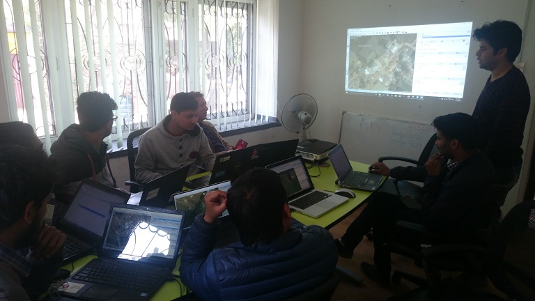
March 17th, 2017, staff and volunteers conducting remote mapping at Kathmandu Living Labs @ Wei Liu | IIASA
Prior to our efforts very few buildings in these areas were identified on online map portals, including Google Maps, Bing Maps, and OSM. Through our mapathons, dozens of Nepalese volunteers mapped over 15,000 buildings and 100 km of roads. The top scorer, Bishal Bhandari, mapped over 1,700 buildings and 6 km of roads for Chosica alone.
Having the basic infrastructure mapped before a flood event can be extremely valuable for increasing flood preparedness of communities and for local authorities and NGOs. During the period of the mapathons, the Lima region in Peru, including Chosica, was hit by a severe flood induced by coastal El Niño conditions. Having almost all buildings in Chosica mapped on the OSM platform now makes visible the high flood risk faced by people living in this densely populated area with both formal and informal settlements. These data may support conducting a quick damage assessment, as suggested by Miguel Arestegui, a collaborator from PA Peru during his visit to IIASA in April, 2017.
Recognizing the value of crowdsourced spatial risk information, we are working closely with partners, including OpenStreetMap Peru, to mobilize the creativity, technical know-how, and practical experience from the Nepal study to Latin America countries. Collecting such information using CGI comes with low cost but high potential for modeling and estimating the amount of people and economic assets potentially being affected under different future flood situations, for improving development and land-use plans to support disaster risk reduction, and for increasing preparedness and helping with allocating humanitarian support in a timely manner after disaster events.
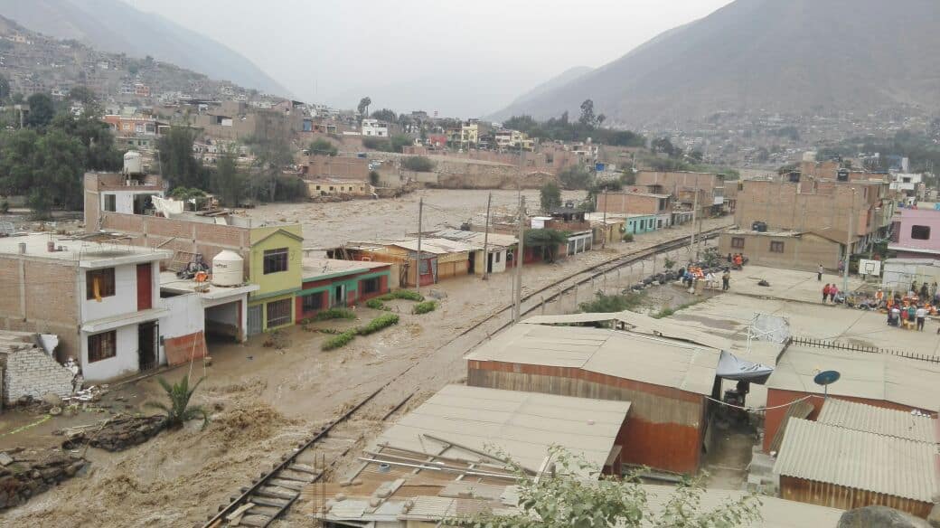
Flood-inundated houses and local railway in Chosica, Peru, 18/03/2017 @ Miluska Ordoñez | Soluciones Prácticas
The United Nation’s Sendai Framework for Disaster Risk Reduction states that knowledge in “all dimensions of vulnerability, capacity, exposure of persons and assets, hazard characteristics and the environment” needs to be leveraged to inform policies and practices across all stages of the disaster risk management cycle. CGI has a great potential to involve citizens from around the world to help fill this critical knowledge gap. These pilot mapathons conducted between Nepal and Latin America are promising examples of supporting community flood resilience through the mobilization of CGI via international partnerships within the Global South.
This article gives the views of the author, and not the position of the Nexus blog, nor of the International Institute for Applied Systems Analysis.
May 23, 2017 | Alumni, Water, Young Scientists
Firdos Khan Yousafzai, PhD student, University of Klagenfurt, Austria, and YSSP 2012 participant
In Pakistan, water supply fell from 5,260 cubic meters per capita in 1951 to 1,050 cubic meters per capita in 2010 according to the World Bank, and is likely to further fall in the future. According to the Falkenmark Water Stress Indicator, a country or a part of a country is said to experience “water stress” when the annual water supplies drop below 1,700 cubic meters per capita per year, and “water scarcity” if the annual water supplies drop below 1,000 cubic meters per capita per year. Water scarcity is especially critical for Pakistan because agriculture contributes 25% of the GDP and 36% of energy is obtained from hydropower.
In terms of geography, Pakistan is incredibly diverse, ranging from plain to desert, hills, forest, and plateaus from the Arabian Sea in the south and to the mountains of Karakorum in the north of the country. It has 796,096 square kilometers area—about the same size as Turkey–and approximately 200 million inhabitants.

The Karakorum mountains in northern Pakistan ©Piotr Snigorski | Shutterstock
Water availability is also different in different parts of the country. While various studies showed that climate change is happening all over Pakistan, research shows that the northern areas are more vulnerable. Possible reasons include the increasing population and deforestation, among others. Therefore, in my PhD work, which was also the subject of my work in the 2012 IIASA Young Scientists Summer Program, I am investigating that how fast climate is changing and exploring its impacts on availability of water.
In a recent study we investigated this issue under four different climate change scenarios, from 2006 to 2039 in the future. Different scenarios have different assumptions about population growth, use of energy type, environmental protection, economic development, technological changes, etc. We calculated the changes on the basis of baseline and future time periods for climate and hydrological projections. We found an increasing trend in maximum and minimum temperature, while precipitation is also changing under each scenario.
To assess water availability and investigate the impacts of changing climate on the operation of reservoirs, we used Tarbela Reservoir as a measurement tool, developing hydrological projections for the reservoir under each scenario. Tarbela Dam is one of the biggest dams in the world, and has a storage capacity of approximately 7 million acre feet and the potential to produce 3,400 megawatts of electricity.
Cholistan Desert in southern Pakistan. Water scarcity varies widely throughout the geographically diverse country. ©image bird | Shutterstock
In our study, we considered all the relevant parameters related to water shortages and surpluses. To compare the status of water availability, we compared the baseline period and future time period. The results show an increasing trend in water availability, however, water scarcity is observed during some months under each scenario. Further, we also observed that there is a 23-40% increase in river flow under the considered scenarios while the average increase is approximately 35% during the future time period.
As a conclusion we can say that enough water is available in Pakistan, and will continue to be available in the future. Instead, the study confirms previous reports that the major problem is mismanagement.
The possible solution may include constructing more dams and storage capacity to store extra water during high river flow which then can be utilized during low river flow. This could probably also be helpful in flood control, raise the groundwater level, and provide cheap and clean electricity to national electricity grid—providing multiple benefits, in view of the fact that the country has faced ongoing energy crises for many years.
References
Ali S, Li D, Congbin F, Khan F (2015). Twenty first century climatic and hydrological changes over Upper Indus Basin of Himalayan region of Pakistan. Environmental Research Letters10 (2015) 014007. DOI:10.1088/1748-9326/10/1/014007.
Khan F, Pilz J, Ali S (2017). Improved hydrological projections and reservoir management in the Upper Indus Basin under the changing climate. Water and Environmental Journal. Vol. 31, No. 2, pp. 235-244. DOI:10.1111/wej.12237.
Khan F, Pilz J, Amjad M, Wiberg D (2015). Climate variability and its impacts on water resources in the Upper Indus Basin under IPCC climate change scenarios. International Journal of Global Warming, Vol. 8, No. 1, pp. 46-69. DOI:10.1504/IJGW.2015.071583.
This article gives the views of the author, and not the position of the Nexus blog, nor of the International Institute for Applied Systems Analysis.
May 9, 2017 | Alumni, Young Scientists
Former IIASA Director Roger Levien started the Young Scientists Summer Program (YSSP) in the summer of 1977. After 40 years the program remains one of the institute’s most successful initiatives.
The idea for the YSSP came out of your own experience as a summer student at The RAND Corporation during your graduate studies. How did that experience inspire you to start the YSSP?
At RAND I was introduced to systems analysis and to working with colleagues from many different disciplines: mathematics, computer science, foreign policy, and economics. After that summer, I changed from a Master’s in Operations Research to a PhD program in Applied Mathematics and moved from MIT to Harvard, because I knew that I needed a broad doctorate to be a RAND systems analyst.
From that point on, I carried the knowledge that a summer experience at a ripe time in one’s life, as one is choosing their post university career, can be life transforming. It certainly was for me.
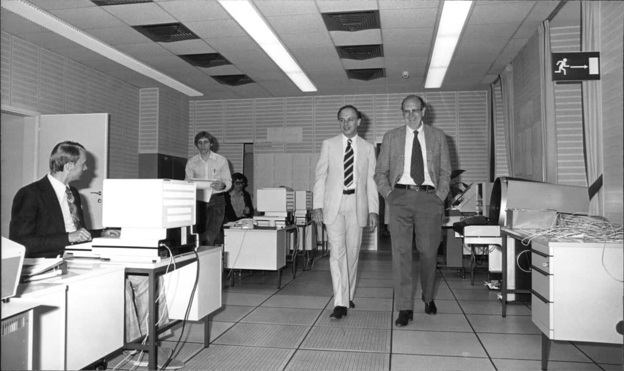
Roger Levien, left, with the first IIASA director Howard Raiffa, right. ©IIASA Archives
Why did you think IIASA would be a good place for such a summer program?
When I thought about such a program within the context of IIASA, it seemed to me that it would offer an even richer experience than mine at RAND. I thought, wouldn’t it be wonderful to bring young scientists from many nations together in their graduate-program years at IIASA. At that time, systems analysis was not well-known anywhere outside of the United States, and even there it was not very well known. In universities interdisciplinary research, and especially applied policy research, was almost nonexistent.
This would be an opportunity to introduce systems analysis to graduate students from around the world, who were otherwise deeply involved in a single discipline. It would be fruitful to bring them together to learn about the uses of scientific analysis to address policy issues, and about working both across disciplines and across nationalities.
What was your vision for the program?
I hoped that these students, who had been introduced to systems analysis at IIASA, would become an international network of analysts sharing a common understanding of international policy problems. And in the future, at international negotiations on issues of public policy, sitting behind the diplomats around the table would be technical experts, many of whom had been graduate students at IIASA, having worked on the same issue in a non-political international and interdisciplinary setting. At IIASA they would have developed a common language, a common way of thought, and perhaps working together at the negotiation they could use their shared view to help their seniors achieve success. A pipe dream perhaps, but also an ideal and a vision of what people from different countries and different disciplines who had studied the same problem with an international system analysis approach could accomplish.

Social activities have been an important component of the YSSP since the beginning ©IIASA Archives
The program is celebrating its 40th year. Why do you think it has been so successful?
I think there are many reasons for success. But for one thing, it’s my impression that just having 50 enthusiastic young scientists around brings an infusion of energy, which is a great boost to the institute. The young scientists also bring findings and methods on the cutting edges of their disciplines to IIASA.
What would be your advice to young scientists coming this summer for the 2017 program
It would be to engage as deeply as you can and as broadly as you can. This is an opportunity to learn about many things that aren’t on the curriculum of any university program. So, now’s the time to engage not only with other disciplines, but with people from other nations, to get their perspective. The people you meet this summer can be lifelong contacts. They can be your friends for life, your colleagues for life, and the opportunities that will open through them, though unpredictable, are bound to be invaluable, both professionally and personally.
This is a learning experience of an entirely different type from the typical graduate program, which goes deeper and deeper into a single discipline. You have a unique opportunity to go broader and wider, culturally, intellectually, and internationally.
IIASA will be celebrating the YSSP 40th Anniversary with an event for alumni on June 20-21, 2017.
This article gives the views of the interviewee, and not the position of the Nexus blog, nor of the International Institute for Applied Systems Analysis.
Apr 28, 2017 | Alumni, Systems Analysis, Young Scientists
University of Tokyo researcher Ali Kharrazi credits the 2012 IIASA Young Scientists Summer Program (YSSP) with strengthening his passion, and giving him the research skills, to make a positive impact on humanity and sustainable development. He continues to collaborate with the institute as a guest researcher.
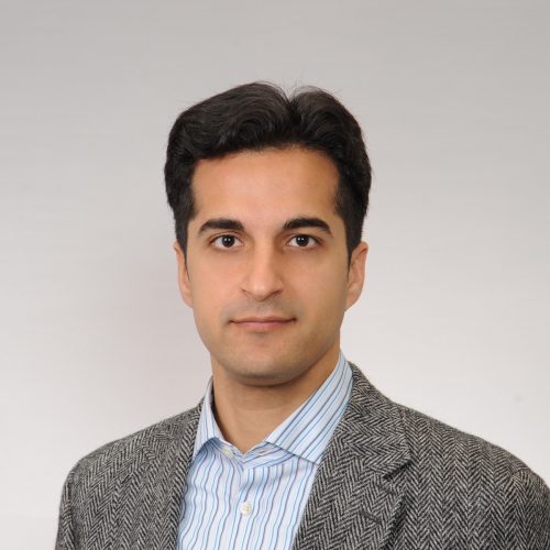
Ali Kharrazi
What is your research focus?
I’m currently examining both theoretical and empirical dimensions related to resilience and the wider application of sustainability indices and metrics. Towards this end, I have lately completed a literature review of empirical approaches to the concept of resilience, examined the resilience of global trade growth, and examined the resilience of water services within a river basin network.
My future project includes the examination of the application of modularity for resilience and its impact on other system characteristics of resilience, such as redundancy, diversity, and efficiency. In addition, I am collecting more data on the water-energy-food nexus, to empirically examine the resilience of these critical coupled human-environmental systems to various shocks and disruptions. I am working with other researchers towards channeling the emergence of urban big data towards practical research in sustainability indices and metrics, especially those which are related to resilience. Finally, I am engaged in what may be called ‘action research’ towards better teaching and engaging the concept of resilience to students.
How do you define resilience for a layperson or a student?
At its simplest, resilience is the ability of a system to survive and adapt in the wake of a disturbance.
The concept of resilience has been dealt by various disciplines: psychology, engineering, ecology, and network sciences. The literature on resilience relevant to coupled social-environmental systems therefore is very scattered, not approached quantitatively, and difficult to rely upon towards evidence based policy making. There are few empirical approaches to the concept of resilience. This makes it difficult to measure, quantify, communicate, and apply the concept to sustainability challenges.
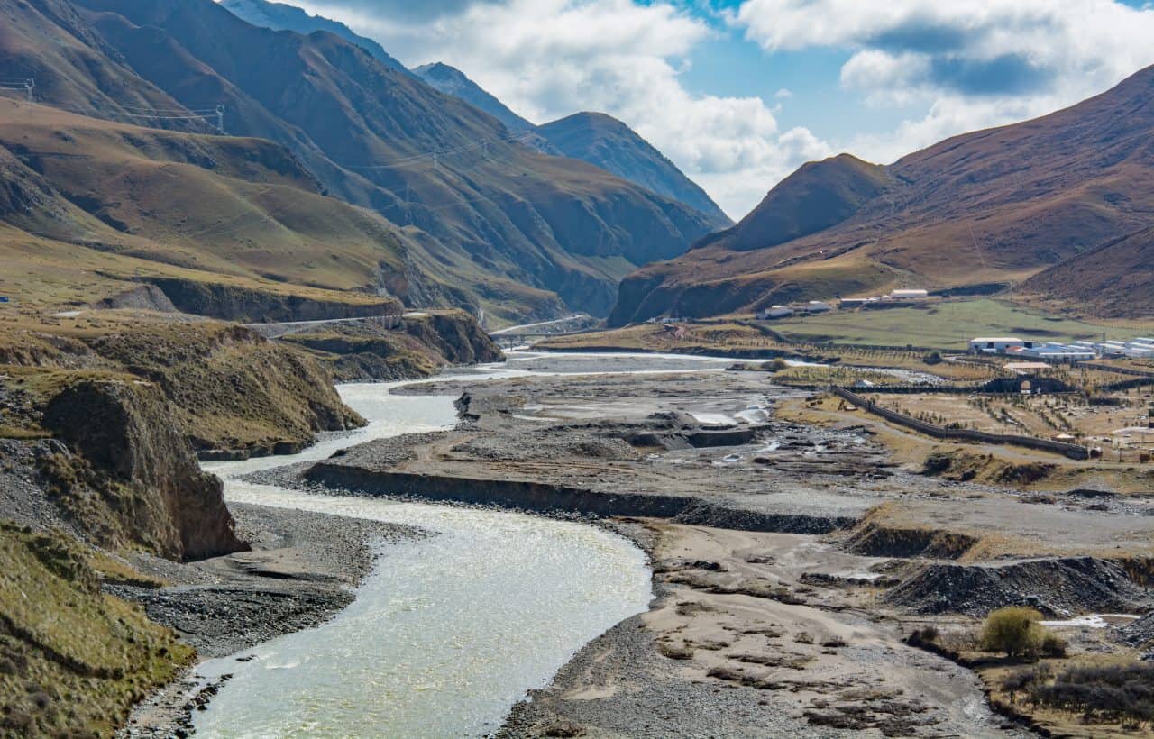
In a recent study, Kharrazi explored the resilience of the Heihe river basin in China ©smiling_z | Shutterstock
What is missing from current approaches of studying resilience?
There is a need for more empirical advancements on the concept of resilience. Furthermore, empirical approaches need to be tested with real data and improved for their ability to measure and apply in policymaking. If you look at the Sustainable Development Goals (SDGs) the concept of resilience is used numerous times, however the indicators used to reflect the concept need to be improved to better reflect the elements of the concept of resilience. This includes the ability to consider adaptation, the ability to integrate social and environmental dimensions, and the ability to evaluate systems-level trade-offs.
We need to apply the different empirical approaches to the concept of resilience towards real-world sustainability challenges. With the emergence of big data, especially urban big data, we can better apply and improve these models.
How did you personally become interested in this field of research?
I always wanted to make a positive impact for humanity and our common interest in sustainable development. When I first started my PhD, my PhD supervisor at Tokyo University, Dr. Masaru Yarime, told me to always set your sight on the ‘vast blue ocean’ and how as researchers we should dedicate our time to critically important yet less researched areas. Given the global discussions of SDGs and the Agenda 2020 at that time I became interested in the concept of resilience, its relationship to common sustainability challenges, and our inability to measure and quantify this importance concept. My research stay at IIASA and YSSP and especially my experience with the ASA group strengthened my passion to contribute to this area and therefore since my PhD I have continued to research in this area and apply it to various domains, such as energy, water, and trade.
How would you say IIASA has influenced your career?
Without IIASA and especially the YSSP in the Advanced Systems Analysis program, my academic career would have never taken off. I am truly indebted to the YSSP, where I learned how to engage in scientific research with others from diverse academic and cultural backgrounds and most importantly had the chance to publish high quality research papers. IIASA also gave me the chance to get experience in applying for international competitive funding schemes and truly believe in the importance of science diplomacy and influence of science on global governance of common human-environmental problems in our modern world.
Follow Ali Kharrazi on Twitter
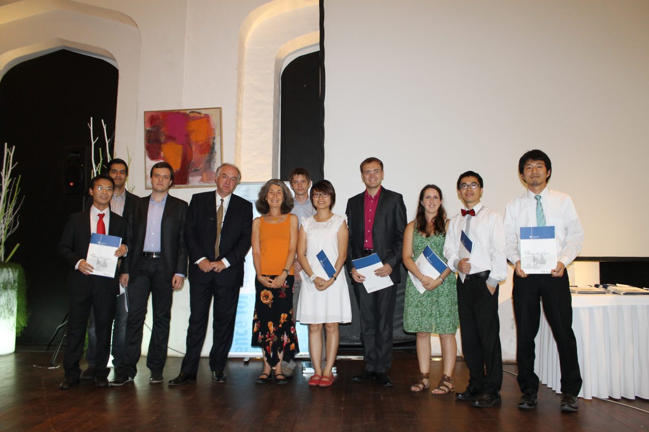
Ali Kharrazi, second from left, received his certificate with other participants of the 2012 YSSP
References
Kharrazi A, Akiyama T, Yu Y, & Li J (2016). Evaluating the evolution of the Heihe River basin using the ecological network analysis: Efficiency, resilience, and implications for water resource management policy. Science of the Total Environment 572: 688-696. http://pure.iiasa.ac.at/13594/
Kharrazi A, Fath B, & Katzmair H (2016). Advancing Empirical Approaches to the Concept of Resilience: A Critical Examination of Panarchy, Ecological Information, and Statistical Evidence. Sustainability 8 (9): e935. http://pure.iiasa.ac.at/13791/
Kharrazi A, Rovenskaya E, & Fath BD (2017). Network structure impacts global commodity trade growth and resilience. PLoS ONE 12 (2): e0171184. http://pure.iiasa.ac.at/14385/
This article gives the views of the author, and not the position of the Nexus blog, nor of the International Institute for Applied Systems Analysis.


You must be logged in to post a comment.