Sep 25, 2017 | Water, Young Scientists
By Parul Tewari, IIASA Science Communication Fellow 2017
Mexico City has been experiencing a major water crisis in the last few decades and it is only getting worse. To keep the water flowing, the city imports large amounts of water from as far as 150 kilometers.
Not only is this energy-intensive and expensive, it creates conflict with the indigenous communities in the donor basins. Over the last decade, a growing number of these communities have been protesting to reclaim their rights to water resources.
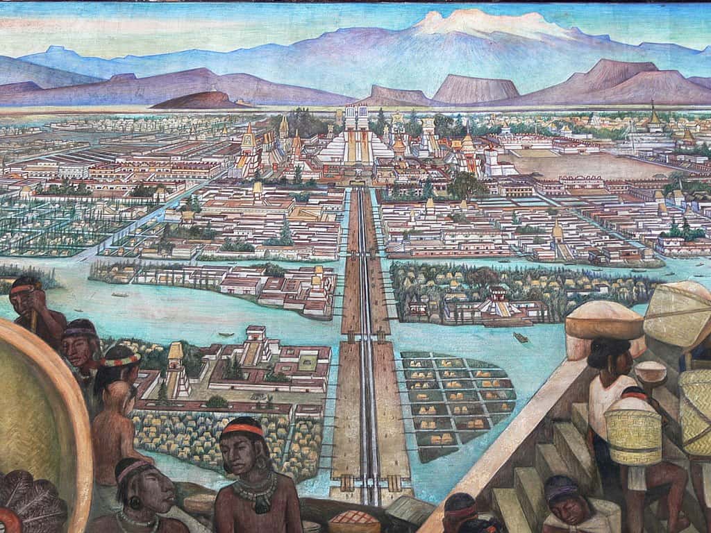
The ancient city of Tenochtitlan as depicted in a mural by Diego Rivera
(cc) Wikimedia Commons
As part of the 2017 Young Scientists Summer Program at IIASA, Francine van den Brandeler studied the struggle that Mexico City is facing as it tries to provide water to its growing population and expanding economy. Local aquifers have been over-exploited, so water needs to be imported from distant sources, with high economic, social, and environmental impacts. Van den Brandeler’s study assesses the effectiveness of water use rights in promoting sustainable water use and reducing groundwater exploitation in the city.
“A few centuries back, Tenochtitlan, the place where Mexico City stands today, was known as the lake city,” says Van den Brandeler. The Aztecs had developed a sophisticated system of dikes and canals to manage water and mitigate floods. However, that changed quickly with the arrival of the Spaniards, who transformed the natural hydrology of the valley. As the population continued to grow over the next centuries, providing drinking water became an increasing challenge, along with controlling floods. As the lake dried up, people pumped water from the ground and built increasingly large infrastructure to bring water from other areas.
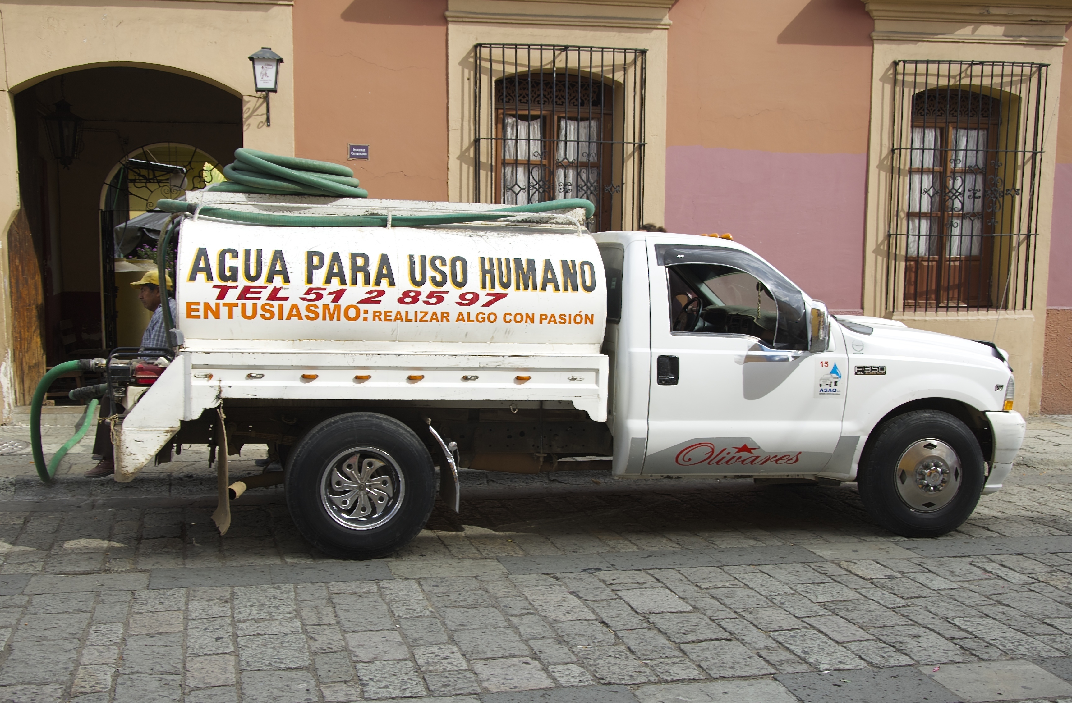
Communities from lower-income groups, living in informal settlements on the outskirts of the metropolitan region are more vulnerable to this scarcity. Many live on just few liters of water every day, and do not have access to the main water supply network, instead relying on water trucks which charge several times the price of water from the public utility.
“In wealthier areas people consume much more than the average European does every day. It is a question of power and politics,” says van den Brandeler. “The voices of marginalized communities go unheard.”

Many people rely on delivery service for drinking water.
© Angela Ostafichuk | Shutterstock
The more one learns about the situation, the more complicated it becomes. The import of water started in the 1940’s. But with a massive increase in population in the last couple of decades, the deficits have become much worse.
The government’s approach has been to find more water rather than rehabilitating or reusing local surface and groundwater sources, or increasing water use efficiency, says van den Brandeler. Therefore wells are being drilled deeper and deeper—as much as 2000 meters into the ground—as the water runs out.
Some people have started initiatives to harvest rainwater, but it is not considered a viable solution by those in charge. “A lot of it has to do with their worldview and general paradigm. The people working at the National Water Commission and the Water Utility of Mexico City have been trained as engineers to make large dams and put pipes in the ground. They don’t believe in small-scale solutions. In their opinion when millions of people are concerned, such solutions cannot work,” says van den Brandeler.
Although the city gets plenty of rain during the rainy season, it goes directly into the drainage system which is linked to the sewage system. This contaminates the water, making it unusable. At the same time, almost 40% of the water in Mexico City’s piped networks is lost due to leakages.
Policy procedures and institutional functioning also remain top-down and opaque, van den Brandeler has found. One of the policy tools for curbing excess water use are water permits for bulk use, for agriculture, industry, or public utilities supplying water. Introduced in the 1940s, lack of proper enforcement has created misuse and conflicts.
For example, while farmers also require a permit that specifies the volume of water they may use each year, they do not pay for their water usage. However, it is difficult to monitor if farmers are extracting water according to the conditions in the permit. Since they do not pay a usage fee, there is also less incentive for the National Water Commission to monitor them. As a result, a huge black market has cropped up in the city where property owners and commercial developers pay exorbitant prices to buy water permits from those who have a license. Since the government allows the exchange of permits between two willing parties, they make it appear above-board. However, it has contributed to the inequalities in water distribution in the city.
With the water crisis worsening every year, Mexico City needs to find a solution before it runs out of water completely. Van den Brandeler is hopeful for a better future as she studies the contributing factors to the problem. She hopes that the water use permits are better enforced and users are given stronger incentives to respect their allocated water quotas. Further, if greater efforts are made within the metropolis to repair decaying infrastructure and scale up alternatives such as rainwater harvesting and wastewater reuse, the city won’t have to look at expensive solutions if adopted in a decentralized manner.
About the Researcher
Francine van den Brandeler is a third year PhD student at the University of Amsterdam in Netherlands. Her research is on the spatial mismatches between integrated river basin management and metropolitan water governance – the incompatibility of institutions and biophysical systems-, which can lead to fragmented water policy outcomes. Fragmented decision-making cannot adequately address the issues of sustainability and social inclusion faced by megacities in the Global South. She aims to assess the effectiveness of policy instruments to overcome this mismatch and suggest recommendations for policy (re)design. At IIASA she was part of the Water Program and worked under the supervision of Sylvia Tramberend and Water Program Director Simon Langan.
This article gives the views of the author, and not the position of the Nexus blog, nor of the International Institute for Applied Systems Analysis.
Aug 30, 2017 | Environment, Food & Water, Young Scientists
By Parul Tewari, IIASA Science Communication Fellow 2017
Two things are distinctly noticeable when you meet Cornelius Hirsch—a cheerful smile that rarely leaves his face and the spark in his eyes as he talks about issues close to his heart. The range is quite broad though—from politics and economics to electronic music.

Cornelius Hirsch
After finishing high school, Hirsch decided to travel and explore the world. This paid off quite well. It was during his travels, encompassing Hong Kong, New Zealand, and California, that Hirsch started taking a keen interest in economic and political systems. This sparked his curiosity and helped him decide that he wanted to take up economics for higher studies. Therefore, after completing his masters in agricultural economics, Hirsch applied for a position as a research associate at the Austrian Institute of Economic Research and enrolled in the PhD-program of the Vienna University of Economics and Business to study trade, globalization, and its impact on rural areas. Currently, he is looking at subsidies and tariffs for farmers and the agricultural sector at a global scale.
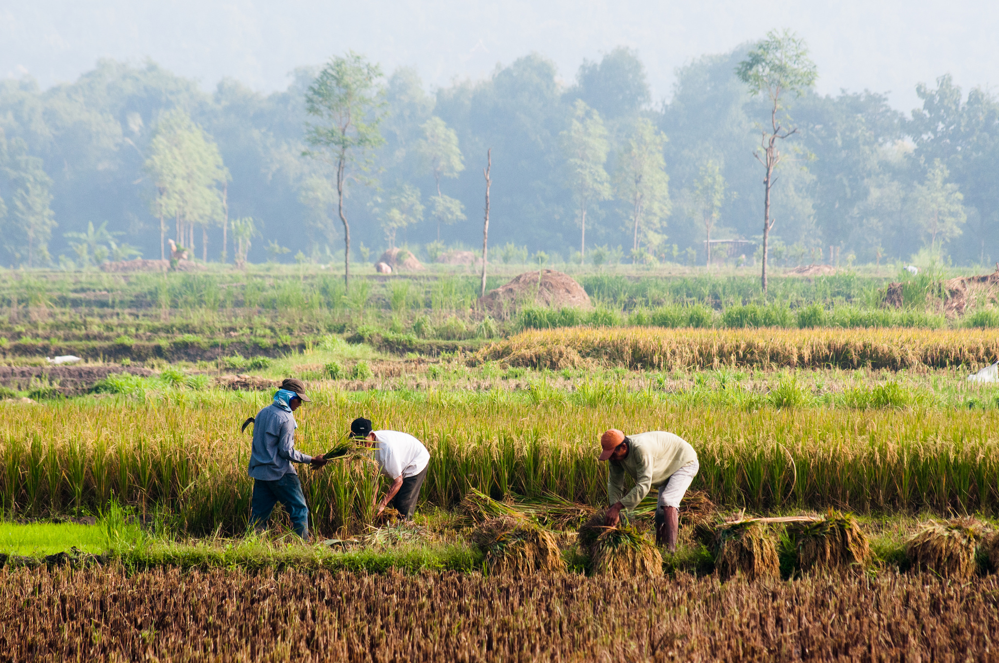
As part of the 2017 Young Scientists Summer Program at IIASA, Hirsch is digging a little deeper to analyze how foreign direct investments (FDI) in agricultural land operate. “Since 2000, the number of foreign land acquisitions have been growing—governmental or private players buy a lot of land in different countries to produce crops. I was interested in knowing why there are so many of these hotspots in the world— sub-Saharan Africa, Papua New Guinea, Indonesia—why are people investing in these areas?,” says Hirsch.
Farming in one of the large agricultural areas in Indonesia ©CIFOR I Flickr
Increased food demand from a growing world population is leading to an increased rate of investment in agriculture in regions with large stretches of fertile land. That these regions are largely rain-fed make them even more attractive for investors as they save the cost of expensive irrigation services. In fact, Hirsch argues that “the term land-grabbing is misleading. It should actually be water-grabbing as water is the foremost deciding factor—even more important than simply land abundance.”
Some researchers have found an interesting contrast between FDI in traditional sectors, such as manufacturing, and the ones in agricultural land. While investors in the former look for stable institutions and good governmental efficiency, FDI in land deals seems to target regions with less stable institutions. This positive relationship between corruption and FDI is completely counterintuitive. Hirsch says that one reason could be that “sometimes weaker institutions are easier to get through when it comes to such vast amount of lands. A lot of times these deals and contracts are oral and have no written proof—the contracts are not transparent anyway.”
For example in South Sudan, the land and soil conditions seem to be so good that investors aren’t deterred despite conflicts due to corrupt practices or inefficient government agencies.
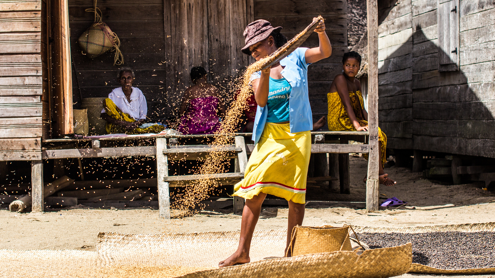
One of the indigenous communities in Madagascar, a place which is vulnerable to land acquisitions © IamNotUnique I Flickr
One area that often goes unnoticed is the violation of land rights of indigenous communities. If a government body decides to sell land or give out production licenses to investors for leasing the land without consulting the actual community, it is only much later that the affected community finds out that their land has been given away. Left with no land and hence no source of livelihood, these communities are forced to migrate to urban areas.
A strain of concern enters his voice as Hirsch talks about the impact. “Land as big as two times the area of Ecuador has been sold off in the past—but it accounts for a tiny percentage of the global production area.” With rising incomes and greater consumption of meat, a lot of land is used to produce animal feed crops. “This is a very inefficient way of using land,” he says.
During the summer program at IIASA, Hirsch is generating data that will help him look at these deals in detail and analyze the main factors that are taken into consideration before finalizing a land deal. At the moment he is only able to give an overview of land-grabbing at the global level. With more data on the location of the deals he can look at the factors that influence these decisions in the first place such as the proximity between the two countries involved in agricultural investments and the size of their economies.
While there is always huge media coverage when a scandal about these land acquisitions comes out in the open, Hirsch seems determined to dig deeper and uncover the dynamics involved.
About the researcher
Cornelius Hirsch is a research associate at the Austrian Institute of Economics and Research (WIFO). At IIASA he is working under the supervision of Tamas Krisztin and Linda See in the Ecosystems Services and Management Program (ESM).
This article gives the views of the author, and not the position of the Nexus blog, nor of the International Institute for Applied Systems Analysis.
Aug 16, 2017 | Climate Change, Young Scientists
By Parul Tewari, IIASA Science Communication Fellow 2017
As climate change warms up the planet, it is the Arctic where the effects are most pronounced. According to scientific reports, the Arctic is warming twice as fast in comparison to the rest of the world. That in itself is a cause for concern. However, as the region increasingly becomes ice-free in summer, making shipping and other activities possible, another threat looms large. That of an oil spill.

©AllanHokins I Flickr
While it can never be good news, an oil spill in the Arctic could be particularly dangerous because of its sensitive ecosystem and harsh climatic conditions, which make a cleanup next to impossible. With an increase in maritime traffic and an interest in the untapped petroleum reserves of the Arctic, the likelihood of an oil spill increases significantly.
Maisa Nevalainen, as part of the 2017 Young Scientists Summer Program (YSSP), is working to assess the extent of the risk posed by oil spills in the Arctic marine areas.
“That the Arctic is perhaps the last place on the planet which hasn’t yet been destroyed or changed drastically due to human activity, should be reason enough to tread with utmost caution,” says Nevalainen
Although the controversial 1989 Exxon Valdez spill in Prince William Sound was quite close to the Arctic Circle, so far no major spills have occurred in the region. However, that also means that there is no data and little to no understanding of the uncertainties related to such accidents in the region.
For instance, one of the significant impacts of an oil spill would be on the varied marine species living in the region, likely with consequences carrying far in to the future. Because of the cold and ice, oil decomposes very slowly in the region, so an accident involving oil spill would mean that the oil could remain in the ice for decades to come.

Thick-billed Murre come together to breed in Svalbard, Norway. Nevalainen’s study so far suggests that birds are most likely to die of an oil spill as compared to other animals. © AllanHopkins I Flickr
Yet, researchers don’t know how vulnerable Arctic species would be to a spill, and which species would be affected more than others. Nevalainen, as part of her study at IIASA will come up with an index-based approach for estimating the vulnerability (an animal’s probability of coming into contact with oil) and sensitivity (probability of dying because of oiling) of key Arctic functional groups of similar species in the face of an oil spill.
“The way a species uses ice will affect what will happen to them if an oil spill were to happen,” says Nevalainen. Moreover, oil tends to concentrate in the openings in ice and this is where many species like to live, she adds.
During the summer season, some islands in the region become breeding grounds for birds and other marine species both from within the Arctic and those that travel thousands of miles from other parts of the world. If these species or their young are exposed to an oil spill, then it could not only result in large-scale deaths but also affect the reproductive capabilities of those that survive. This could translate in to a sizeable impact on the world population of the affected species. Polar bears, for example, have, on an average two cubs every three years. This is a very low fertility rate – so, even if one polar bear is killed, the loss can be significant for the total population. Fish on the other hand are very efficient and lay eggs year round. Even if all their eggs at a particular time were destroyed, it would most likely not affect their overall population. However, if their breeding ground is destroyed then it can have a major impact on the total population depending on their ability and willingness to relocate to a new area to lay eggs, explains Nevalainen.
Due to lack of sufficient data on the number of species in the region as well as that on migratory population, it is difficult to predict future scenarios in case of an accident, she adds. “Depending on the extent of the spill and the ecosystem in the nearing areas, a spill can lead to anything from an unfortunate incident to a terrible disaster,” says Nevalainen.
©katiekk I Shutterstock
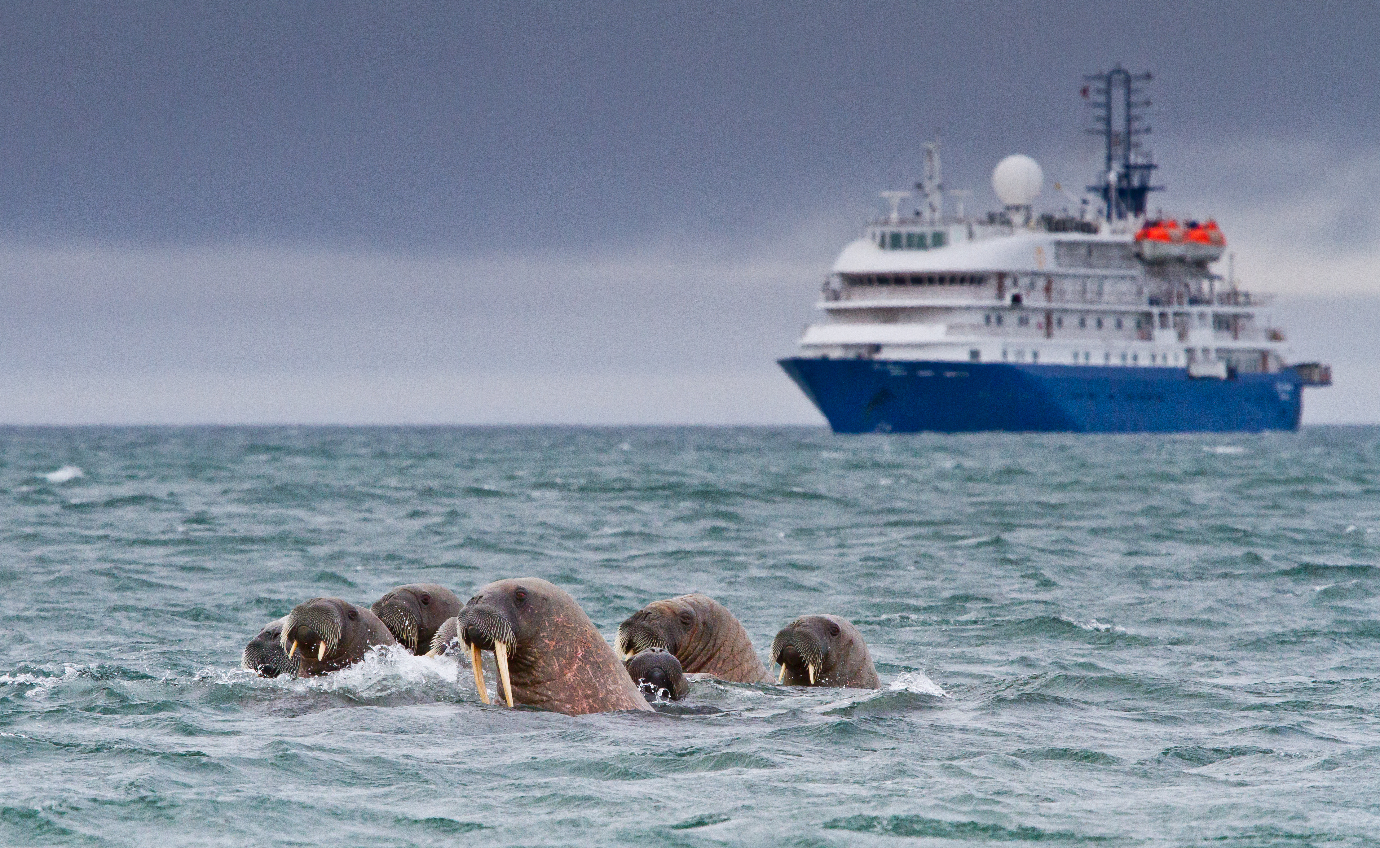
It might even affect the food chain, at a local or global level. “If oil sinks to the seafloor, some species run the risk of dying or migrating due to destroyed habitat – an example being walruses as they merely dive to get food from the sea floor,” adds Nevalainen. As the walrus is a key species in the food web, this has a high probability of upsetting the food chain.
When the final results of her study come through, Nevalainen aims to compare different regions of the Arctic and the probability of damage in these areas, as well as potential solutions to protect the ecosystem. This would include several factors. One of them could be breeding patterns – spring, for instance, is when certain areas need to be cordoned off for shipping activities, as most animals breed during this time.
“At the moment there are no mechanisms to deal with an oil spill in the Arctics. I hope that it never happens. The Arctic ecosystem is very delicate and it won’t take too much to disturb it, and the consequences can be huge, globally,” warns Nevalainen.
About the Researcher
Maisa Nevalainen is a third- year PhD student at the University of Helsinki, Finland. Her main focus is on environmental impacts caused by Arctic oil spills, while her main research interests include marine environment, and environmental impacts of oil spills among others. Nevalainen is working with the Arctic Futures Initiative at IIASA over the summer, with Professor Brian Fath as her supervisor and Mia Landauer and Wei Liu as her co-supervisors.
This article gives the views of the author, and not the position of the Nexus blog, nor of the International Institute for Applied Systems Analysis.
Aug 7, 2017 | Climate Change, Food & Water, Water, Young Scientists
By Parul Tewari, IIASA Science Communication Fellow 2017
In 2016, Bolivia saw its worst drought in nearly 30 years. While the city of La Paz faced an acute water shortage with no piped water in some parts, the agricultural sector was hit the hardest. According to The Agricultural Chamber of the East, the region suffered a loss of almost 50% of total produce. Animal carcasses lay scattered in plain sight in the valleys, where they had died looking for watering holes.
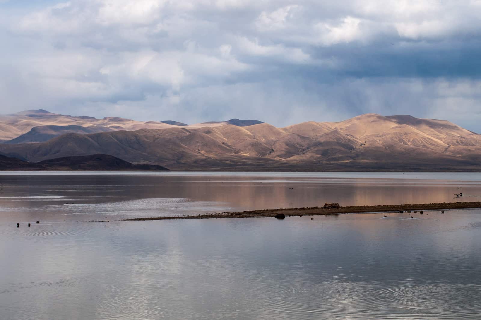
Lake Poopo (Bolivia) before it dried up © David Almeida I Flickr
One of the most dramatic results of this catastrophic drought was that Lake Poopo, (pronounced po-po) Bolivia’s second largest lake was drained of every drop of water. Located at a height of approximately 1127 meters, and covering an area of 1,000 square kilometers, what remains of it now resembles a desert more than a lake. This event forced the fishing community of Uru Uru, which depended on the lake, to either migrate to other lakes or look for alternate livelihood options.
Lake Poopo is located in the central South American Altiplano, one of the largest high plateaus in the world (Bolivia’s largest lake, Titicaca, is located in the north of the region). Due to its unique topography, the highland faces extreme climatic conditions, which are responsible for difficult lives as well as widespread poverty among the people who live there.
While Titicaca is over 100 meters deep, Poopo had a depth of less than three meters. Combined with a high rate of evapotranspiration, erratic rainfall, and limited flow of water from the Desaguadero River, Poopo was in a precarious position even during the best of times. Whatever little water flowed in from the river is further depleted by intensive irrigation activities at the south of Lake Titicaca before the water makes it way down to Poopo.
Sattelite images of Lake Poopo
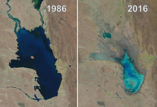
Changes in water levels of Lake Poopo over 30 years © U.S. Geological Survey, Associated Press
The lake’s existence had been threatened several times in the past. However, the 2016 drought was one of the most devastating ones. According to the Defense Ministry of Bolivia, early this year the lake started recovering after several days of heavy rain, restoring as much as 70% of the water. However, since the lake is a part of a very fragile ecosystem, there have been some irreversible changes to the flora and fauna in addition to the losses to the fishing communities living around the lake.
Charting a better future
Claudia Canedo, a participant of the 2017 Young Scientists Summer Program (YSSP) at IIASA, is exploring the impact of droughts and the risk on agricultural production in the light of this event, after which Bolivia declared a state of water emergency. Canedo was born and raised in the city of La Paz and experienced water shortages while growing up close to the Altiplano. This motivated her to investigate a sustainable solution for water availability in the region. With the results of her study she is hoping to ensure that such a situation doesn’t arise again in the Altiplano – that other communities directly dependent on ecosystem services, like that of Lake Poopo, do not have to lose everything because of an extreme weather event.
For a region where more than half the population is dependent on agriculture for their livelihoods, droughts serve as a major setback to the national economy. “It is not just one factor that led to the drought, though. There were different factors that contributed to the drying up of the lake and also contribute to the agricultural distress,” she says.
“The southern Altiplano lies in an arid zone and receives low precipitation due to its proximity to the Atacama Desert. Poor soil quality (high saline content and lack of nutrients) makes it unsuitable for most crops, except quinoa and potato in some areas,” adds Canedo. Residents also lack the knowledge and the monetary resources to invest in newer technology, which could possibly lead to better water management.
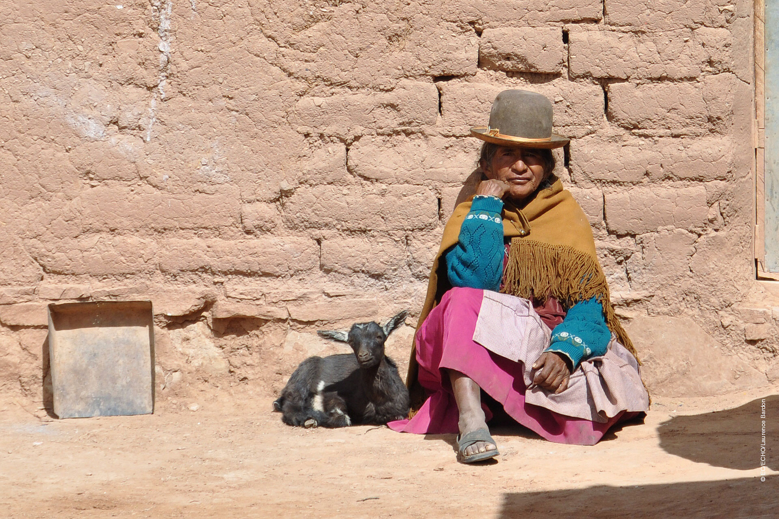
A woman from one of the drought affected communities in Bolivia © EU – Photo credits: EC/ECHO/Laurence Bardon I Flickr
One of the most critical factors in the recent drought was the El Nino- Southern Oscillation, the warming of the sea temperatures in the Pacific Ocean, which in turn carries the warmer oceanic winds and lowers the rate of precipitation in the highland leading to increased evapotranspiration. In 2015 and 2016, the losses due to this phenomenon were devastating for agriculture in the Altiplano, says Canedo.
In her quest to find solutions, the biggest challenge is the lack of recorded data from local weather stations for the past years. Although satellite data is available, it is too generic in nature to do a local analysis. Therefore combining ground and satellite data could enhance the present knowledge and provide consistent results of the climate and vegetation variability. If done successfully, Canedo hopes to identify a correlation between precipitation and vegetation. With this information, she can improve climate forecasting that could help the local people adapt to droughts powerful enough to turn their lives upside down.
With weather forecasts and early warning systems for extreme weather events like droughts, farmers would know what to expect and would be able to plant resilient varieties of crops. This might not earn them the same profits as in a normal year, but would not result in a failed crop. Claudia aims to come up with a drought index useful for drought monitoring and early warning, which will integrate short-term and long-term meteorological predictions.
Perhaps, in the future, with this newfound knowledge, the price for extreme weather events won’t be paid in terms of lost ecosystems like that of Lake Poopo, robbing people of their lives and livelihoods.
About the Researcher
Claudia Canedo is a participant in the 2017 IIASA YSSP. She is pursuing a doctoral program in water resources engineering at Lund University, Sweden. She is interested in studying the hydrological and climatological conditions over small basins in the South American highlands. The aim of her research is to define water resources availability and find strategies for sustainable water management in the semi-arid region.
This article gives the views of the author, and not the position of the Nexus blog, nor of the International Institute for Applied Systems Analysis.
May 23, 2017 | Alumni, Water, Young Scientists
Firdos Khan Yousafzai, PhD student, University of Klagenfurt, Austria, and YSSP 2012 participant
In Pakistan, water supply fell from 5,260 cubic meters per capita in 1951 to 1,050 cubic meters per capita in 2010 according to the World Bank, and is likely to further fall in the future. According to the Falkenmark Water Stress Indicator, a country or a part of a country is said to experience “water stress” when the annual water supplies drop below 1,700 cubic meters per capita per year, and “water scarcity” if the annual water supplies drop below 1,000 cubic meters per capita per year. Water scarcity is especially critical for Pakistan because agriculture contributes 25% of the GDP and 36% of energy is obtained from hydropower.
In terms of geography, Pakistan is incredibly diverse, ranging from plain to desert, hills, forest, and plateaus from the Arabian Sea in the south and to the mountains of Karakorum in the north of the country. It has 796,096 square kilometers area—about the same size as Turkey–and approximately 200 million inhabitants.

The Karakorum mountains in northern Pakistan ©Piotr Snigorski | Shutterstock
Water availability is also different in different parts of the country. While various studies showed that climate change is happening all over Pakistan, research shows that the northern areas are more vulnerable. Possible reasons include the increasing population and deforestation, among others. Therefore, in my PhD work, which was also the subject of my work in the 2012 IIASA Young Scientists Summer Program, I am investigating that how fast climate is changing and exploring its impacts on availability of water.
In a recent study we investigated this issue under four different climate change scenarios, from 2006 to 2039 in the future. Different scenarios have different assumptions about population growth, use of energy type, environmental protection, economic development, technological changes, etc. We calculated the changes on the basis of baseline and future time periods for climate and hydrological projections. We found an increasing trend in maximum and minimum temperature, while precipitation is also changing under each scenario.
To assess water availability and investigate the impacts of changing climate on the operation of reservoirs, we used Tarbela Reservoir as a measurement tool, developing hydrological projections for the reservoir under each scenario. Tarbela Dam is one of the biggest dams in the world, and has a storage capacity of approximately 7 million acre feet and the potential to produce 3,400 megawatts of electricity.
Cholistan Desert in southern Pakistan. Water scarcity varies widely throughout the geographically diverse country. ©image bird | Shutterstock
In our study, we considered all the relevant parameters related to water shortages and surpluses. To compare the status of water availability, we compared the baseline period and future time period. The results show an increasing trend in water availability, however, water scarcity is observed during some months under each scenario. Further, we also observed that there is a 23-40% increase in river flow under the considered scenarios while the average increase is approximately 35% during the future time period.
As a conclusion we can say that enough water is available in Pakistan, and will continue to be available in the future. Instead, the study confirms previous reports that the major problem is mismanagement.
The possible solution may include constructing more dams and storage capacity to store extra water during high river flow which then can be utilized during low river flow. This could probably also be helpful in flood control, raise the groundwater level, and provide cheap and clean electricity to national electricity grid—providing multiple benefits, in view of the fact that the country has faced ongoing energy crises for many years.
References
Ali S, Li D, Congbin F, Khan F (2015). Twenty first century climatic and hydrological changes over Upper Indus Basin of Himalayan region of Pakistan. Environmental Research Letters10 (2015) 014007. DOI:10.1088/1748-9326/10/1/014007.
Khan F, Pilz J, Ali S (2017). Improved hydrological projections and reservoir management in the Upper Indus Basin under the changing climate. Water and Environmental Journal. Vol. 31, No. 2, pp. 235-244. DOI:10.1111/wej.12237.
Khan F, Pilz J, Amjad M, Wiberg D (2015). Climate variability and its impacts on water resources in the Upper Indus Basin under IPCC climate change scenarios. International Journal of Global Warming, Vol. 8, No. 1, pp. 46-69. DOI:10.1504/IJGW.2015.071583.
This article gives the views of the author, and not the position of the Nexus blog, nor of the International Institute for Applied Systems Analysis.

You must be logged in to post a comment.