Jan 28, 2017 | Science and Art
By Gloria Benedikt, IIASA Science and Arts Associate
This post was originally published in the magazine of the 2017 Vienna Science Ball.
Post-truth: the Oxford English Dictionary word of the year 2016 is a paradox for artists and scientists in particular. Post-truth proposes that there has been such a thing as truth in the past. Responsible scientists and artists are – and always have been – on a lifelong journey, driven by curiosity to discover what is not apparent. One group specialized in reason, the other in emotion, they are searching for insights to help society make better informed decisions, knowing that they are only a small part of a truth-searching journey that will continue infinitely. And while scientists try to be as exact as possible, knowing that 100% certainty does not exist, artists strive for perfection all their lives, knowing that perfection does not exist. For both the journey must be the goal. Until recently, this understanding was a fundament on which society could progress. What post-truth really seems to get at is that definite black and white, simple solutions based on instinct are increasingly challenging the nature of science, which is based on ranges and probabilities that are built on knowledge and reason.
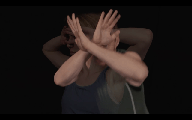
A still from the short film by Gloria Benedikt and Christian Felber ©Patrick Zadrobilek
Public discourse over the causes for this development has increased significantly over the past months, identifying information overload and the loss of gatekeepers due to the digital revolution which seems to be leading people to create their own realities or cognitive ease. I’m confident that many of the problems on the surface, such as the fake news phenomenon will be addressed and solved in the near future. But how can and should science respond and contribute to the underlying issue?
If we are to accept that the new dividing lines appear between ‘rational progressives’ and ‘emotional regressives;’ between those who focus inward and backward, attempting to reject forces of globalization and those who focus outward and forward, embracing the forces of globalization; between those who are overwhelmed by interconnectedness, seeking simple short term solutions, and those willing to work on sustainable long term solutions; between those employing fear and hatred versus those advocating complicated but hopeful solutions,
I believe we need to extend our mission from knowledge production to developing compelling narratives, conveying positive, hopeful solutions that enable people to envision a sustainable future with heart and mind and overcome fear along the way.
This is where artists and scientists can come together, combining their strengths right now: united by the quest to understand how the world works, scientists finding data, artists embedding them in meaning. The short film on post-truth, shown at the Science Ball, is a small step on that journey. It developed out of an artistic urge to respond to the current discourse, which only seemed to touch on the surface of a more fundamental development. To shed light into these depths and find a different response, scientists contributed their views on the issue. Then, there are findings you cannot express with words, and that’s where non-verbal communication comes in. Here the medium is dance.
“Dance is one of the most beautiful forms of cooperation. Verbal language is an inefficient, incomplete form of communication that is prone to misunderstandings. Completing it by the physical, sensual, emotional, intuitive and spiritual spheres will provide a more holistic form of communication,” the economist and dancer Christian Felber observed a while back. He thus was a perfect match in realizing this project. May it now inspire you the audience to contemplate (post) truth from a different angle and the potential of science marrying art along the way.
Watch the full film
Gloria Benedikt is Associate for Science and Art at the International Institute for Applied Systems Analysis (IIASA). She is a graduate of the Vienna State Opera Ballet School 01’ and Harvard University 13’.
This article gives the views of the author, and not the position of the Nexus blog, nor of the International Institute for Applied Systems Analysis.
Jan 27, 2017 | Demography
By Anne Goujon, IIASA World Population Program
Less than 6% of the working age population has a post-secondary education in sub-Saharan Africa, according to the Wittgenstein Centre Data Explorer. However, there is a huge diversity of experiences in the region: those countries located in Southern and Western Africa have higher shares of highly educated people compared to those in Eastern and Middle Africa.
The potential for increasing education levels is tremendous as there is a huge demand for higher education, partly driven by rapid population growth. The population in the age of attending higher education—18–23 years—is forecasted to increase by 50% from its 2015 level (110 million) by 2035 (183 million), and will have doubled by 2050 to 235 million. The number of colleges and universities in the region has been burgeoning to fulfill the demand. Those are not always of very good quality, whether they are in the public sector or the private, as most are. While regulatory bodies exist to check whether all education providers meet national and international standards, they are not universal.
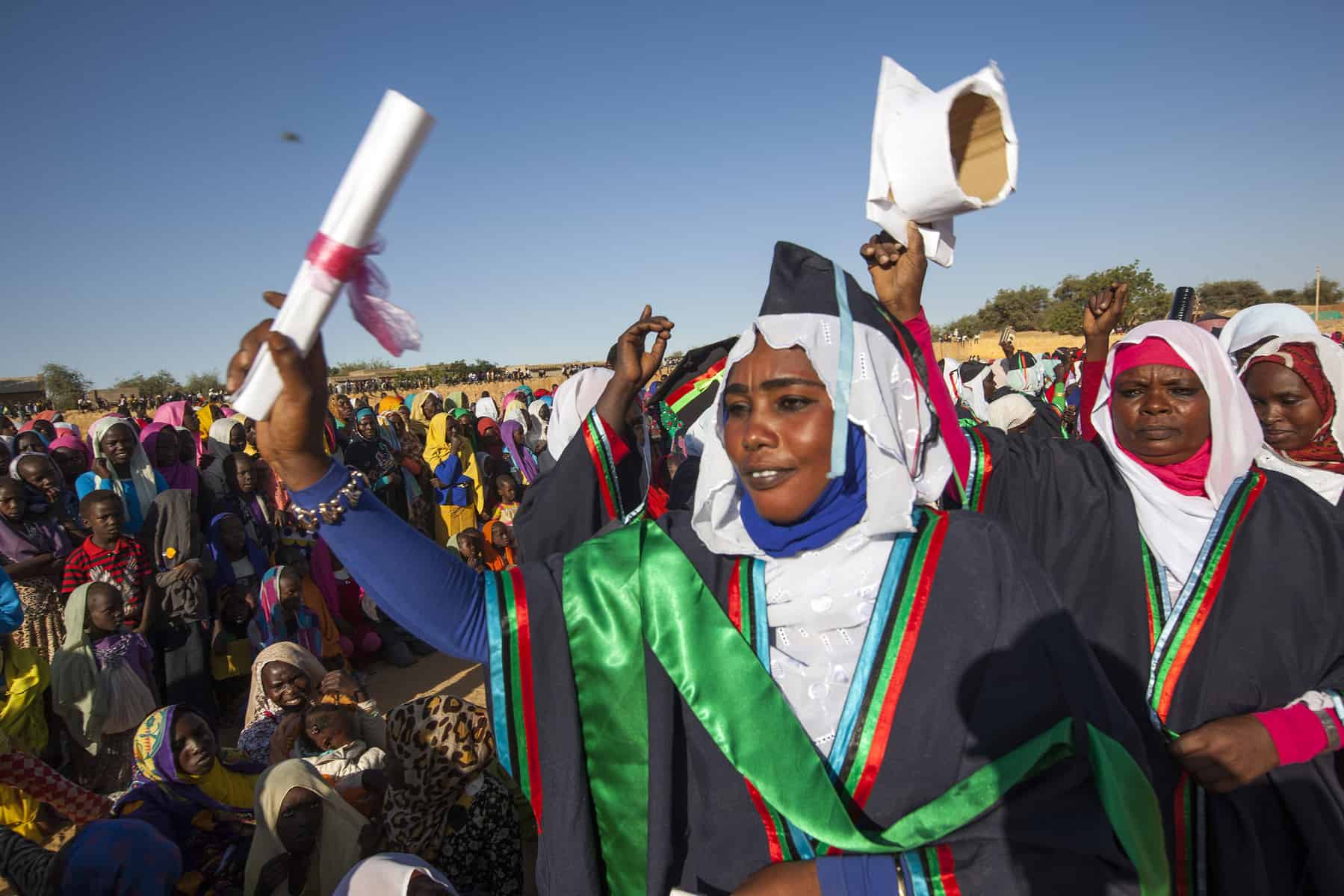
A 2015 graduation ceremony for the Open University of Sudan. ©Hamid Abdulsalam, UNAMID via Flickr
The expansion of higher education has led to substantial brain drain to Europe, North America, and Australia, because highly educated find better opportunities there for studying and jobs–and better salaries. Researchers have estimated that in some countries such as Eritrea, Ghana, Kenya, Sierra Leone, Somalia, and Uganda, more than a third of the national high-skilled labor force had migrated to OECD countries in 2000. While remittances that these people send home help compensate and reinforce the education in their countries of origin, they do not compensate for the departed skills and knowledge.
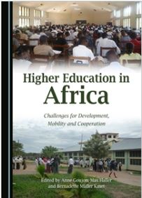
These facts about education in sub-Saharan Africa are well-known to education professionals and researchers in the field. But as we show in a new book Higher Education in Africa: Challenges for Development, Mobility and Cooperation, published in January 2017, there are a lot of other aspects of education in the region that are not so well-known and that could provide interesting avenues for further research.
For instance, you probably did not know that the African Union has a higher education harmonization strategy. The general idea is the same as the Bologna process in Europe: enhance the mobility of students by making higher education systems more compatible and by strengthening the quality assurance mechanisms. One chapter by Emnet Tadesse Woldegiorgis, which looks at the process of harmonization of higher education in Sub-Saharan Africa, shows that it follows in the footsteps of the Bologna process mostly because of the involvement of international donors and of the strong links between African universities and European ones.
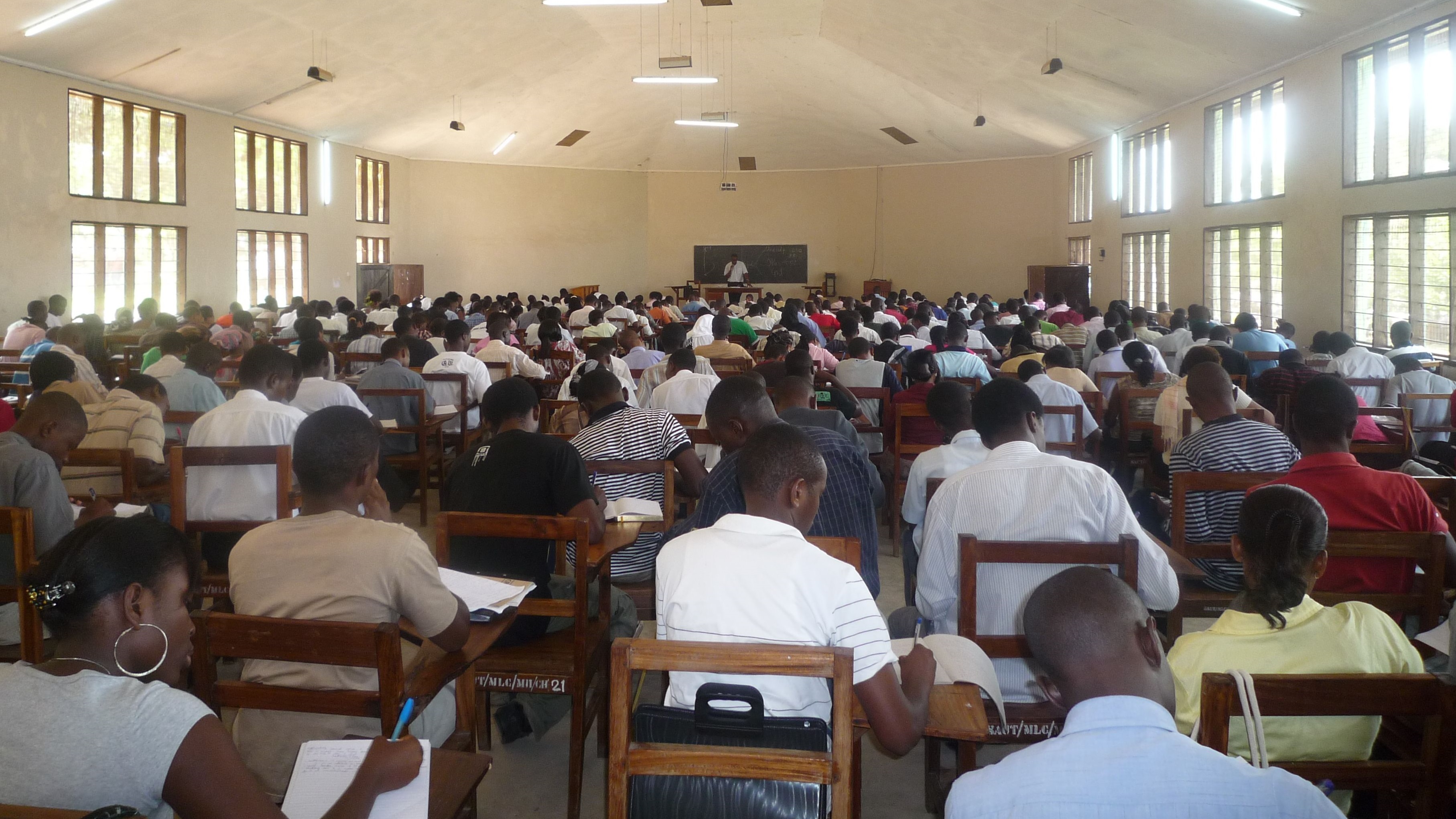
Students in lecture room at St. Augustine University of Tanzania © Max Haller and Bernadette Mueller Kmet 2009
Many chapters of the book look at the mobility of more highly educated people between Europe and sub-Saharan Africa. This is the case of a chapter by Julia Boger who interviewed graduates from Germany returning to their countries of origin: Ghana and Cameroon. The experiences of those graduates from the two West African countries are radically different: because mainly of their networks, the Ghanaian graduates face less difficulties in finding a job upon return to their country than the Cameroonians.
The last part of the book looks at some cooperation programs that are in place between the North and South (also between the South and the South). Lorenz Probst and colleagues, in their chapter, report about the challenges in implementing a transdisciplinary course in Africa within the context of the rather compartmentalized sectors of higher education in Africa.
The development of higher education could push forward change and innovation, just as much as capacity building in sub-Saharan Africa where it is direly needed.
 Reference
Goujon, Anne, Max Haller, and Bernadette Müller Kmet. 2017. Higher Education in Africa: Challenges for Development, Mobility and Cooperation. Newcastle upon Tyne, UK: Cambridge Scholars Publishing.
Note: This article gives the views of the author, and not the position of the Nexus blog, nor of the International Institute for Applied Systems Analysis.
Jan 12, 2017 | Citizen Science, Risk and resilience
By Ian McCallum, IIASA Ecosystems Services and Management Program
Communities need information to prepare for and respond to floods – to inform risk reduction strategies and strengthen resilience, improve land use planning, and generally prepare for when disaster strikes. But across much of the developing world, data are sparse at best for understanding the dynamics of flood risk. When and if disaster strikes, massive efforts are required in the response phase to develop or update information about basic infrastructure, for example, roads, bridges and buildings. In terms of strengthening community resilience it is important to know about the existence and location of such features as community shelters, medical clinics, drinking water, and more.
The risk Geo-Wiki platform
The Risk Geo-Wiki is online platform established in 2014, which acts not only as a repository of available flood related spatial information, but also provides for two-way information exchange. You can use the platform to view available information about flood risk at any location on the globe, along with geo-tagged photos uploaded by yourself or other users via a mobile application Geo-Wiki Pictures. The portal is intended to be of practical use to community leaders and NGOs, governments, academia, industry and citizens who are interested in better understanding the information available to strengthen flood resilience.
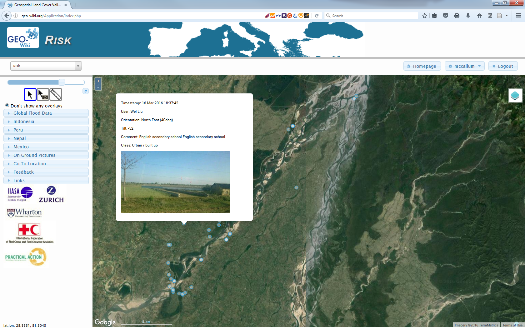
The Risk Geo-Wiki showing geo-tagged photographs overlaid upon satellite imagery across the Karnali basin, Nepal. © IIASA
With only a web browser, and a simple registration, anyone can access flood-related spatial information worldwide. Available data range from flood hazard, exposure and risk information, to biophysical and socioeconomic data. All of this information can be overlaid upon satellite imagery or OpenStreetMap, along with on-ground pictures taken with the related mobile application Geo-Wiki Pictures. You can use these data to understand the quality of available global products or to visualize the numerous local datasets provided for specific flood affected communities. People interested in flood resilience will benefit from visiting the platform and are welcome to provide additional information to fill many of the existing gaps in information.
Flood resilience and data gaps
One of the aims of the Risk Geo-Wiki is to identify and address data gaps on flood resilience and community-based disaster risk reduction. For example, there is a big disconnect between information suitable for global flood risk modelling and that necessary for community planning. Global modelers need local information with which to validate their forecasts while community planners want both detailed local information and an understanding of their communities in the wider region. The Flood Resilience Alliance is working with many interested groups to help fill this gap and at the same time help strengthen community resilience against floods and to develop and disseminate knowledge and expertise on flood resilience.
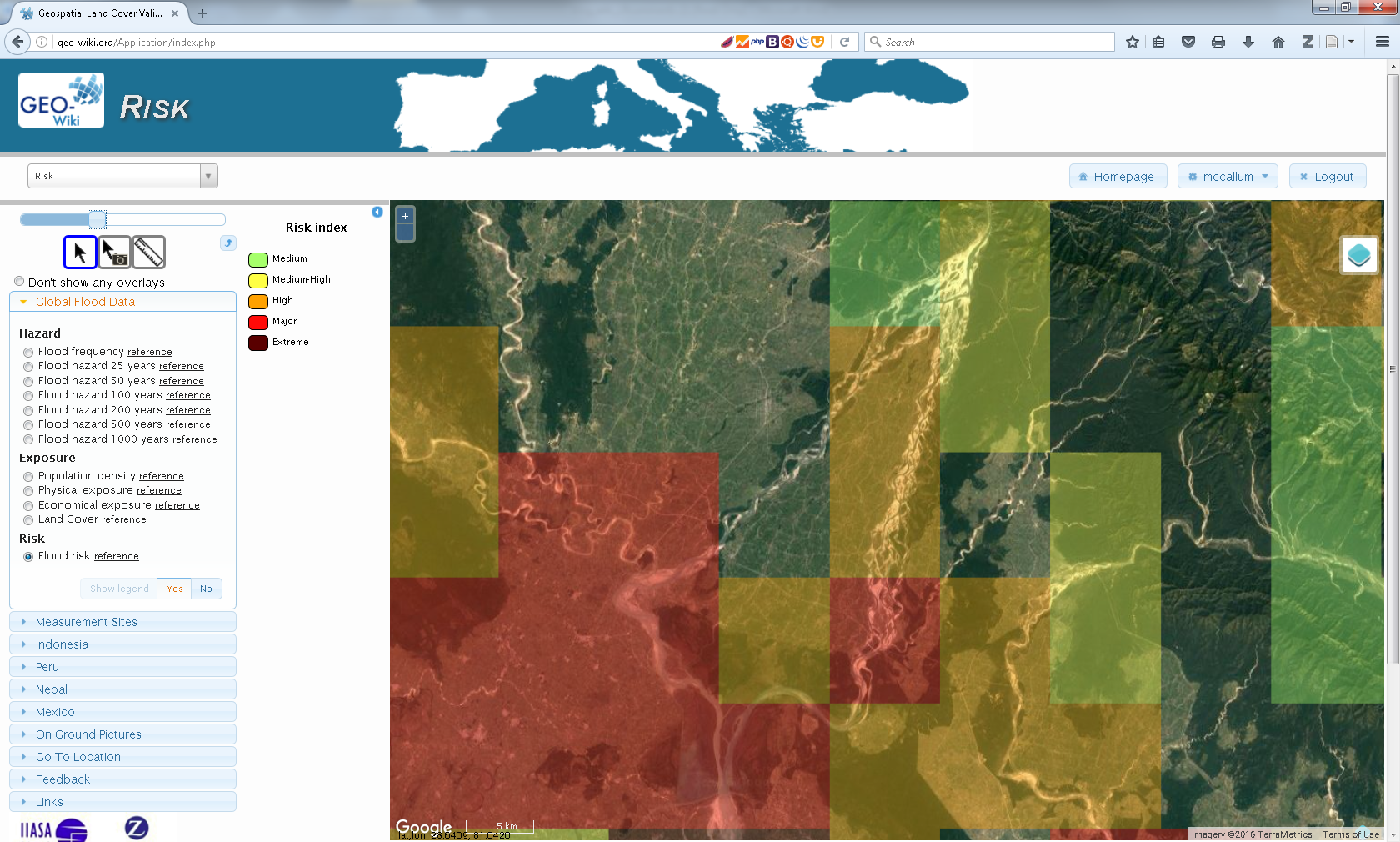
The Risk Geo-Wiki showing modelled global flood risk data overlaid at community level. While this data is suitable at the national and regional level, it is too coarse for informing community level decisions. © IIASA
Practical applications for local communities
Already, communities in Nepal, Peru, and Mexico have uploaded data to the site and are working with us on developing it further. For local communities who have uploaded spatial information to the site, it allows them to visualize their information overlaid upon satellite imagery or OpenStreetMap. Furthermore, if they have used Geo-Wiki Pictures to document efforts in their communities, these geo-tagged photos will also be available.
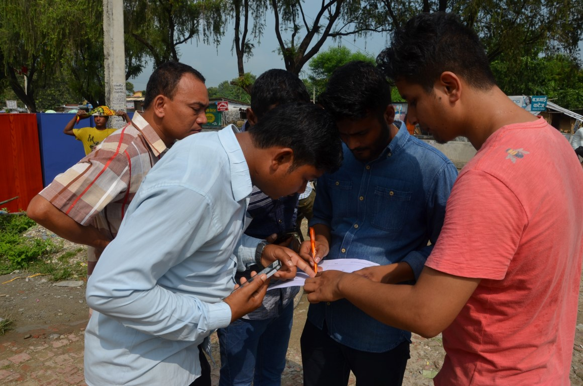
Community and NGO members mapping into OSM with mobile devices in the Karnali basin, Nepal. © Wei Liu, IIASA
In addition to local communities who have uploaded information, the Risk Geo-Wiki will provide important data to others interested in flood risk, including researchers, the insurance industry, NGOs, and donors. The portal provides a source of information that is both easily visualized and overlaid on satellite imagery with local images taken on the ground if available. Such a platform allows anyone interested to better understand flood events over their regions and communities of interest. It is, however, highly dependent upon the information that is made available to the platform, so we invite you to contribute. In particular if you have geographic information related to flood exposure, hazard, risk and vulnerability in the form of images or spatial data we would appreciate you getting in contact with us.
About the portal:
The Risk Geo-Wiki portal was established by the International Institute for Applied Systems Analysis (IIASA) in the context of the Flood Resilience Alliance. It was developed by the Earth Observation Systems Group within the Ecosystems Services and Management Program at IIASA.
Further information
- Risk Geo-Wiki
- Collection of geo-tagged photos with Geo-Wiki Pictures
- Mapping flood resilience in rural Nepal
- Flood Resilience Portal
- McCallum, I., Liu, W., See, L., Mechler, R., Keating, A., Hochrainer-Stigler, S., Mochizuki, J., Fritz, S., Dugar, S., Arestegui, M., Szoenyi, M., Laso Bayas, J.C., Burek, P., French, A. and Moorthy, I. (2016) Technologies to Support Community Flood Disaster Risk Reduction. International Journal of Disaster Risk Science, 7 (2). pp. 198-204.http://pure.iiasa.ac.at/13299/
This article gives the views of the author, and not the position of the Nexus blog, nor of the International Institute for Applied Systems Analysis.
You must be logged in to post a comment.