Aug 7, 2017 | Climate Change, Food & Water, Water, Young Scientists
By Parul Tewari, IIASA Science Communication Fellow 2017
In 2016, Bolivia saw its worst drought in nearly 30 years. While the city of La Paz faced an acute water shortage with no piped water in some parts, the agricultural sector was hit the hardest. According to The Agricultural Chamber of the East, the region suffered a loss of almost 50% of total produce. Animal carcasses lay scattered in plain sight in the valleys, where they had died looking for watering holes.
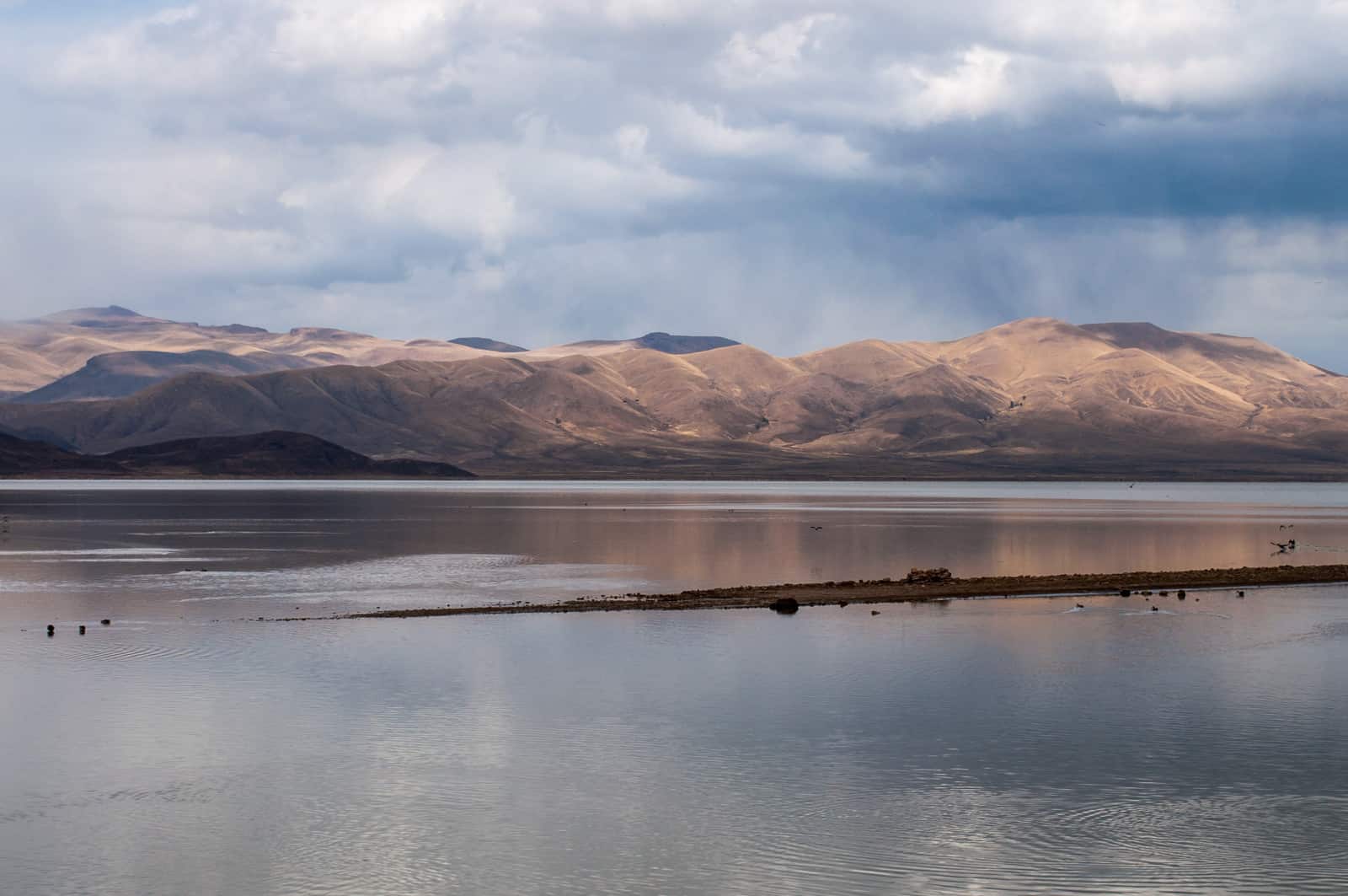
Lake Poopo (Bolivia) before it dried up © David Almeida I Flickr
One of the most dramatic results of this catastrophic drought was that Lake Poopo, (pronounced po-po) Bolivia’s second largest lake was drained of every drop of water. Located at a height of approximately 1127 meters, and covering an area of 1,000 square kilometers, what remains of it now resembles a desert more than a lake. This event forced the fishing community of Uru Uru, which depended on the lake, to either migrate to other lakes or look for alternate livelihood options.
Lake Poopo is located in the central South American Altiplano, one of the largest high plateaus in the world (Bolivia’s largest lake, Titicaca, is located in the north of the region). Due to its unique topography, the highland faces extreme climatic conditions, which are responsible for difficult lives as well as widespread poverty among the people who live there.
While Titicaca is over 100 meters deep, Poopo had a depth of less than three meters. Combined with a high rate of evapotranspiration, erratic rainfall, and limited flow of water from the Desaguadero River, Poopo was in a precarious position even during the best of times. Whatever little water flowed in from the river is further depleted by intensive irrigation activities at the south of Lake Titicaca before the water makes it way down to Poopo.
Sattelite images of Lake Poopo
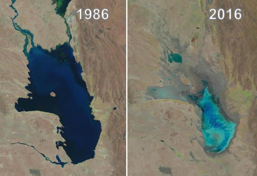
Changes in water levels of Lake Poopo over 30 years © U.S. Geological Survey, Associated Press
The lake’s existence had been threatened several times in the past. However, the 2016 drought was one of the most devastating ones. According to the Defense Ministry of Bolivia, early this year the lake started recovering after several days of heavy rain, restoring as much as 70% of the water. However, since the lake is a part of a very fragile ecosystem, there have been some irreversible changes to the flora and fauna in addition to the losses to the fishing communities living around the lake.
Charting a better future
Claudia Canedo, a participant of the 2017 Young Scientists Summer Program (YSSP) at IIASA, is exploring the impact of droughts and the risk on agricultural production in the light of this event, after which Bolivia declared a state of water emergency. Canedo was born and raised in the city of La Paz and experienced water shortages while growing up close to the Altiplano. This motivated her to investigate a sustainable solution for water availability in the region. With the results of her study she is hoping to ensure that such a situation doesn’t arise again in the Altiplano – that other communities directly dependent on ecosystem services, like that of Lake Poopo, do not have to lose everything because of an extreme weather event.
For a region where more than half the population is dependent on agriculture for their livelihoods, droughts serve as a major setback to the national economy. “It is not just one factor that led to the drought, though. There were different factors that contributed to the drying up of the lake and also contribute to the agricultural distress,” she says.
“The southern Altiplano lies in an arid zone and receives low precipitation due to its proximity to the Atacama Desert. Poor soil quality (high saline content and lack of nutrients) makes it unsuitable for most crops, except quinoa and potato in some areas,” adds Canedo. Residents also lack the knowledge and the monetary resources to invest in newer technology, which could possibly lead to better water management.
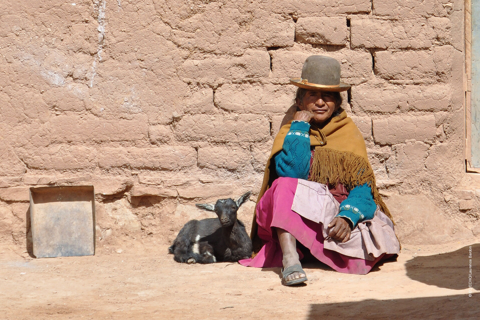
A woman from one of the drought affected communities in Bolivia © EU – Photo credits: EC/ECHO/Laurence Bardon I Flickr
One of the most critical factors in the recent drought was the El Nino- Southern Oscillation, the warming of the sea temperatures in the Pacific Ocean, which in turn carries the warmer oceanic winds and lowers the rate of precipitation in the highland leading to increased evapotranspiration. In 2015 and 2016, the losses due to this phenomenon were devastating for agriculture in the Altiplano, says Canedo.
In her quest to find solutions, the biggest challenge is the lack of recorded data from local weather stations for the past years. Although satellite data is available, it is too generic in nature to do a local analysis. Therefore combining ground and satellite data could enhance the present knowledge and provide consistent results of the climate and vegetation variability. If done successfully, Canedo hopes to identify a correlation between precipitation and vegetation. With this information, she can improve climate forecasting that could help the local people adapt to droughts powerful enough to turn their lives upside down.
With weather forecasts and early warning systems for extreme weather events like droughts, farmers would know what to expect and would be able to plant resilient varieties of crops. This might not earn them the same profits as in a normal year, but would not result in a failed crop. Claudia aims to come up with a drought index useful for drought monitoring and early warning, which will integrate short-term and long-term meteorological predictions.
Perhaps, in the future, with this newfound knowledge, the price for extreme weather events won’t be paid in terms of lost ecosystems like that of Lake Poopo, robbing people of their lives and livelihoods.
About the Researcher
Claudia Canedo is a participant in the 2017 IIASA YSSP. She is pursuing a doctoral program in water resources engineering at Lund University, Sweden. She is interested in studying the hydrological and climatological conditions over small basins in the South American highlands. The aim of her research is to define water resources availability and find strategies for sustainable water management in the semi-arid region.
This article gives the views of the author, and not the position of the Nexus blog, nor of the International Institute for Applied Systems Analysis.
Feb 27, 2017 | Postdoc, Risk and resilience
By Adam French – Peter E. de Jánosi Postdoctoral Scholar Risk and Resilience and Advanced Systems Analysis Programs
In mid-January, I found myself calling upon rusty rock climbing skills to scramble up a steep side canyon of Peru’s Rimac River valley. I was with a group of engineers and local municipal officials on the way to assess disaster reduction infrastructure that had been installed in early 2016 against the threat of a strong El Niño-enhanced rainy season. The Swiss-made barriers we were going to see, which resembled giant steel spider webs stretched across the streambeds, had been constructed in multiple locations in the Rimac watershed to reduce the destructive impacts of the region’s recurrent but unpredictable huaicos—powerful debris flows that form when precipitation runoff mixes with loose rock and other material on unstable slopes. The 2015-16 El Niño did not live up to its forecasted intensity in Peru, and the barriers went untested until heavy rains in early 2017 unleashed a series of huaicos on the Rimac valley, damaging homes and flooding roadways. Where the barriers were installed, however, no major impacts had been reported, and we were eager to see if the infrastructure had made a difference.
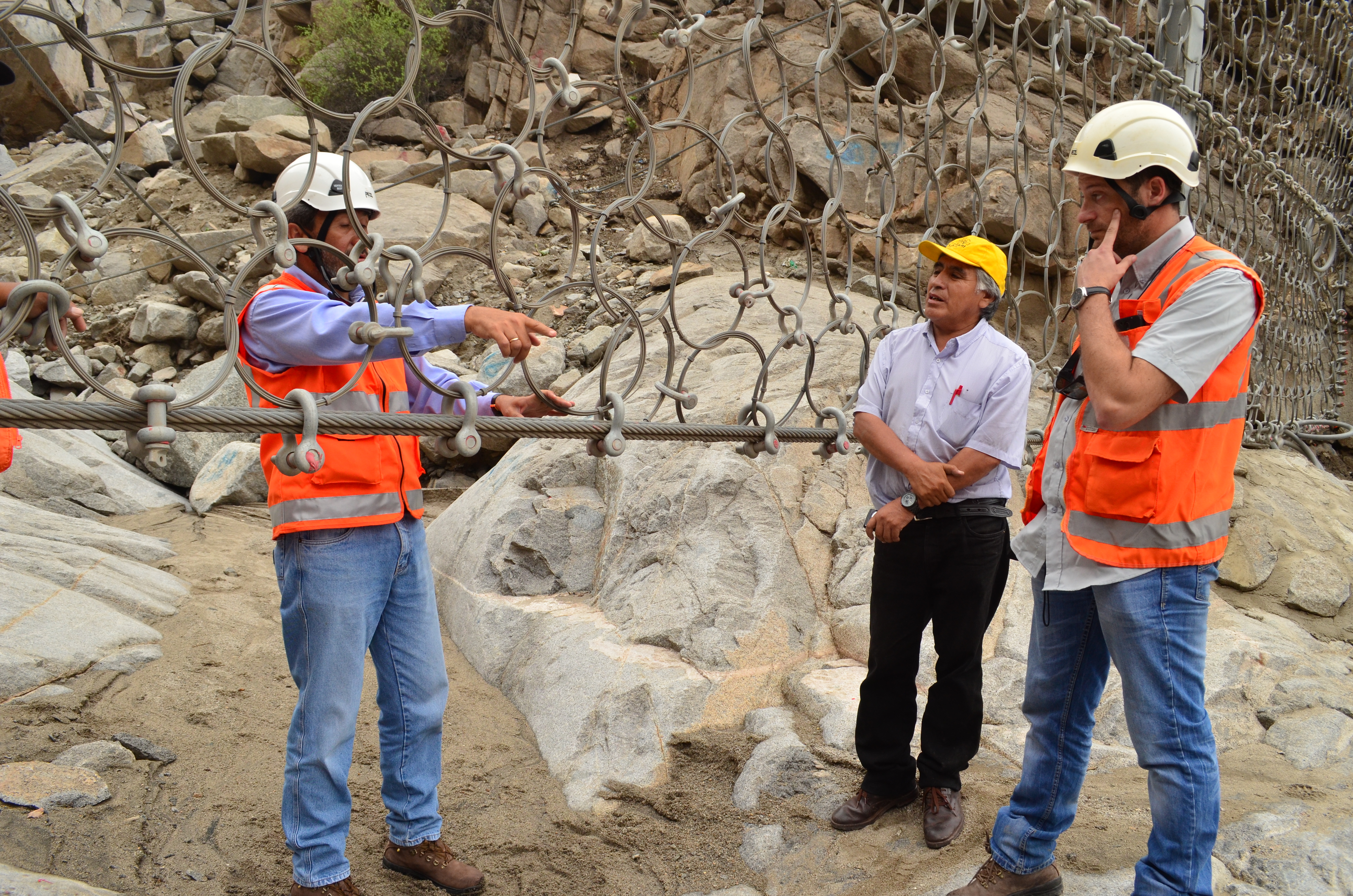
Engineers discuss hazard reduction infrastructure above Chosica, Peru. ©Soluciones Prácticas, Abel Cisneros (Click for more photos)
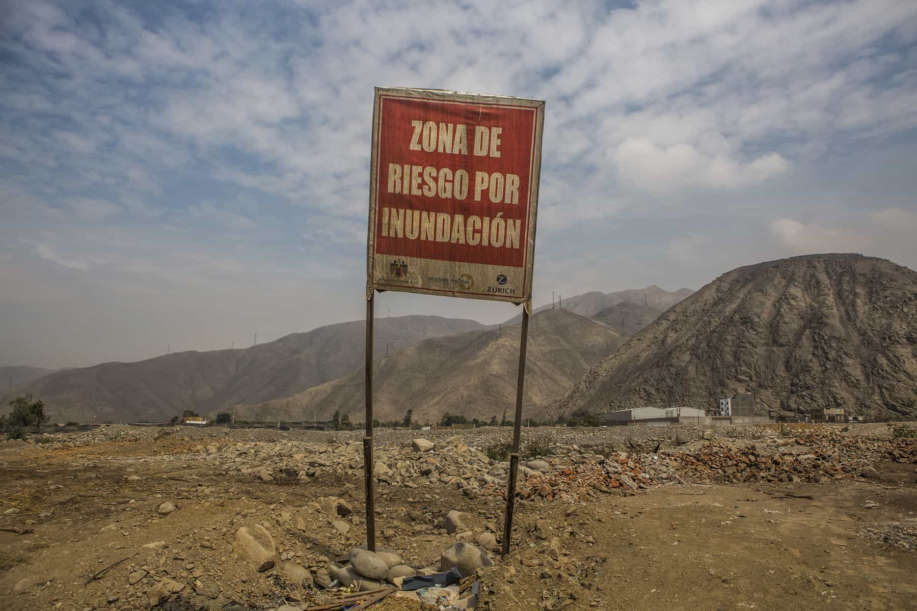
Most of the time, the Rimac valley looks more like a lunar landscape than a flood-risk hotspot. Yet with only a few millimeters of rain in the surrounding highlands, this arid region becomes extremely vulnerable to huaicos. Located between the sprawling cityscape of Lima—the planet’s second largest desert city—and the lush foothills of the central Andes, the middle reaches of the Rimac watershed have been settled rapidly over recent decades, often without effective zoning regulations to restrict occupation in even the most hazard-prone areas.
I had not planned to work in the Rimac basin when I moved to Austria to take up a postdoctoral position in late 2015. While my research includes the study of climate change-related risk in Peru’s Cordillera Blanca (the world’s most extensively glaciated tropical mountain range), I came to IIASA to focus on watershed-level governance and the implementation of the Integrated Water Resource Management (IWRM) paradigm. Yet as a Spanish speaker with extensive experience in Peru, I was well suited to get involved in IIASA’s activities in the Rimac valley as part of the Zurich Flood Resilience Alliance Project. This project, which includes close collaboration with the NGO Practical Action in Peru and Nepal, supports measures to understand and address the underlying drivers of flood risk and to move beyond short-term disaster preparedness and response towards transformative actions that build long-term capacity and resilience.
As part of IIASA’s Flood Resilience team, my work in the Rimac valley has included activities ranging from evaluating El Niño preparations to conducting interviews with public authorities and local residents living in the Rimac basin. This fieldwork is just part of our project’s efforts to identify the systemic components of flood risk and vulnerability in the region and to promote productive exchanges between residents, policymakers, and the scientific community through participatory research and innovative approaches such as serious gaming.
“Flood Risk Zone,” Ate, Peru. ©Soluciones Prácticas. Click for more photos.
In addition to building expertise in a new setting, my involvement in this work has helped me better incorporate risk-focused systems thinking into my broader research agenda—a perspective that is too often overlooked in integrated resource planning. An example of how my research interests are converging within this project is through the promotion of a risk-management working group to advise the multi-sectorial watershed council in charge of IWRM planning in the Rimac valley. The establishment of this working group and the participation of project partners at Practical Action in its activities should mark an important step in bringing lessons from the Flood Resilience project regarding links between disaster risk reduction, economic development, and community resilience to bear on watershed planning in the Rimac basin. More broadly, we hope these insights will influence policy making in other settings in Peru and beyond that face similar challenges in handling risk management and economic development as intricately linked and co-dependent governance processes.
Returning to our January field inspection, we found that one of the new barriers had been put to the test. The structure had captured several tons of debris, protecting a neighborhood that had been devastated by a huaico in 2015, and local authorities were already discussing the potential to build additional barriers to guard their community. While I celebrated this outcome with them, as I look to the future and the goals of the Flood Resilience Alliance, I am hopeful that such infrastructural interventions will be just one aspect of comprehensive plans for hazard reduction, with long-term risk management actions increasingly seen as a vital component of watershed-level planning and governance.
More information
IIASA, Zurich, Wharton, Practical Action: Flood Resilience Partnership
Flickr photo album: Rimac River valley, Peru – Fieldwork
Flood Resilience Portal
This article gives the views of the author, and not the position of the Nexus blog, nor of the International Institute for Applied Systems Analysis.
Nov 10, 2016 | Risk and resilience
By Wei Liu, IIASA Risk and Resilience and Ecosystems Services and Management programs
Disasters caused by extreme weather events are on the rise. Floods in particular are increasing in frequency and severity, with reoccurring events trapping people in a vicious cycle of poverty. Information is key for communities to prepare for and respond to floods – to inform risk reduction strategies, improve land use planning, and prepare for when disaster strikes.
But, across much of the developing world, data is sparse at best for understanding the dynamics of flood risk. When and if disaster strikes, massive efforts are required in the response phase to develop or update information. After that, communities have an even greater need for data to help with recovery and reconstruction and further enhance communities’ resilience to future floods. This is particularly important for the Global South, such as the Karnali Basin in Nepal, where little information is available regarding community’s exposure and vulnerability to floods.
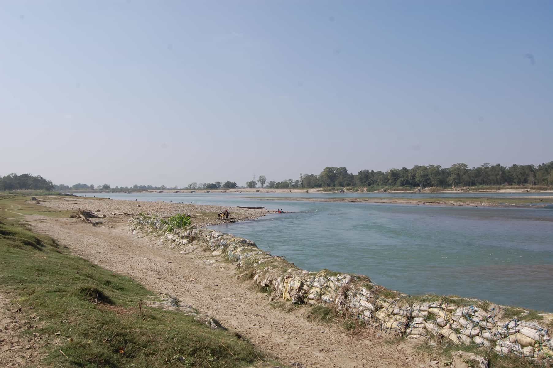
Karnali Basin in Nepal © Wei Liu | IIASA
That’s why we are working with Practical Action in the Zurich Flood Resilience Alliance to try to remedy this situation. Participatory Vulnerability and Capacity Assessment is a widely used tool to collect community level disaster risk and resilience information and to inform disaster risk reduction strategies. One of our first projects was to digitize a set of existing maps on disaster risk and community resources where the locations of, for example, rivers, houses, infrastructure and emergency shelters are usually hand-drawn by selected community members. Such maps provide critical information used by local stakeholders in designing and prioritizing among possible flood risk management options.
From hand-drawn to internet mapping
While hand-drawn maps are ideal for working in remote rural communities, they risk being damaged, lost, or simply unused. They are also more difficult to share with other stakeholders such as emergency services or merge with additional mapped information such as flood hazard. With the recent increase in internet mapping, platforms such as OpenStreetMap have made it possible for us to transfer existing maps or capture new information on a common platform in such a way that anyone with an internet connection can add, edit, and share maps. As this information is digital, it makes it easier to perform additional tasks, such as identifying households in areas of high risk or measuring the distance to the nearest emergency shelter, to support effective risk-reduction and resilience-building.
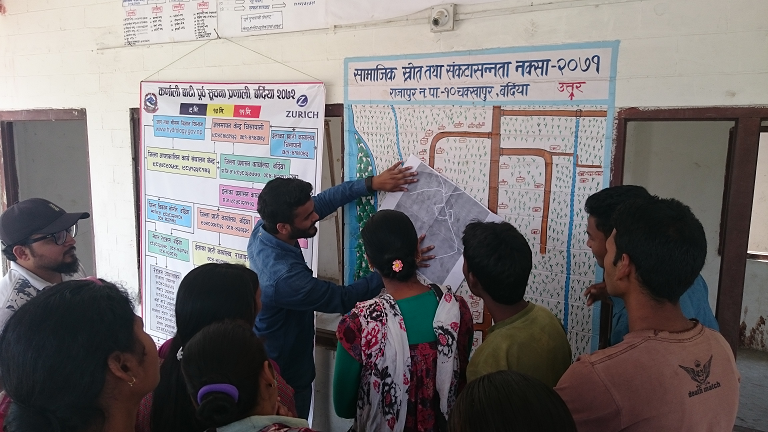
Practical Action Nepal, the Center for Social Development and Research, and community members discuss the transfer of community maps to online maps © Wei Liu | IIASA
From theory to practice
In March 2016, the Project team travelled to two Nepal communities in the Rajapur and Tikapur districts, to pilot the idea of working with a local NGO (the Center for Social Development and Research) and community members, to transfer their maps into a digital environment. The latter can easily be further edited, improved and shared within a broad range of stakeholders and potential users. Local residents in both communities were excited seeing their households and other features for the first time overlaid on a map with satellite imagery. The Center for Social Development and Research was also very enthusiastic about integrating their future community mapping activities with digital mapping, without losing the spirit of participation.
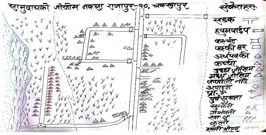
Hand drawn maps produced from community mapping exercises in Chakkhapur, Nepal © Practical Action
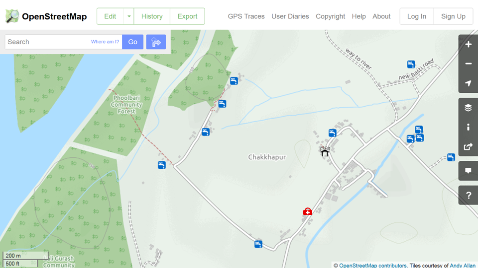
The resulting online maps in OpenStreetMap of Chakkhapur, Nepal, showing the location of drinking water, an emergency shelter and medical clinic. ©OpenStreetMap
Increasing resilience through improved information management
The first stage pilot study in the Karnali river basin confirmed the great potential of new digital technologies in providing accurate and locally relevant maps to improve flood risk assessment to support resilience building at the community level. The next step is to further engage local stakeholders. A wider partnership has been established between Practical Action, the Center for Social Development and Research, the International Institute for Applied Systems Analysis and Kathmandu Living Labs to further build local stakeholders’ capacity in mapping with digital technologies, including a training workshop for NGO staff members in September, 2016. The plan is to have more communities’ flood risk information mapped for designing more effective action plans and strategies for coping with future flood events across the Karnali river basin. A greater potential can be realized when this effort is further scaled up across the region and the results are placed into shared open online databases such as OpenStreetMap.
Further information
- Flood Resilience Portal
- Geo-Wiki Risk
- McCallum, I., Liu, W., See, L., Mechler, R., Keating, A., Hochrainer-Stigler, S., Mochizuki, J., Fritz, S., Dugar, S., Arestegui, M., Szoenyi, M., Laso Bayas, J.C., Burek, P., French, A. and Moorthy, I. (2016) Technologies to Support Community Flood Disaster Risk Reduction. International Journal of Disaster Risk Science, 7 (2). pp. 198-204. http://pure.iiasa.ac.at/13299/
Note: This article gives the views of the author, and not the position of the Nexus blog, nor of the International Institute for Applied Systems Analysis.
Sep 21, 2016 | Demography
By Raya Muttarak, IIASA World Population Program
Taking action on climate change is one top priority of the Sustainable Development Goals (SDGs), especially since its adverse impacts can undermine sustainable development. At the same time, reducing gender inequalities and empowering women and girls is fundamental in making progress across all the goals.
These two issues are also closely linked: in certain circumstances, women are more vulnerable to the effects of climate change than men, for example, due to weaker physical ability, lower socioeconomic status, and greater social, economic and political barriers in coping capacity.
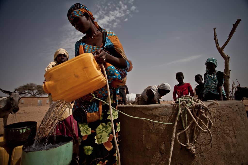
This is why, in recent work, we have been exploring the differential impacts of climate change on subgroups of population such as by gender, age, education, and income. The rising number of households headed by women across the world and, in particular, in southern Africa calls for special attention to their economic welfare. In general female-headed households are more likely to be in poverty. Under the context of the changing climate, it is likely that weather extremes, rainfall variability, and natural disasters associated with climate change will exacerbate economic disadvantages of female-headed households.
Female-headed households are more economically vulnerable to climate-related shocks for three big reasons, which researchers call a “triple burden”. First, persistent gender disparities in the labor market and other productive activities, including limited access to formal credit markets and land contribute to greater economic disadvantage for female-headed households. Second, these households often have a higher total dependency ratio–that is, women take care of a higher proportion of dependent children and the elderly. Third, women who are heads of households with no other adult help have a “double day burden” where they have to fulfil both domestic duties and make money outside the home. That means that female heads face greater time and mobility constraints and may have to work fewer hours or choose lower-paying jobs.
Female-headed households are more economically vulnerable to climate-related shocks for three big reasons, which researchers call a “triple burden”.
Photo: Pablo Tosco/Oxfam
Add climatic shocks to an already disadvantaged family, and the livelihood disruption can be a catastrophe. However, there have been very few studies of how female-headed households actually fare in the context of climate change. In our new study published in World Development, we used household survey data from South Africa and local rainfall data over the period 2006-2012 to examine how female-headed households fare economically when facing variation in rainfall. The study provides new empirical evidence on economic welfare of households headed by women following climatic shocks.
The new and unique part of our study is that we are able to control for observed and unobserved characteristics of households using a statistical technique called fixed effects estimation, which enables us to control for the household-specific effects on income. It also lets us account for different income trajectories in households with different demographic compositions. Furthermore, we were able to evaluate the impacts of income shock on economic vulnerability of female-headed households using rainfall variability as an exogenous source of risk. Income loss due to other variables such as death of a household member or losing a job are likely to be endogenously determined by household characteristics, that is, female heads have lower level of education and hence are more likely to fall into unemployment. But because rainfall variation is not connected to household factors, we were able to measure the causal effect of climate variability on incomes, comparing different household types.
Our study shows that female-headed households in South Africa are indeed more vulnerable to climate variability than households headed by two adults, and not just because of the greater economic disadvantages that they start with. Even after controlling for household socioeconomic characteristics, female heads still fare worse when facing economic shocks. This might be due to limited access to family support and protective social networks who can step in to help in time of crisis.
Our analysis also reveals that not all types of female-headed households are vulnerable to rainfall variability. This finding is especially important for designing a policy to reduce vulnerability of female-headed households. Given different routes into female headship, we show that never-married female heads, women with a non-resident spouse (for example, where the husband has moved to work in another region), and widows have greater economic vulnerability to climate variability. The group of female-headed households where the female head has never been married is the largest of these groups. Households with adults of both genders where the female works but the male does not work and households of separated or divorced women are no more vulnerable than male-headed households.
We also found that vulnerability to climate impacts is related to the effect of rainfall on agriculture. We find that female-headed households face greater economic vulnerability only in the districts where rainfall has a large effect on loss in agricultural yields. Regardless of household engagement in agriculture, crop losses in a district can affect food and livelihood security through surges in food prices and shortfalls in local demand.
Although our study focuses on South Africa, the results showing that female-headed households are more vulnerable to climate variability call for particular interventions to their vulnerability in the context of climate change. The number of female-headed households is rising, with an exceptionally high proportion in southern African countries (36.3% in Lesotho (2006), 43.9% in Namibia (2013), 47.9% in Swaziland (2007). As climate variation and extremes also increase, policies to reduce vulnerability to climate change need to explicitly consider the plight of this subgroup of population.
References
Flatø, M., Muttarak, R., & Pelser, A. (2016). Women, weather, and woes: The triangular dynamics of female-headed households, economic vulnerability, and climate variability in South Africa. World Development. doi:10.1016/j.worlddev.2016.08.015
Muttarak, R., Lutz, W., & Jiang, L. (2015). What can demographers contribute to the study of vulnerability? Vienna Yearbook of Population Research, 13, 1–13. doi:10.1553/populationyearbook2015s001
Rosenhouse, S. (1989). Identifying the poor : is “headship” a useful concept? (No. LSM58) (pp. 1–62). Washington, DC: The World Bank. http://documents.worldbank.org/curated/en/1989/07/442370/identifying-poor-headship-useful-concept. Accessed 24 February 2015
Note: This article gives the views of the author, and not the position of the Nexus blog, nor of the International Institute for Applied Systems Analysis.
Jan 27, 2016 | Climate Change, Postdoc, Risk and resilience
By Mia Landauer, a Finnish postdoc at IIASA Risk, Policy and Vulnerability Program and Arctic Futures Initiative
When I was a child I did not like cross-country skiing. One reason was that like many other schoolmates in Finland, I had no other option than to ski to school throughout the winter, even when temperatures were below -20 C, and even though my skis were too big because I got them from my sister and so old that they could have broken anytime.
When I decided to write my dissertation in Austria about climate adaptation of winter tourism, I found I still couldn’t get away from skiing. My professor at the University of Natural Resources and Life Sciences (BOKU) asked me to join a research team investigating this topic. “What a great tradition you have in Finland! My friend and colleague from METLA (now Natural Resources Institute) in Finland would love to do research with us but with somebody who knows about cross-country skiing! You are the perfect match!” I guess I was too shy to admit that I was not excited about having cross-country skiing as a case study—but I decided to give it a try.
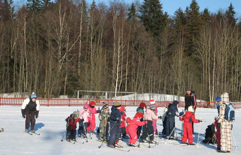
Cross country skiing in Finland is practiced by all age groups (voluntarily or not). Photo Credit: © Mia Landauer
Cross-country skiing is socially and culturally a very important activity in Finland, with considerable health benefits. Forty-two percent of the population practice skiing annually and 98% have the skills. But cross-country skiing, like other snow-based activities, is affected by climate change: even Nordic countries are now seeing lack of snow, shift of seasons, and extreme weather events. The winter 2015/2016 has been no exception. Many Finns are concerned that losing this activity would lead to reduced well-being and loss of cultural tradition. Furthermore, economic impacts on tourism regions brought about by a decrease in skiing would cause problems to local economies heavily dependent on snow-based tourism.
Although vulnerability indicators of some other tourism sectors such as beach tourism exist, nobody had thought about cross-country skiing. So we decided to develop an index, based on climatic observations together with extensive survey data on skiers living in climatically different regions in Finland.
We found that exposure to changes in snow conditions have a considerable effect on regional vulnerability. The most vulnerable skiers are in southernmost parts of Finland, which makes sense. But it is not only the amount of snow and length of winter that matter. We also found that skiers in North and East Finland have the highest capacity to adapt, as indicated by their ability to ski: having the necessary skills and equipment, as well as capacity and willingness to travel to be able to ski.
However, the results also show that if it we could enhance these components of adaptive capacity, also the skiers in the south would have a chance. If there are no adaptation options (no artificial snow tracks, no indoor skiing facilities, or simply no interest to use these, or no money or time to travel to be able to ski), in the short term the Finnish cross-country skiing population will face impacts on health, well-being, and quality of life. In the long term, the skiing culture could be lost. Furthermore, decline in demand would lead to regional economic losses in tourism-dependent local economies.
Attempts are being made to maintain the skiing tradition. Nowadays there are a lot of organized activities where kids are introduced to outdoor activities in a playful and educational environment, and ski school and clubs are being established. They play an important role to create a close and pleasant relationship to nature and increase motivation for skiing. But of course the most important element for skiing is snow.
I have always had a very close relationship to nature. Believe me or not, sometimes I do go skiing although it also brings back the unpleasant memories. Despite them, wintery landscapes and nature experience have motivated me to continue skiing as an adult. The gray and rainy winters make me worried and I simply cannot see myself skiing in a ski tunnel… Albeit “you will never know the true value of a moment until it becomes a memory“, I want snow!

Cross country ski track in Ruka, Finland Photo Credit: © Timo Newton-Syms via Flickr
More information:
Project: “Map Based Assessment of Vulnerability to Climate Change Employing Regional Indicators” (MAVERIC)” http://www.syke.fi/projects/maveric
References
Landauer, M., Sievänen, T., & Neuvonen, M. (2015). Indicators of climate change vulnerability for winter recreation activities: a case of cross-country skiing in Finland, Leisure/Loisir, 39:3-4, 403-440. http://dx.doi.org/10.1080/14927713.2015.1122283
Landauer, M., Haider, W., & Pröbstl, U. (2014). The influence of culture on climate change adaptation strategies: Preferences of cross-country skiers in Austria and Finland. Journal of Travel Research 53(1), pp. 95-109. doi: 10.1177/0047287513481276
Landauer, M., & Sievänen, T. (2011). Suomalaisten maastohiihtäjien sopeutuminen ilmastonmuutokseen. In T. Sievänen & M. Neuvonen (Eds.), Luonnon virkistyskäyttö 2010 (pp. 91–101). Vantaa: Working Papers of the Finnish Forest Research Institute, 212.
Landauer, M., Sievänen, T., & Neuvonen, M. (2009). Adaptation of Finnish cross-country skiers to climate change. Fennia 187 (2), pp. 99–113. http://ojs.tsv.fi/index.php/fennia/article/view/3697
Neuvonen, M., Sievänen, T., Fronzek, S., Lahtinen, I., Veijalainen, N., & Carter, T. R. (2015). Vulnerability of cross-country skiing to climate change in Finland – An interactive mapping tool. Journal of Outdoor Recreation and Tourism, 11, 64–79. doi:10.1016/j.jort.2015.06.010
Neuvonen, M. & Sievänen,T. (2011). Ulkoilutilastot 2010 (Outdoor Recreation Statistics 2010). In: Sievänen, T. & Neuvonen, M. (toim.). Luonnon virkistyskäyttö 2010. Metlan työraportteja / Working Papers of the Finnish Forest Research Institute 212: 133–190
Perch-Nielsen, S. L. (2010). The vulnerability of beach tourism to climate change – An index approach. Climatic Change, 100(3–4), 579–606. doi:10.1007/s10584-009-9692-1
Note: This article gives the views of the author, and not the position of the Nexus blog, nor of the International Institute for Applied Systems Analysis.
You must be logged in to post a comment.