Aug 12, 2021 | Climate Change, Evolution, Science and Policy, Women in Science, Young Scientists
By Neema Tavakolian, 2021 IIASA Science Communication Fellow
Young Scientists Summer Program (YSSP) participant Lyndsie Wszola explores how human interactions with warming freshwater systems have affected the evolution of fish species through the lens of the North American walleye.

© Justinhoffmanoutdoors | Dreamstime.com
The effects of climate change have intensified over the past few years, especially in our oceans, and human based activities contributing to it are now being taken more seriously. While the warming of our oceans is indeed troubling, many forget that freshwater systems are also being influenced, and that this is affecting the growth and evolution of the species that reside in them.
2021 YSSP participant Lyndsie Wszola wants to explore changes in freshwater systems using human-natural modeling systems at IIASA.

© Lyndsie Wszola
Growing up with a conservation officer father, Wszola is a second-generation conservationist. Knowing she wanted to enter this field at an early age, she realized that she had to get into research and academia first. Her main interests while studying at the University of Nebraska have been the interactions between humans and wildlife.
While researching the relationships between hunters and ring-necked pheasants, she discovered an affinity for quantitative research. This curiosity went even further after she discovered literature on harvest induced evolution and mathematical ecology specifically pertaining to fish populations. Together, this initial desire to explore human and wildlife interactions and her newfound interest in mathematical ecology, led Wszola to take a closer look at North American freshwater systems and how we as humans are influencing its ecology. Her research specifically delves into the growth and evolutionary changes seen in the North American walleye (Sander vitreus) – a popular fish in Canada and the United States. The reason for its fame is its palatable taste as a freshwater fish and its status among anglers, making it both a commercially and recreationally fished species.
Walleye was chosen as the subject of Wszola’s research for many reasons. First, walleye, like many fish, are ectotherms meaning that their body processes and behaviors are directly linked to their body temperature, which is in turn directly linked to the temperature of the water. Unlike other fish however, there is already plenty of research and data on the relationship between the walleye’s growth and temperature. This information makes it much easier to simulate the walleye’s eco-evolutionary growth dynamics in the context of human driven harvests in warming waters. Wszola will also be working with very large datasets spanning multiple latitudes ranging from Ontario, Canada down to Nebraska, USA. The datasets include up to six million fish with four million of those being walleye.
“My goal is to model the influence of temperature on fish harvests based on size. Due to their ectotherm nature, we can observe the changes in body size in annual harvests. As waters warm, walleye grow much faster. We also know that intensely harvested fish often evolve to reach maturation at smaller sizes. When coupled with rising temperatures, this relationship between harvest induced and temperature induced evolution can be fascinating, as we now have two sources working together to change the growth evolution of this fish,” she explains.
Due to warming temperatures, many natural resources are at stake with some of the most sensitive being aquatic in nature. Research like this is important as it allows us to look at our relationships with the environment to be able to react accordingly.
“I hope that the research I do yields fascinating enough results so that from a practical standpoint, future fisheries policies can include climate change dynamics in addition to fish and human dynamics,” Wszola concludes.
Note: This article gives the views of the author, and not the position of the Nexus blog, nor of the International Institute for Applied Systems Analysis.
Nov 2, 2018 | Citizen Science, Ecosystems, Environment, Food
by Rastislav Skalsky, Ecosystems Services and Management Program, International Institute for Applied Systems Analysis
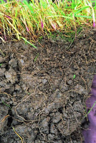
Clay soil
As growers, we know soil is important. It supports plants, and provides nutrients and water for them to grow. But do we all appreciate how crucial the role of soil is in continuously supplying plants with water, even when it hasn’t rained for a few days or even weeks, even without extra water being added via watering?
Soil is like a sponge. It can retain rain water and, if it is not taken up by plants, soil can store it for a long time. We can feel the water in soil as soil moisture. Try it — take and hold a lump (clod) of soil — if it is wet it will leave a spot on your palm. If it’s only moist then it will feel cold — cooler than the air around. And if the soil is dry, it will feel a little warm.
Soil moisture not only can be felt, but it can also be measured — in the lab, or directly in the field with professional or low-cost soil moisture sensors.
Soil moisture in general indicates how much water is contained by the soil. But it is not always the case that soil which feels moist or wet is able to support plants. It could happen that, despite feeling moist, the soil simply does not hold enough water, or holds the water too tightly for the plants to extract it. Or the opposite, soil can sometimes contain too much water. To understand how this works, one has to learn more about how water is stored in the soil.
Water is bound to soil by physical forces. Some forces are too weak to hold water in the plant root zone and water percolates to deeper layers, where plants can no longer reach it. Other forces can be too strong, preventing water from being retrieved by the roots.
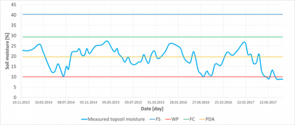
Figure 1
If soil moisture is measured at one place over time, it can reveal its seasonal dynamics. Having estimated important soil water content thresholds (FS — full saturation, FC — field capacity, PDA — point of decreased availability, and WP — wilting point) for that particular site, e.g. based on soil texture test or measurement, one can easily interpret if the measured soil moisture and say if there was enough water or not to fully support plants with water and air. In this particular case of sandy 0–30 cm deep topsoil from Slovakia, it was never wet enough to cause oxygen stress for plants, — in fact it never reached state of all capillary voids filled with water (FC). On the other hand, each summer the topsoil moisture dropped below the point of decreased availability (PDA), even got close to the wilting point or went through (WP), which means that during those periods plants suffered drought conditions.
Thresholds
In order to describe this behavior in more useful terms, plant ecologists and soil hydrologists came up with couple of important soil water content thresholds (Figure 1). These thresholds, also called “soil moisture ecological intervals”, define how easily plants can get the water out of the soil.
We speak about full saturation of soil when all empty spaces (pores/voids) are completely filled with water. Full saturation of the soil with water prevents air entering into the soil. Yet there is no force holding water in the soil. Roots need air as well as water so, if this situation continues, it eventually causes oxygen stress for most of the common plants because roots simply cannot breathe.
Soil also has different types of pores. Larger ones, which are called “gravitational pores”, are filled with water only when the soil is saturated and otherwise drains freely, and smaller ones called “capillary pores” which are small enough in size to prevent water from percolating down the soil profile by gravitation. These smaller pores can hold water even in well-drained soils and make it available for plants to extract. There are also even smaller pores where the water is held so tightly that plants cannot extract it.
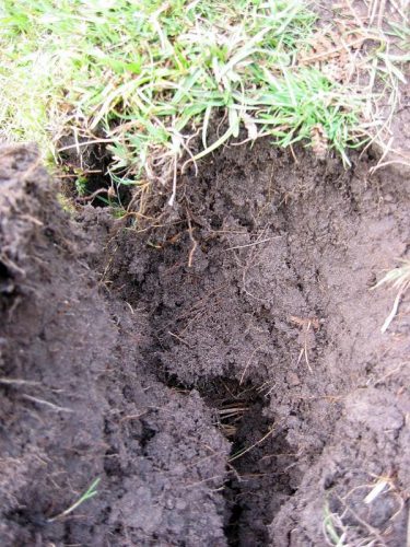
Sandy soil
When all gravitational pores/voids are empty of water and it is present only in so called capillary pores/void we speak about the field water capacity — which is considered to be the best soil moisture status of the soil — enabling plants to retrieve the water they need, whilst leaving enough air for roots to breathe. If no new water is added into the soil, the soil dries as water is used by plants or evaporates. As soil dries less water is available to plants until the point of decreased availability when water remains only in the smallest capillary pores/voids. But this water is bound to soil particles so strongly that most plants are not able to extract it suffer from drought. Ultimately, all the available water is used up by plants, and the remaining water is inaccessible. Soil reaches the so-called wilting point and water is not available for the plants anymore. Plants permanently wilt and eventually die.
How Soil Characteristics Relate to Moisture
The tricky thing with soil moisture however is that the same amount of water (volumetric percent of the total soil column volume) can, in different soils, represent different amount of water available for plants. How big this difference could be is defined by many soil characteristics.
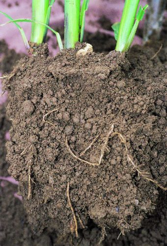
Loamy soil
The most important is the soil texture — a blend of all fine-earth soil mineral constituents (sand, silt, clay) and stones in various rates. In general, the finer the texture is (i.e. more clay, less sand) the more water is bound in the soil too tightly to be retrieved by plants. Even if the soil feels moist, plants can permanently wilt in clay soils. In contrast, those soils with coarse texture (i.e. more sand, less clay) can support plants with nearly all the water they can hold. Although the soil looks dry, plants can still effectively take the water out of it. The drawback here is that in coarse textured, sandy, soil nearly all water drains down the gravitational pores and therefore such a soil cannot support plants for very long time. That is also why medium textured soils (loam, silty loam, clay loam) are considered best for holding and providing the water for plants. Medium textured soils can effectively drain excess water, yet hold much water in capillary pores/voids for a long time, and still, only a relatively small amount of water remains unavailable for the plants.
A practical implication of this behavior of soil with different soil texture could be that one has to apply slightly different strategies to maintain soil moisture in the way that it can effectively supply plants with water. Sandy soils will require more frequent watering with smaller amount of water. It would not make any practical sense to try build-up a storage of water in these soils. All extra water added will simply drain out of the topsoil. Clay rich soils can absorb big amounts of water but a lot is bounded too strongly to the soil particles and thus not available for the plants. Therefore one should water even if the soil looks moist or wet — and if dry a lot of water must be added to recharge the topsoil so that it can support plants effectively. With loamy soils it is possible to be more relaxed with watering frequency, simply because one can build solid storage of water in such soils. Adding a bit more water than is necessary is perfectly fine with these soils because the water is effectively kept in the soil profile and it can be used later on.
Interested in learning more? Why not sign up for GROW Observatory’s next free online course – Citizen Research: From Data to Action – to discover how citizen-generated data on soils, food and a changing climate can create positive change in the world. Starts 5th November.
This blog was originally published on https://medium.com/grow-observatory-blog/moisture-matters-a9e33dc880a1
Sep 25, 2017 | Water, Young Scientists
By Parul Tewari, IIASA Science Communication Fellow 2017
Mexico City has been experiencing a major water crisis in the last few decades and it is only getting worse. To keep the water flowing, the city imports large amounts of water from as far as 150 kilometers.
Not only is this energy-intensive and expensive, it creates conflict with the indigenous communities in the donor basins. Over the last decade, a growing number of these communities have been protesting to reclaim their rights to water resources.
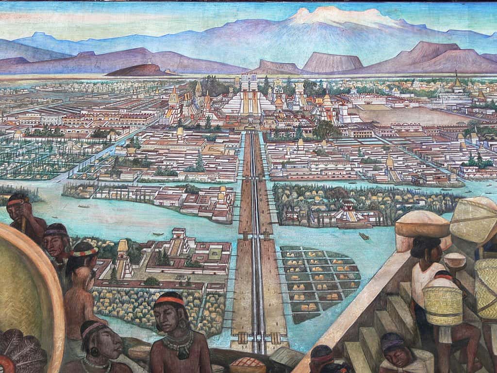
The ancient city of Tenochtitlan as depicted in a mural by Diego Rivera
(cc) Wikimedia Commons
As part of the 2017 Young Scientists Summer Program at IIASA, Francine van den Brandeler studied the struggle that Mexico City is facing as it tries to provide water to its growing population and expanding economy. Local aquifers have been over-exploited, so water needs to be imported from distant sources, with high economic, social, and environmental impacts. Van den Brandeler’s study assesses the effectiveness of water use rights in promoting sustainable water use and reducing groundwater exploitation in the city.
“A few centuries back, Tenochtitlan, the place where Mexico City stands today, was known as the lake city,” says Van den Brandeler. The Aztecs had developed a sophisticated system of dikes and canals to manage water and mitigate floods. However, that changed quickly with the arrival of the Spaniards, who transformed the natural hydrology of the valley. As the population continued to grow over the next centuries, providing drinking water became an increasing challenge, along with controlling floods. As the lake dried up, people pumped water from the ground and built increasingly large infrastructure to bring water from other areas.
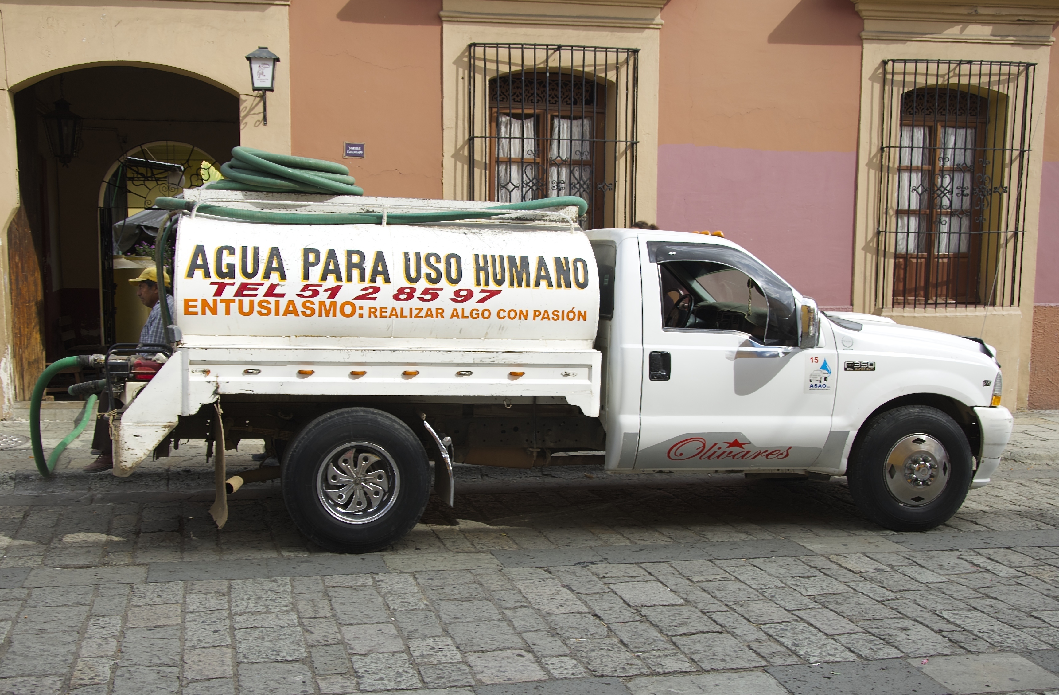
Communities from lower-income groups, living in informal settlements on the outskirts of the metropolitan region are more vulnerable to this scarcity. Many live on just few liters of water every day, and do not have access to the main water supply network, instead relying on water trucks which charge several times the price of water from the public utility.
“In wealthier areas people consume much more than the average European does every day. It is a question of power and politics,” says van den Brandeler. “The voices of marginalized communities go unheard.”

Many people rely on delivery service for drinking water.
© Angela Ostafichuk | Shutterstock
The more one learns about the situation, the more complicated it becomes. The import of water started in the 1940’s. But with a massive increase in population in the last couple of decades, the deficits have become much worse.
The government’s approach has been to find more water rather than rehabilitating or reusing local surface and groundwater sources, or increasing water use efficiency, says van den Brandeler. Therefore wells are being drilled deeper and deeper—as much as 2000 meters into the ground—as the water runs out.
Some people have started initiatives to harvest rainwater, but it is not considered a viable solution by those in charge. “A lot of it has to do with their worldview and general paradigm. The people working at the National Water Commission and the Water Utility of Mexico City have been trained as engineers to make large dams and put pipes in the ground. They don’t believe in small-scale solutions. In their opinion when millions of people are concerned, such solutions cannot work,” says van den Brandeler.
Although the city gets plenty of rain during the rainy season, it goes directly into the drainage system which is linked to the sewage system. This contaminates the water, making it unusable. At the same time, almost 40% of the water in Mexico City’s piped networks is lost due to leakages.
Policy procedures and institutional functioning also remain top-down and opaque, van den Brandeler has found. One of the policy tools for curbing excess water use are water permits for bulk use, for agriculture, industry, or public utilities supplying water. Introduced in the 1940s, lack of proper enforcement has created misuse and conflicts.
For example, while farmers also require a permit that specifies the volume of water they may use each year, they do not pay for their water usage. However, it is difficult to monitor if farmers are extracting water according to the conditions in the permit. Since they do not pay a usage fee, there is also less incentive for the National Water Commission to monitor them. As a result, a huge black market has cropped up in the city where property owners and commercial developers pay exorbitant prices to buy water permits from those who have a license. Since the government allows the exchange of permits between two willing parties, they make it appear above-board. However, it has contributed to the inequalities in water distribution in the city.
With the water crisis worsening every year, Mexico City needs to find a solution before it runs out of water completely. Van den Brandeler is hopeful for a better future as she studies the contributing factors to the problem. She hopes that the water use permits are better enforced and users are given stronger incentives to respect their allocated water quotas. Further, if greater efforts are made within the metropolis to repair decaying infrastructure and scale up alternatives such as rainwater harvesting and wastewater reuse, the city won’t have to look at expensive solutions if adopted in a decentralized manner.
About the Researcher
Francine van den Brandeler is a third year PhD student at the University of Amsterdam in Netherlands. Her research is on the spatial mismatches between integrated river basin management and metropolitan water governance – the incompatibility of institutions and biophysical systems-, which can lead to fragmented water policy outcomes. Fragmented decision-making cannot adequately address the issues of sustainability and social inclusion faced by megacities in the Global South. She aims to assess the effectiveness of policy instruments to overcome this mismatch and suggest recommendations for policy (re)design. At IIASA she was part of the Water Program and worked under the supervision of Sylvia Tramberend and Water Program Director Simon Langan.
This article gives the views of the author, and not the position of the Nexus blog, nor of the International Institute for Applied Systems Analysis.
May 23, 2017 | Alumni, Water, Young Scientists
Firdos Khan Yousafzai, PhD student, University of Klagenfurt, Austria, and YSSP 2012 participant
In Pakistan, water supply fell from 5,260 cubic meters per capita in 1951 to 1,050 cubic meters per capita in 2010 according to the World Bank, and is likely to further fall in the future. According to the Falkenmark Water Stress Indicator, a country or a part of a country is said to experience “water stress” when the annual water supplies drop below 1,700 cubic meters per capita per year, and “water scarcity” if the annual water supplies drop below 1,000 cubic meters per capita per year. Water scarcity is especially critical for Pakistan because agriculture contributes 25% of the GDP and 36% of energy is obtained from hydropower.
In terms of geography, Pakistan is incredibly diverse, ranging from plain to desert, hills, forest, and plateaus from the Arabian Sea in the south and to the mountains of Karakorum in the north of the country. It has 796,096 square kilometers area—about the same size as Turkey–and approximately 200 million inhabitants.

The Karakorum mountains in northern Pakistan ©Piotr Snigorski | Shutterstock
Water availability is also different in different parts of the country. While various studies showed that climate change is happening all over Pakistan, research shows that the northern areas are more vulnerable. Possible reasons include the increasing population and deforestation, among others. Therefore, in my PhD work, which was also the subject of my work in the 2012 IIASA Young Scientists Summer Program, I am investigating that how fast climate is changing and exploring its impacts on availability of water.
In a recent study we investigated this issue under four different climate change scenarios, from 2006 to 2039 in the future. Different scenarios have different assumptions about population growth, use of energy type, environmental protection, economic development, technological changes, etc. We calculated the changes on the basis of baseline and future time periods for climate and hydrological projections. We found an increasing trend in maximum and minimum temperature, while precipitation is also changing under each scenario.
To assess water availability and investigate the impacts of changing climate on the operation of reservoirs, we used Tarbela Reservoir as a measurement tool, developing hydrological projections for the reservoir under each scenario. Tarbela Dam is one of the biggest dams in the world, and has a storage capacity of approximately 7 million acre feet and the potential to produce 3,400 megawatts of electricity.

Cholistan Desert in southern Pakistan. Water scarcity varies widely throughout the geographically diverse country. ©image bird | Shutterstock
In our study, we considered all the relevant parameters related to water shortages and surpluses. To compare the status of water availability, we compared the baseline period and future time period. The results show an increasing trend in water availability, however, water scarcity is observed during some months under each scenario. Further, we also observed that there is a 23-40% increase in river flow under the considered scenarios while the average increase is approximately 35% during the future time period.
As a conclusion we can say that enough water is available in Pakistan, and will continue to be available in the future. Instead, the study confirms previous reports that the major problem is mismanagement.
The possible solution may include constructing more dams and storage capacity to store extra water during high river flow which then can be utilized during low river flow. This could probably also be helpful in flood control, raise the groundwater level, and provide cheap and clean electricity to national electricity grid—providing multiple benefits, in view of the fact that the country has faced ongoing energy crises for many years.
References
Ali S, Li D, Congbin F, Khan F (2015). Twenty first century climatic and hydrological changes over Upper Indus Basin of Himalayan region of Pakistan. Environmental Research Letters10 (2015) 014007. DOI:10.1088/1748-9326/10/1/014007.
Khan F, Pilz J, Ali S (2017). Improved hydrological projections and reservoir management in the Upper Indus Basin under the changing climate. Water and Environmental Journal. Vol. 31, No. 2, pp. 235-244. DOI:10.1111/wej.12237.
Khan F, Pilz J, Amjad M, Wiberg D (2015). Climate variability and its impacts on water resources in the Upper Indus Basin under IPCC climate change scenarios. International Journal of Global Warming, Vol. 8, No. 1, pp. 46-69. DOI:10.1504/IJGW.2015.071583.
This article gives the views of the author, and not the position of the Nexus blog, nor of the International Institute for Applied Systems Analysis.
Feb 27, 2017 | Postdoc, Risk and resilience
By Adam French – Peter E. de Jánosi Postdoctoral Scholar Risk and Resilience and Advanced Systems Analysis Programs
In mid-January, I found myself calling upon rusty rock climbing skills to scramble up a steep side canyon of Peru’s Rimac River valley. I was with a group of engineers and local municipal officials on the way to assess disaster reduction infrastructure that had been installed in early 2016 against the threat of a strong El Niño-enhanced rainy season. The Swiss-made barriers we were going to see, which resembled giant steel spider webs stretched across the streambeds, had been constructed in multiple locations in the Rimac watershed to reduce the destructive impacts of the region’s recurrent but unpredictable huaicos—powerful debris flows that form when precipitation runoff mixes with loose rock and other material on unstable slopes. The 2015-16 El Niño did not live up to its forecasted intensity in Peru, and the barriers went untested until heavy rains in early 2017 unleashed a series of huaicos on the Rimac valley, damaging homes and flooding roadways. Where the barriers were installed, however, no major impacts had been reported, and we were eager to see if the infrastructure had made a difference.
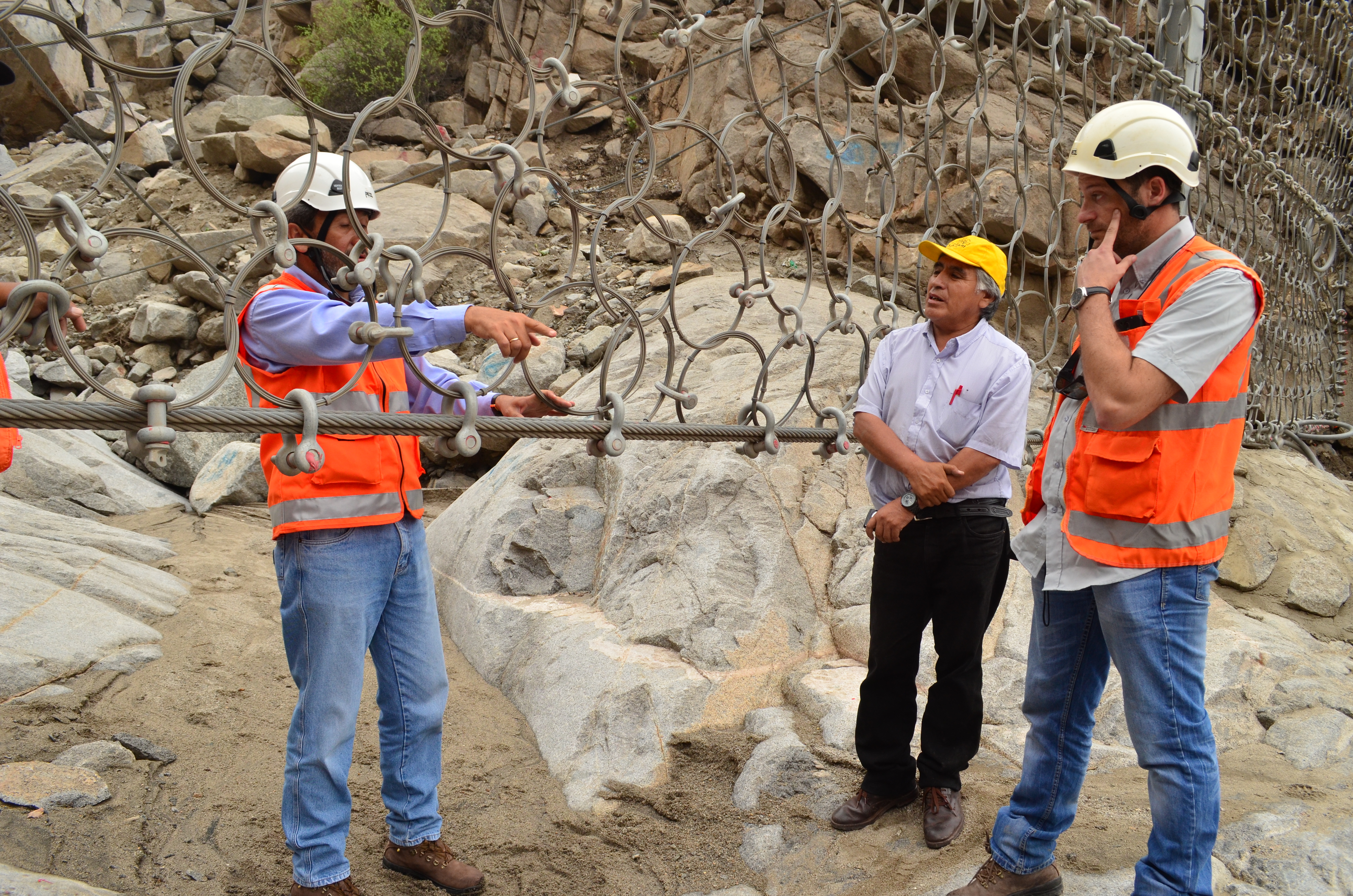
Engineers discuss hazard reduction infrastructure above Chosica, Peru. ©Soluciones Prácticas, Abel Cisneros (Click for more photos)
Most of the time, the Rimac valley looks more like a lunar landscape than a flood-risk hotspot. Yet with only a few millimeters of rain in the surrounding highlands, this arid region becomes extremely vulnerable to huaicos. Located between the sprawling cityscape of Lima—the planet’s second largest desert city—and the lush foothills of the central Andes, the middle reaches of the Rimac watershed have been settled rapidly over recent decades, often without effective zoning regulations to restrict occupation in even the most hazard-prone areas.
I had not planned to work in the Rimac basin when I moved to Austria to take up a postdoctoral position in late 2015. While my research includes the study of climate change-related risk in Peru’s Cordillera Blanca (the world’s most extensively glaciated tropical mountain range), I came to IIASA to focus on watershed-level governance and the implementation of the Integrated Water Resource Management (IWRM) paradigm. Yet as a Spanish speaker with extensive experience in Peru, I was well suited to get involved in IIASA’s activities in the Rimac valley as part of the Zurich Flood Resilience Alliance Project. This project, which includes close collaboration with the NGO Practical Action in Peru and Nepal, supports measures to understand and address the underlying drivers of flood risk and to move beyond short-term disaster preparedness and response towards transformative actions that build long-term capacity and resilience.
As part of IIASA’s Flood Resilience team, my work in the Rimac valley has included activities ranging from evaluating El Niño preparations to conducting interviews with public authorities and local residents living in the Rimac basin. This fieldwork is just part of our project’s efforts to identify the systemic components of flood risk and vulnerability in the region and to promote productive exchanges between residents, policymakers, and the scientific community through participatory research and innovative approaches such as serious gaming.
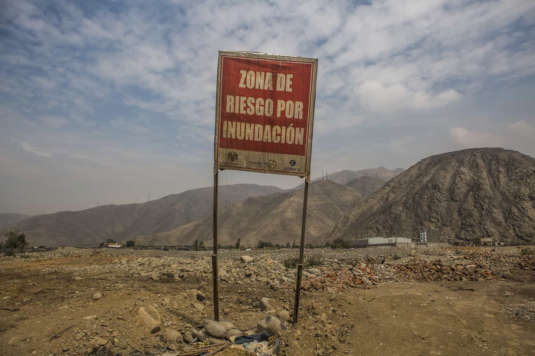
“Flood Risk Zone,” Ate, Peru. ©Soluciones Prácticas. Click for more photos.
In addition to building expertise in a new setting, my involvement in this work has helped me better incorporate risk-focused systems thinking into my broader research agenda—a perspective that is too often overlooked in integrated resource planning. An example of how my research interests are converging within this project is through the promotion of a risk-management working group to advise the multi-sectorial watershed council in charge of IWRM planning in the Rimac valley. The establishment of this working group and the participation of project partners at Practical Action in its activities should mark an important step in bringing lessons from the Flood Resilience project regarding links between disaster risk reduction, economic development, and community resilience to bear on watershed planning in the Rimac basin. More broadly, we hope these insights will influence policy making in other settings in Peru and beyond that face similar challenges in handling risk management and economic development as intricately linked and co-dependent governance processes.
Returning to our January field inspection, we found that one of the new barriers had been put to the test. The structure had captured several tons of debris, protecting a neighborhood that had been devastated by a huaico in 2015, and local authorities were already discussing the potential to build additional barriers to guard their community. While I celebrated this outcome with them, as I look to the future and the goals of the Flood Resilience Alliance, I am hopeful that such infrastructural interventions will be just one aspect of comprehensive plans for hazard reduction, with long-term risk management actions increasingly seen as a vital component of watershed-level planning and governance.
More information
IIASA, Zurich, Wharton, Practical Action: Flood Resilience Partnership
Flickr photo album: Rimac River valley, Peru – Fieldwork
Flood Resilience Portal
This article gives the views of the author, and not the position of the Nexus blog, nor of the International Institute for Applied Systems Analysis.

You must be logged in to post a comment.